Guestuser: Login or enrol?
- Home
- Main Display
- Main Display (Old)
- Find a Walk
- Display INTRODUCTION
- DONATE
- Click below for your
profile & contributions
guestuser- New
- Tracks, Walks
- Challenge
- Community
- Lists & Logs
- Popular Lists:
- County Highpoints
- Range & Area Highpoints
- Local 100
- Highest Hundred
- Vandeleur-Lynams
- Arderins
- Carns
- Best rated
- Irish 900 up
- Irish Island
- Munros
- All Lists
- Shorter Irish
- County Highpoints
- Range & Area Highpoints
- Highest Hundred
- Local 100
- Local 100 (pre2014)
- Local Historical Cultural
- Best rated
- Irish 900 up
- Larger Irish
- Arderins
- Arderin Begs
- Arderins + Arderin Begs
- Vandeleur-Lynams
- Vandeleur-Lynams + Arderins
- Carns
- Binnions
- Highest 50 per Province
- Island Features
- Irish Island
- Coastal Hills
- Irish 600 up
- Irish 500 up
- British
- Munros
- British 600 up
- British 500-600
- British Marilyns
- Comprehensive
- All Irish summits
- All Irish features
- All British summits
- All Britain+ Ireland
- Special
- Analysis List
- Simple Irish Listings
- Simple Irish & British Listings
-
- More
- Motley Views
Welcome to MountainViews
If you want to use the website often please enrol (quick and free) at top right.OverviewFor more map options click on any overview map area or any detail map feature.Detail Map FeaturesShowing 18 of a total of 51 items:
Camaderry Mountain 698.6m, Tomaneena 682.4m, Camaderry East Top 677.3m, Lugduff 653.2m, Fair Mountain 571.2m, Brockagh Mountain 556.9m, Brockagh Mountain NW Top 549.5m, Tonelagee South-East Top 545.8m,Tracks:1441, 34km 1898, 33km 5234, 32km 3395, 29km 3030, 25km 3549, 25km 2333, 20km 2684, 20km 4075, 19km 1764, 19km Find Suggested Walks
Find hill, mountain, island, coastal feature.Videos


Recent Contributions
 Get Notifications
Lake District: Lonscale Fell
Haulbowline Island: Permission granted
Slievereagh: An Easy Hike to the Summit
North Wicklow from Curtlestown after massive felling.
Carriglineen Mountain: Panorama
Bealick
Kirikee Mountain: Grandstand views
Mount Eagle: Name belies the reality
Hills above Sneem
Baraveha: Meshtastic Weather Nodes and soggy bog.
South of Glenbeigh Range
Baraveha: Forest tracks before slog to dull top.
Conditions and Info
Use of MountainViews is governed by conditions and a privacy policy.
Read general information about the site.
Opinions in material here are not necessarily endorsed by MountainViews.
Hillwalking is a risk sport. Information in comments, walks, shared GPS tracks or about starting places may not be accurate for example as regards safety or access permission. You are responsible for your safety and your permission to walk.
See the credits and list definitions.Video displayWicklow Area Cen: Glendalough North SubareaPlace count in area: 116, OSI/LPS Maps: 28B, 55, 56, 61, 62, AWW, EW-DM, EW-LG, EW-WE, EW-WS
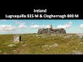
Highest place: Lugnaquilla, 924.7m
Maximum height for area: 924.7 metres, Maximum prominence for area: 905 metres,
Places in area Wicklow:
Cen: Glendalough North:Brockagh Mountain 556.9mBrockagh Mountain NW Top 549.5mBrockagh Mountain SE Top 471.7mCamaderry East Top 677.3mCamaderry Mountain 698.6mConavalla 734mTomaneena 682.4m
Cen: Glendalough South:Carriglineen Mountain 456.6mCullentragh Mountain 510mDerrybawn Mountain 476.1mKirikee Mountain 474.5mLugduff 653.2mLugduff SE Top 638mMullacor 660.7mTrooperstown Hill 430m
N Cen: Tonelagee:Carrignagunneen 561mFair Mountain 571.2mStoney Top 713.7mTonelagee 815.8mTonelagee E Top 668mTonelagee South-East Top 545.8m
NE: Bray & Kilmacanogue:Bray Head Hill 238.9mCarrigoona Commons East 242mDowns Hill 372.9mGreat Sugar Loaf 501.2mKindlestown Hill 210mLittle Sugar Loaf 342.4m
NE: Djouce:Djouce 725.5mKnockree 342.1mMaulin 570mTonduff 642mTonduff East Top 593mWar Hill 684.8mWhite Hill 631.1m
NE: Fancy:Ballinafunshoge 480mKanturk 527.4mKnocknacloghoge 532.4mLuggala 593.3mRobber's Pass Hill 508.9mScarr 640mScarr North-West Top 559.8mSleamaine 430m
NE: Vartry:Ballinacorbeg 336mBallycurry 301mDunranhill 342mMount Kennedy 365.9m
NW: Blessington:Carrigleitrim 408mLugnagun 446.2mSlieveroe 332mSorrel Hill 599.5m
NW: Mullaghcleevaun:Black Hill 602.2mCarrigshouk 572.5mCarrigvore 682.4mDuff Hill 720.8mGravale 719mMoanbane 703mMullaghcleevaun 846.7mMullaghcleevaun East Top 796mSilsean 698m
S: Aughrim Hills:Cushbawn 400mKilleagh 249mMoneyteige North 427mPreban Hill 389m
S: Croaghanmoira:Ballinacor Mountain 529.3mBallycurragh Hill 536mBallyteige 447mCarrickashane Mountain 508mCroaghanmoira 662.3mCroaghanmoira North Top 579.5mFananierin 426mSlieve Maan 547.8mSlieve Maan North Top 546.1m
S: Croghan Kinsella:Annagh Hill 454mCroghan Kinsella 606mCroghan Kinsella East Top 562.1mSlievefoore 414m
S: Shillelagh Hills:Lakeen 357mMonaughrim 206mSeskin 344mStookeen 420m
S: Tinahely Hills:Ballycumber Hill 429.7mEagle Hill 296mMuskeagh Hill 398.2m
SE: Wicklow South East:Ballinastraw 284mBallyguile Hill 188mBarranisky 280mCarrick Mountain 381mCollon Hill 238mKilnamanagh Hill 217mWestaston Hill 270m
W: Baltinglass:Ballyhook Hill 288mBaltinglass Hill 382mCarrig Mountain 571mCarrigeen Hill 298mCloghnagaune 379.5mCorballis Hill 258mKeadeen Mountain 653mSpinans Hill 409mSpinans Hill SE Top 400mTinoran Hill 312m
W: Cen Lugnaquilla:Ballineddan Mountain 652.3mBenleagh 689mCamenabologue 758mCamenabologue SE Top 663mCloghernagh 800mCorrigasleggaun 794.6mLugnaquilla 924.7mSlievemaan 759.7m
W: Donard:Brewel Hill 222mChurch Mountain 544mCorriebracks 531mLobawn 636mSlievecorragh 418mSugarloaf 552mTable Mountain 701.7mTable Mountain West Top 563m
Note: this list of places includes island features such as summits, but not islands as such.
(Ir. Céim an Doire [OSNB], 'step/pass of the oak-wood') Wicklow County in Leinster Province, in Arderin, Vandeleur-Lynam Lists, Adamellite with microcline phenocrysts Bedrock
Height: 698.6m OS 1:50k Mapsheet: 56 Grid Reference: T08155 98084
Place visited by 921 members. Recently by: itscolinbrophy, Haulie, MarionP, rosduke, abacusms, hugh_oc, ccartwright, AnthonyJ, Aidan_Ennis, djay281, discovering_dann, RonanS, DarrenY, 500plusclub, PadraiginI have visited this place: NO (You need to be a logged-in member to change this.)Longitude: -6.388958, Latitude: 53.022824 , Easting: 308155, Northing: 198084 Prominence: 71m, Isolation: 1.1km
ITM: 708080 698118 , GPS IDs, 6 char: CmdrMn, 10 char: CmdryMntn
Bedrock type: Adamellite with microcline phenocrysts, (Glendalough Adamellite)
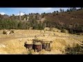
Camaderry Mountain is the 117th highest place in Ireland.
Linkback: https://mountainviews.ie/summit/114/COMMENTS for Camaderry Mountain (Sliabh Cham an Doire) 1 2 3 4 5 Next page >>  Follow this place's comments
 Height layer: © MapTiler

MountainViews.ie, a Hill-walking Website for the island of Ireland. 2500 Summiteers, 1480 Contributors, maintainer of lists such as: Arderins, Vandeleur-Lynams, Highest Hundred, County Highpoints etc

 Fergalh
 JohnFinn
 simon3
 hibby
hibby
 hibby
hibby
 Collaborative entry
 Colin Murphy
 Collaborative entry
 Visit our Facebook page.