Welcome to MountainViews
If you want to use the website often please enrol (quick and free) at top right.
If you want to use the website often please enrol (quick and free) at top right.
Overview

For more map options click on any overview map area or any detail map feature.
Detail Map Features
Showing 20 of a total of 30 items:
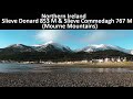
Slieve Donard 849m, Slieve Commedagh 767m, Slievelamagan 702.2m, Chimney Rock Mountain 656m, Cove Mountain 654.8m, Slieve Corragh 641.9m, Slieve Beg 595.9m, Slievenaglogh 584.4m, Slievenaglogh East Top 571m, Crossone 540m,
4460, 32km
3076, 31km
2815, 25km
3827, 19km
3262, 15km
3379, 15km
4120, 14km
4575, 14km
4116, 14km
3038, 13km
Slieve Donard 849m, Slieve Commedagh 767m, Slievelamagan 702.2m, Chimney Rock Mountain 656m, Cove Mountain 654.8m, Slieve Corragh 641.9m, Slieve Beg 595.9m, Slievenaglogh 584.4m, Slievenaglogh East Top 571m, Crossone 540m,
Tracks:
Find Suggested Walks
Find hill, mountain, island, coastal feature.
Videos
Recent Contributions
 Get Notifications
Get Notifications
Hag's Tooth: This might hurt
 No1Grumbler
Galtymore: Dawn on Galtymore
 DeirdreM
One of Irelnad`s finest routes
Keale Mountain: Hard to access the top
Half Glencoaghan
East Girt Hill: Short trek from West Girt Hill
 Fergalh
Traverse of Lackavrea
 glencree
West Girt Hill: Short trek to summit
 Fergalh
Belmore from NW - SOUTH route CLOSED
Hill of Stake: East trek along track to mines followed by wet heather bash
 Fergalh
Carrane from SSW
Fynloch Hill: Outlier of Kilpatrick Hills
 Fergalh
Conditions and Info
Use of MountainViews is governed by conditions and a privacy policy.
Read general information about the site.
Opinions in material here are not necessarily endorsed by MountainViews.
Hillwalking is a risk sport. Information in comments, walks, shared GPS tracks or about starting places may not be accurate for example as regards safety or access permission. You are responsible for your safety and your permission to walk.
See the credits and list definitions.
 Visit our Facebook page.
Video display
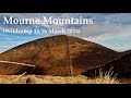
Mourne Mountains
Area N: Commedagh Subarea
Place count in area: 58,
OSI/LPS Maps: 20, 29, EW-CLY
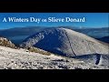
Highest place: Slieve Donard, 849m
Maximum height for area: 849 metres,
Maximum prominence for area: 821 metres,
Places in area Mourne Mountains:
Cen: Loughshannagh:Ben Crom 526mCarn Mountain 585.2mCarn Mountain North Top 553.7mDoan 592.6mOtt Mountain 526.8mSlieve Loughshannagh 617mSlieve Muck 670.4mSlievenaglogh 445m
E: Binnian:Slieve Binnian 745.9mSlieve Binnian East Top 639mSlieve Binnian North Top 678mSlieve Binnian North Tor 682.5mWee Binnian 460m
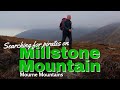
E: Donard:Chimney Rock Mountain 656mCrossone 540mMillstone Mountain 460mRocky Mountain 524mSlieve Donard 849m
E: Lamagan:Cove Mountain 654.8mSlieve Beg 595.9mSlievelamagan 702.2m
N: Bearnagh:Slieve Bearnagh 739mSlieve Bearnagh North Tor 680mSlieve Meelbeg 701.9mSlieve Meelmore 687m
N: Castlewellan:Slievenalargy 280mSlievenaslat 272m
N: Commedagh:Slieve Commedagh 767mSlieve Corragh 641.9mSlievenaglogh 584.4mSlievenaglogh East Top 571m
N: Croob:Cratlieve 429mSlieve Croob 534mSlievegarran 391mSlievenisky 446m
N: Rathfriland:Knockiveagh 235m
S: Kilkeel:Knockchree 306m
S: Rostrevor:Crenville 460mFinlieve 578mSlievemartin 485mSlievemeel 420mSlievemeen 472m
W: Hilltown:Gruggandoo 382mSlieveacarnane 296m
W: Slievemoughanmore:Crotlieve Mountain 347mEagle Mountain 638mRocky Mountain 404mShanlieve 626mSlievemoughanmore 560mTievedockaragh 473mWee Slievemoughan 428m
W: Spelga:Butter Mountain 500mCock Mountain 504mCock Mountain South-West Top 505mHen Mountain 354mPigeon Rock Mountain 534mPigeon Rock Mountain South Top 530mSlievenamiskan 444m
Note: this list of places includes island features such as summits, but not islands as such.
Highest place:
Slieve Donard, 849mPlaces in area Mourne Mountains:
Cen: Loughshannagh:
Ben Crom 526mCarn Mountain 585.2mCarn Mountain North Top 553.7mDoan 592.6mOtt Mountain 526.8mSlieve Loughshannagh 617mSlieve Muck 670.4mSlievenaglogh 445mE: Binnian:
Slieve Binnian 745.9mSlieve Binnian East Top 639mSlieve Binnian North Top 678mSlieve Binnian North Tor 682.5mWee Binnian 460mE: Donard:
Chimney Rock Mountain 656mCrossone 540mMillstone Mountain 460mRocky Mountain 524mSlieve Donard 849mE: Lamagan:
Cove Mountain 654.8mSlieve Beg 595.9mSlievelamagan 702.2mN: Bearnagh:
Slieve Bearnagh 739mSlieve Bearnagh North Tor 680mSlieve Meelbeg 701.9mSlieve Meelmore 687mN: Castlewellan:
Slievenalargy 280mSlievenaslat 272mN: Commedagh:
Slieve Commedagh 767mSlieve Corragh 641.9mSlievenaglogh 584.4mSlievenaglogh East Top 571mN: Croob:
Cratlieve 429mSlieve Croob 534mSlievegarran 391mSlievenisky 446mN: Rathfriland:
Knockiveagh 235mS: Kilkeel:
Knockchree 306mS: Rostrevor:
Crenville 460mFinlieve 578mSlievemartin 485mSlievemeel 420mSlievemeen 472mW: Hilltown:
Gruggandoo 382mSlieveacarnane 296mW: Slievemoughanmore:
Crotlieve Mountain 347mEagle Mountain 638mRocky Mountain 404mShanlieve 626mSlievemoughanmore 560mTievedockaragh 473mWee Slievemoughan 428mW: Spelga:
Butter Mountain 500mCock Mountain 504mCock Mountain South-West Top 505mHen Mountain 354mPigeon Rock Mountain 534mPigeon Rock Mountain South Top 530mSlievenamiskan 444mNote: this list of places includes island features such as summits, but not islands as such.

Bedrock type: Granite granophyre, (Mourne Mountains granite)
As on Slieve Meelmore, there is a tower near the summit of Slieve Commedagh. On the southern side, at the head of the Annalong Valley, is a spectacular group of granite tors known as 'the Castles'. These can be appreciated from the Brandy Pad, a track once used by smugglers. During the 18th Century the Mourne Mountains were notorious for smuggling commodities such as wine, silk, tobacco, tea and brandy, mainly from Britain. The cargo would be brought ashore under the cover of darkness and taken over the mountains to Hilltown and the surrounding areas. Slieve Commedagh is the second highest mountain in the Mourne Mountains area and the 64th highest in Ireland. Slieve Commedagh is the second highest point in county Down.
Linkback: https://mountainviews.ie/summit/63/
COMMENTS for Slieve Commedagh (Sliabh Coimhéideach) << Prev page 1 2 3 4 5  Follow this place's comments

|
|
|
|
||
| MountainViews.ie, a Hill-walking Website for the island of Ireland. 2400 Summiteers, 1480 Contributors, maintainer of lists: Arderins, Vandeleur-Lynams, Highest Hundred, County Highpoints etc | |||