Cookies. This website uses cookies, which are small text files that the website puts on your computer to facilitate operation. Cookies help us provide a better service to you. They are used to track general user traffic information and to help the website function properly.

Click to hide this notice for 30 days.
Welcome to MountainViews
If you want to use the website often please enrol (quick and free) at top right.
Overview
Detail
Zoom: ??
For more map options click on any overview map area or any detail map feature.
Find Suggested Walks
Find hill, mountain, island, coastal feature.
Videos


Recent Contributions
Get Notifications

Fairy Castle Loop Via Kilmashogue Forrest

Bweengduff: The Shiddy Way?

Seefin - Seefin East Top

Bweengduff: A good forest road to access this summit

Seefin East Top: An easy bog trot.

Glenmalure zig-zags route closed.

Glenshee ramble

Seefin: An easy road with distant balcony views but nearby clutter

Inisbroon: Interesting looking island

Ballinruan

Knocklettercuss: A grand viewpoint into the Wild Nephin National Park

Slievelamagan: Steep, rocky peak with great local views

Conditions and Info
Use of MountainViews is governed by conditions and a privacy policy.
Read general information about the site.
Opinions in material here are not necessarily endorsed by MountainViews.
Hillwalking is a risk sport. Information in comments, walks, shared GPS tracks or about starting places may not be accurate for example as regards safety or access permission. You are responsible for your safety and your permission to walk.
See the credits and list definitions.
Video display
Mourne Mountains Area   S: Rostrevor Subarea
Place count in area: 58, OSI/LPS Maps: 20, 29 
Highest place:
Slieve Donard, 849m
Maximum height for area: 849 metres,     Maximum prominence for area: 821 metres,

Note: this list of places includes island features such as summits, but not islands as such.
Rating graphic.
Slievemeel Hill Sliabh Míol A name in Irish Down County in NI and in Ulster Province, in Carn List, Granite granophyre Bedrock

Height: 420m OS 1:50k Mapsheet: 29 Grid Reference: J21146 20593
Place visited by 73 members. Recently by: Dee68, cmcv10, finkey86, pcman, dregish, Andy1287, atlantic73, Carolyn105, Colin Murphy, abcd, mountainmike, arderincorbett, trostanite, msammon, LorraineG60
I have visited this place: NO (You need to be a logged-in member to change this.)

Longitude: -6.14799, Latitude: 54.120177 , Easting: 321146, Northing: 320593 Prominence: 65m,  Isolation: 2km
ITM: 721068 820599,   GPS IDs, 6 char: Slvml, 10 char: Slievemeel
Bedrock type: Granite granophyre, (Mourne Mountains granite)

Slievemeel is the 847th highest place in Ireland.

Linkback: https://mountainviews.ie/summit/735/
COMMENTS for Slievemeel (Sliabh Míol) 1 2 Next page >>  
Follow this place's comments
MountainViews.ie Picture about mountain Slievemeel (<i>Sliabh Míol</i>) in area Mourne Mountains, Ireland
Picture: Looking to Slievemeel from Crenville
 
Another steady little hill
Short Summary created by wicklore  14 May 2011
Slievemeel is situated midway along a ridge of upland that starts with Slievemeen above Carlingford Lough to the south, and which leads eventually to Shanlieve and Eagle Mountain to the north. It is a part of the 400 metre group of hills known as Rosstrevor Mountains, and the lower slopes of these hills are extensively forested. Slievemeel has some nice views of the higher mountains to the north, as well as such small hills as Tievedockeragh, Gruggandoo and Crenville. There some good views along Carlingford Lough and over some of the coastal villages such as Rostrevor.

Slievemeel can be reached from the carpark at J196 174 starA. At about 250 metres altitude it takes some of the effort out of the walk. Follow forest tracks north about 3kms to J205 200 starB. Climb the fence to handrail a forest edge upwards for about 1km before turning east to reach the boggy summit about 150 metres away.

Reaching Slievemeel from Crenville to the south is difficult due to forestry and tough underfoot conditions between the two hills. You could make your way out onto the forest tracks shown on the map but Crenville makes you work, so think hard if you want to approach Slievemeel from here! Linkback: https://mountainviews.ie/summit/735/comment/5494/
 
MountainViews.ie Picture about mountain Slievemeel (<i>Sliabh Míol</i>) in area Mourne Mountains, Ireland
Picture: Tievedockaragh and Kilbroney Red Bog from near the summit of Slievemeel
Making a Meel of it!!
by Trailtrekker  24 May 2012
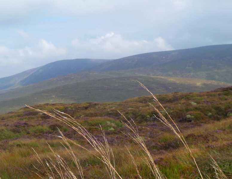
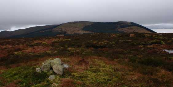
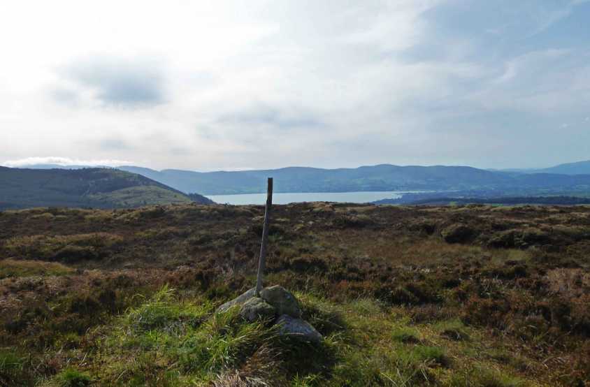
I must preface my comments on this hill by saying that I love the Mournes, from its big beauties like Bearnagh to its little hills like the Hen. However, this is one hill that won’t live long in the heart for me or be revisited! Its not that it was gruelling, like Donard on the worst day of winter, I did this yesterday evening on one of the finest days of summer. It’s just that it has no real character, it doesn’t link up nicely with its neighbours like most in the Mournes. By the standards of this area the views are average, with the bulk of Finlieve and Shanlieve blocking views of the greater hills to the north, also, the route I took to the summit was a bit of a mess!

I took in Slievemeel as part of a 12k circuit, starting out at the yellow water picnic area taking the summit of Tievedockaragh first. From here I headed over open ground for Slievemeel. As Wicklore had mentioned on the general forum earlier this week, the good weather gives us a great opportunity to get out and walk in areas that are usually boggy. The route between Tievedockaragh and Slievemeel is definitely one of these areas. Being aware of the dangers of Shanlough and the nearby Red Bog I wasn’t aware of any such dangers on the route I took (however, if I did take a foolhardy route and got lucky I would appreciate for some of the wiser ones to advise).

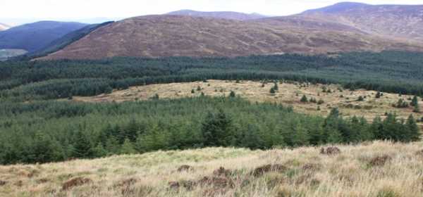
From the summit of Tievedockaragh I headed south for the edge of the forest, from here I simply skirted the edge of it until I reached the far end, at the foot of Slievemeel. From here it was a straight forward ascent to the top of this boggy, featureless hump of a hill! This route was tough enough going in dry conditions, it would be a pure slog in the wet and not one I would repeat, but it did make a circuit!

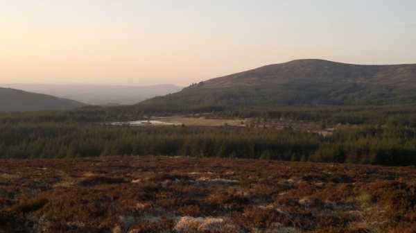
The route I took for my descent was far better and more interesting and an approach that I would recommend as a possible alternative to the route already outlined in the previous comments (for those of you who are ticking this hill off a list, I wouldn’t bother with this hill otherwise). From the summit I headed roughly north west towards the forest, hoping for a fire break, some tree felling or any kind of opening that would let me out of here. At J 20951 20766 starC I came across a small stile that took me into a very mature section of the forest, I soon came across mountain bike tracks and was able to follow them back to the end of a forest track at J 20952 21038 starD. If you were approaching this from the forest track, look out for a gap at the top right part of the clearing, the bike track is very muddy to start with and then the route is soon covered by boardwalks. I followed the forest track for about 1.5k to J 19896 19863 starE where it joins the Mourne Way, which I followed back to my car. Linkback: https://mountainviews.ie/summit/735/comment/6818/
Your Score: Very useful <<  >>Average
 
MountainViews.ie Picture about mountain Slievemeel (<i>Sliabh Míol</i>) in area Mourne Mountains, Ireland
Picture: Eagle mountain from Slievemeel summit
 
A walk of two halves
by garrettd  5 Sep 2014
Having bagged Slievecarnane and Crotlieve as a warm-up earlier in the day, I decided on a main course of a circuit of Slievemeen, Slievemartin, Crenville and Sleivemeel. The advise from other posters on the challenges of Crenville weren't ignored and a little online research for Kilbroney Park revealed a far better and more uptodate map with all its bike tracks than my 15 year old Sheet 29 OS Map.

I should preface my comments by saying that I did this walk mid-week in early September and met only one mountain biker on the stretches of bike track that I used. I would not recommend trying to use the bike tracks at weekends when they would likely be far busier and hazardous to walkers.

The circuit started at the upper carpark at J196173 starF, taking the good walking tracks past Cloghmore and into the gap between Slievemeen and Slievemartin, climbing the former first and then backtracking to head to the latter. That was the easy part of the walk and the going gets much more difficult from here. Although the south side of Crenville didn't look all that bad from the slopes of Slievemartin, I wasn't about to ignore the warnings of tussocky, boggy ground offered by others. At this point I descended to the Red/Black bike track heading north around the slopes of Slievedermot and ascended Crenville from a point after where the Red and Black tracks split at approximately J208191 starG. There is a section of board walk through the forest and after this the northern slopes of Crenville open out to reveal clear access to the summit. The underfoot conditions are difficult with holes and tussocks and long grass all the way. I can't compare with the southern side, but if that's worse then it should really be avoided.

To get from Crenville to Slievemeel is where I went wrong. I went back to the Red track and continued (east). Cycle tracks, unlike walking tracks are made unnecessarily long by adding meanders at every available opportunity and the walk around to the southern slopes of Slievemeel took about 75 minutes, almost all of it through dense, dull forest.

A better route for my walk would have been to descend from Crenville and re-trace my steps back to where the Red and Black tracks split and descend north on the Black track to the forest edge at J204199 starH. This would have been far more direct and a much more pleasant walk. The route back to the upper car park is made returning to this point and taking the forest track for around 1km to J197194 starI, where it forks. Take the upper (left) fork for about another 2km to reach the car park. The OS Sheet 29 is reliable for all of the last forested section of this circuit. Linkback: https://mountainviews.ie/summit/735/comment/17665/
Your Score: Very useful <<  >>Average
 
MountainViews.ie Picture about mountain Slievemeel (<i>Sliabh Míol</i>) in area Mourne Mountains, Ireland
Picture: The view south towards Crenville and Rostrevor.
csd on Slievemeel, 2008
by csd  3 Feb 2008
I approached Sleevemeel from the forest tracks to the west. Parking at the end of the small boreen at J192 192 starJ, my intention was to follow the tracks up to the saddle between Crenville and Slievemeel. This is harder than it looks. Coming from my starting point, you actually need to take what looks like a small path on the right about 5 - 7 mins after the forest opens out on the Mourne Way track. This will bring you up to the track that leads to the col. The summit of Slievemeel is a rounded boggy affair, adorned by a modest cairn. You do get some great views over to Crenville and Rostrevor to the south, Tievedockeragh to the north, and Shanlieve to the east. Linkback: https://mountainviews.ie/summit/735/comment/2956/
Your Score: Very useful <<  >>Average
 
Not frequented
by Val Jones  11 May 2017
Not a frequently visited summit compared to other Mourne peaks judging by the lack of paths leading up. Visited it recently when dry but it's probably a lot boggier normally. While I wouldn't discourage visiting it I wouldn't recommend trying a direct ridge route from Slieve Martin via Creville. Linkback: https://mountainviews.ie/summit/735/comment/19502/
Your Score: Very useful <<  >>Average
 
MountainViews.ie Picture about mountain Slievemeel (<i>Sliabh Míol</i>) in area Mourne Mountains, Ireland
Picture: Summit view of Carlingford Lough.
 
An energy-sapping exercise in masochism.
by Colin Murphy  21 Sep 2020
The was the third top in a three-summit circular walk involving Tievedockaragh and Finlieve, and by far the most unpleasant. Having bagged Finlieve I backtracked to J227 217 starK leaving me with a trek of 2.5km in a SW direction. It seemed straightforward enough except that for the entire journey the landscape was covered in knee-length grasses and heather, and the ground was extremely uneven. The final ascent of about 90m climbing would normally take me about 15 minutes were the going underfoot good, this took me almost an hour of energy-draining leg lifting, tumbling and sinking in boggy patches - and this was after a week of dry, sunny weather. Decent views at the top, but one purely for the baggers, and if you must do it, avoid this approach! Linkback: https://mountainviews.ie/summit/735/comment/20896/
Your Score: Very useful <<  >>Average
 
COMMENTS for Slievemeel (Sliabh Míol) 1 2 Next page >>
(End of comment section for Slievemeel (Sliabh Míol).)

OSi logo OSNI/LPS logo
Some mapping:
Open Street Map
(Various variations used.)
British summit data courtesy:
Database of British & Irish Hills
(Creative Commons Licence)
MountainViews.ie, a Hill-walking Website for the island of Ireland. 2300 Summiteers, 1460 Contributors, Newsletter since 2007