Donation Request 2024

DONATE
Members and Supporters, the MountainViews Committee requests your help to meet the costs of the website and of other activities such as insured events or publications.
You do not have to be logged in to donate.
Features
Nearby features appear when you click the map.
Declutter tracks on map.
Place Search
Video
X
Pub: by
Mourne Mountains Area , W: Slievemoughanmore Subarea
Feature count in area: 58, all in Down, OSI/LPS Maps: 20, 29, EW-CLY
Highest Place: Slieve Donard 849m

Starting Places (33) in area Mourne Mountains:
Alex Steddom Tree, Aughrim Airstrip, Ben Crom Dam, Bloody Bridge Car Park, Carlingford Greenway, Carrick Little, Crocknafeola Wood, Crotlieve Mountain, Donard Car Park Newcastle, Drummanmore Picnic, Fofanny Reservoir, Forest Office CP, Gamekeepers Lodge CP, Happy Valley Trassey Rd, Hen Mountain CP, Leitrim Lodge CP, Mayo Road Corner, Meelmore Lodge, Newcastle Harbour, Ott CP, Red Bog Road, Rourkes Park, Sandy Brae, Silent Valley Reservoir Head Rd, Slieve Donard Trail Head, Slieve Foye Viewing Point, Slievefoy Forest CP, Spelga Dam E, Spelga Dam N, Spelga Dam S, Trassey Car Park, Two Mile River CP, Yellow Water Park

Summits & other features in area Mourne Mountains:
Cen: Loughshannagh: Ben Crom 526m, Carn Mountain 585.2m, Carn Mountain North Top 553.7m, Doan 592.6m, Ott Mountain 526.8m, Slieve Loughshannagh 617m, Slieve Muck 670.4m, Slievenaglogh 445m
E: Binnian: Slieve Binnian 745.9m, Slieve Binnian East Top 639m, Slieve Binnian North Top 678m, Slieve Binnian North Tor 682.5m, Wee Binnian 460m
E: Donard: Chimney Rock Mountain 656m, Crossone 540m, Millstone Mountain 460m, Rocky Mountain 524m, Slieve Donard 849m
E: Lamagan: Cove Mountain 654.8m, Slieve Beg 595.9m, Slievelamagan 702.2m
N: Bearnagh: Slieve Bearnagh 739m, Slieve Bearnagh North Tor 680m, Slieve Meelbeg 701.9m, Slieve Meelmore 687m
N: Castlewellan: Slievenalargy 280m, Slievenaslat 272m
N: Commedagh: Slieve Commedagh 767m, Slieve Corragh 641.9m, Slievenaglogh 584.4m, Slievenaglogh East Top 571m
N: Croob: Cratlieve 429m, Slieve Croob 534m, Slievegarran 391m, Slievenisky 446m
N: Rathfriland: Knockiveagh 235m
S: Kilkeel: Knockchree 306m
S: Rostrevor: Crenville 460m, Finlieve 578m, Slievemartin 485m, Slievemeel 420m, Slievemeen 472m
W: Hilltown: Gruggandoo 382m, Slieveacarnane 296m
W: Slievemoughanmore: Crotlieve Mountain 347m, Eagle Mountain 638m, Rocky Mountain 404m, Shanlieve 626m, Slievemoughanmore 560m, Tievedockaragh 473m, Wee Slievemoughan 428m
W: Spelga: Butter Mountain 500m, Cock Mountain 504m, Cock Mountain South-West Top 505m, Hen Mountain 354m, Pigeon Rock Mountain 534m, Pigeon Rock Mountain South Top 530m, Slievenamiskan 444m

Note: this list of places may include island features such as summits, but not islands as such.
Rating graphic.
Eagle Mountain, 638m Mountain Sliabh an Iolair A name in Irish,
Place Rating ..
(Ir. Sliabh an Iolair [PNNI], 'mountain of the eagle'), Down County in Ulster province, in Arderin, Vandeleur-Lynam Lists, Eagle Mountain is the 225th highest place in Ireland.
Grid Reference J24492 22977, OS 1:50k mapsheet 29
Place visited by: 389 members, recently by: trostanite, rhw, MeabhTiernan, davidrenshaw, Prem, Magic, Carolineswalsh, Dee68, arthur, ElaineM76, Beti13, ToughSoles, Sonyalaw, Kaszmirek78, abeach
I visited this place: NO (You need to be a logged-in member for this.)
Longitude: -6.095881, Latitude: 54.140775, Easting: 324492, Northing: 322977, Prominence: 263m,  Isolation: 0.5km
ITM: 724412 822982
Bedrock type: Granite granophyre, (Mourne Mountains granite)
Notes on name: The approach from Attical gives you a view of the spectacular Great Gully. The eastern slopes are dotted with quarries.
  Short or GPS IDs, 6 char: EglMnt, 10 char: EglMntn

Linkback: https://mountainviews.ie/summit/217/
Gallery for Eagle Mountain (Sliabh an Iolair) and surrounds
Summary for Eagle Mountain (Sliabh an Iolair): A fine place for a view
Summary created by Harry Goodman 2011-10-26 19:43:44
            MountainViews.ie picture about Eagle Mountain (<em>Sliabh an Iolair</em>)
Picture: Looking E to Slieve Binnian from Eagle Mt. summit.
Route 1:Start Leitrim Lodge car park A (J224 257). Follow the track SE to B (J232 244). Go up left (E) over a small col before dropping down SE to cross the Rocky Water stream. Continue up in same direction to the Windy Gap C (J246 236). Turn steeply up right (SW) and follow line of Batts Wall for 500m. Where it turns sharp left follow it along for 300m, cross a stile and walk the short distance out to the summit cairn. Route 2: Start from Attical Community Centre car park D (J268 189). Go NE and turn into Sandy Brae. Follow along for 2k to a small foot bridge SndyBr (J263 206). Once across go left and follow a stone wall up to and over a stile. Head NW up the spur picking up a track E (J25253 21673) and then up to a check point F (J24792 22303). Continue up along the high right edge of the steep east face of the mountain to gain the top (summit cairn). Return by way of ascent or for a looped walk go the short distance across to Batt's Wall and follow it NW along the crest and then steeply down NE to Windy Gap G (J24650 23675). From here a right turn SE soon leads to a track which can then be followed down to Sandy Brae and back to the start.
The views from the top of Eagle are extensive in all directions, from Slieve Foye and the Cooleys to the W, the distant Sperrins and Belfast Hills to the N and best of all a wonderful panorama E to the High Mournes with the jagged profile of Slieve Binnian particularly prominent.
Linkback: mountainviews.ie/summit/217/comment/4977/
Member Comments for Eagle Mountain (Sliabh an Iolair)
Comment create / edit display placeholder

            MountainViews.ie picture about Eagle Mountain (<em>Sliabh an Iolair</em>)
Picture: The Old Man of Eagle
Renewing old acquaintances
by Harry Goodman 27 Oct 2011
As I had not been over Eagle Mt. for some time a friend and I decided on 20th April 2010 to include it in a looped walk which also took in the tops of Shanlieve and Finlieve (not a listed mv Top). We parked in the Attical Community Centre Car Park H (J26828 18940) and walked a short way towards the village before turning left into Sandy Brae which we followed along for some 2k to an old foot-bridge SndyBr (J26331 20593). In the past I would have driven up to this point and parked beside some farm buildings but I understand that from time to time there has been some tampering with cars left here and I did not consider it worth taking any chances! Also at this point along the Brae there was a notice stating that the lane beyond is private land. A small detour was therefore necessary by turning left along a stone wall and up to and over a stile. From here we headed NW up the long spur of Eagle Mt. to pick up a track at I (J22525 32167)3. From time to time this path became rather sparse but was always idenifiable as it led us up to a high point at F (J24792 22303) with superb views across the steep E face of the mountain and down to the Windy Gap track. The path then wound around W and N to the top. On the way we stopped to renew our acquaintances with the "Old Man of Eagle" (my name), a cluster of large granite blocks (see photo) on the high cliff edge of the mountain. J (J24766 22331). Once at the summit cairn we walked the short distance across to Batts Wall where we turned left and followed it along to Shanlieve the next top in our planned loop. The views from the top are extensive, in all directions, from Slieve Foye and the Cooleys to the W, the distant Sperrins and Belfast Hills to the N and best of all a wonderful panorama of the High Mournes E with the jagged profile of Slieve Binnian particularly prominent. For someone not wishing to do this loop I would recommend that the Wall is followed NW and then sharply down NE to Windy Gap at G (J24650 23675) where a right turn SE soon leads to a path which can then be followed down to what becomes the Sandy Brae track and back to the start. However remember on the way down to leave the track and follow the short detour around the private land noted on the way up. Linkback: mountainviews.ie/summit/217/comment/4650/
Read Less
Read More

            MountainViews.ie picture about Eagle Mountain (<em>Sliabh an Iolair</em>)
Picture: Eagle Mt east side.
mneary34 on Eagle Mountain
by mneary34 2 Oct 2005
Eagle Mountain is set well away from the main summits in the Mournes and it takes a dedicated trip to get there. I approached it from Slievemoughanmore and there is quite a height drop between the two. This photo shows the typical Mourne wall leading down from Slievemoughanmore and up more steeply on the other side to the Summit of Eagle Mountain. Linkback: mountainviews.ie/summit/217/comment/1976/
Read Less
Read More

Bleck Cra on Eagle Mountain
by Bleck Cra 1 Aug 2004
tsunami: the fact that you enjoyed any of that is testament to your determination. The best way to do any any of these is to kick off from just out of Hilltown at the foot of Hen Mountain: that way you can do a horseshoe without even getting the horse's feet damp - unlike your own experience. The castle and red bogs are famous in these airts and will soak you to your gusset even after 6 months of drought. It is also arguable if Finlieve is ever worth the bother. My one and only recollection of same is that the views across Carlingford are stunning but not stunning enough ever to get me back there. Take my route and be very pleased and congratulations for foregoing the main Mourne thoroughfares. Linkback: mountainviews.ie/summit/217/comment/1040/
Read Less
Read More

Bleck Cra on Eagle Mountain
by Bleck Cra 13 Oct 2004
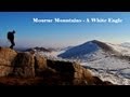
A couple of weeks back, in appalling conditions, thirty-or-so Drogheda innocents were lead off the Mournes by the Rescue. Some sneer; some not and some are glad no one died.
There is not one of us who has not had the bejasus scared out of us at some time by ……. absolutely nothing. Not kiss-close crags; not sand-blast hail; neither distance nor danger.
It’s that “absolutely nothing” - the blind bog in the black mirk that does the trick.
Of the 15 odd years in the Scottish Hills and now nearly the same in the Mournes and beyond, there are only 2 spots fill me with quaking apprehension every time I beat myself into them.
The knife ridges of Aonach Eagach? The wicked black airiness of Mweelrea? The lepping lottery of the Devil’s Coachroad?
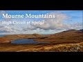
Nope - two black-hearted bogs: South of Mullwharchar in the Galloway Hills and The Red/Castle Bogs: out of Hilltown, out of sight, out of mind.
The latter as I understand is where a third century of terrified youngsters were tracked down by the peak police.
This is a very bad place.

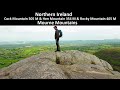
As soon as the mist comes down, two things happen: coming off Eagle, you play safe (to avoid nowhereland) by bearing too far South - problem 1. And now problem 2, navigating what is actually a “flow” - the best of us find ourselves knee-deep in bog with not a stone for a visual ref and the prospect of death exhausting us.
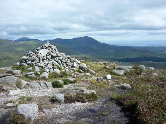
Dragged up on to Pierce’s Castle, you feel like a cormorant come out of an oil slick.
Going the other way ….., alas I have to go with the first opinion above - and were it such, thanks to various saints they never got a-top Eagle or they might have gone a-bottom. Linkback: mountainviews.ie/summit/217/comment/1245/
Read Less
Read More

            MountainViews.ie picture about Eagle Mountain (<em>Sliabh an Iolair</em>)
simon3 on Eagle Mountain
by simon3 12 Dec 2004
Descending at sunset one winter’s day off the spur leading north from Eagle’s summit one of my fellow travellers, (well known MV contributor, Bleck Cra) pointed out this misty sunset. The sunset certainly was a thing of beauty which is more than can be said for the boggy, tussocky couple of k we had walking out north along the Rocky Water stream. Linkback: mountainviews.ie/summit/217/comment/1360/
Read Less
Read More
EDIT Point of Interest
text
Videos


Recent Contributions
x
Conditions and Info
Use of MountainViews is governed by conditions and a privacy policy.
Read general information about the site.
Opinions in material here are not necessarily endorsed by MountainViews.
Hillwalking is a risk sport. Information in comments, walks, shared GPS tracks or about starting places may not be accurate for example as regards safety or access permission. You are responsible for your safety and your permission to walk.
See the credits and list definitions.

OSi logo
OSNI/LPS logo
Open Street Map
(Various variations used.)
British summit data courtesy:
Database of British & Irish Hills