If you want to use the website often please enrol (quick and free) at top right.

 Get Notifications
Hag's Tooth: This might hurt
 No1Grumbler
Galtymore: Dawn on Galtymore
 DeirdreM
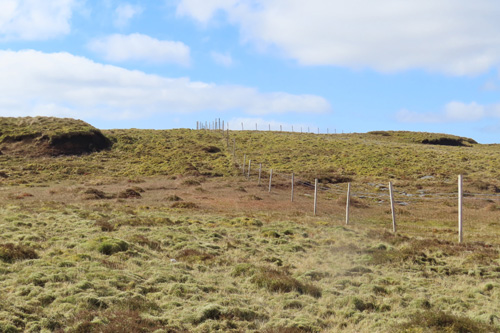
One of Irelnad`s finest routes
Keale Mountain: Hard to access the top
Half Glencoaghan
East Girt Hill: Short trek from West Girt Hill
 Fergalh
Traverse of Lackavrea
 glencree
West Girt Hill: Short trek to summit
 Fergalh
Belmore from NW - SOUTH route CLOSED
Hill of Stake: East trek along track to mines followed by wet heather bash
 Fergalh
Carrane from SSW
Fynloch Hill: Outlier of Kilpatrick Hills
 Fergalh
Use of MountainViews is governed by conditions and a privacy policy.
Read general information about the site.
Opinions in material here are not necessarily endorsed by MountainViews.
Hillwalking is a risk sport. Information in comments, walks, shared GPS tracks or about starting places may not be accurate for example as regards safety or access permission. You are responsible for your safety and your permission to walk.
See the credits and list definitions.
 Visit our Facebook page.
 Length: 13.8km, Creator time taken: 4h41m, Ascent: 569m,
Descent: 571m
Places: Start at G7013481134, Crocknapeast, Maol na nDamh, end at Start
Logged as completed by 1

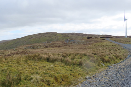
There is parking for about 3 cars at the start point, which is a gate to a windfarm/forest road. Cross this and turn right at the T-junction, simply following the (rather boring) gravel road as it rises to the north for about 3km. As you climb the views improve greatly to the south, with Croaghanard rising above a broad valley and the ocean beyond Killybegs.
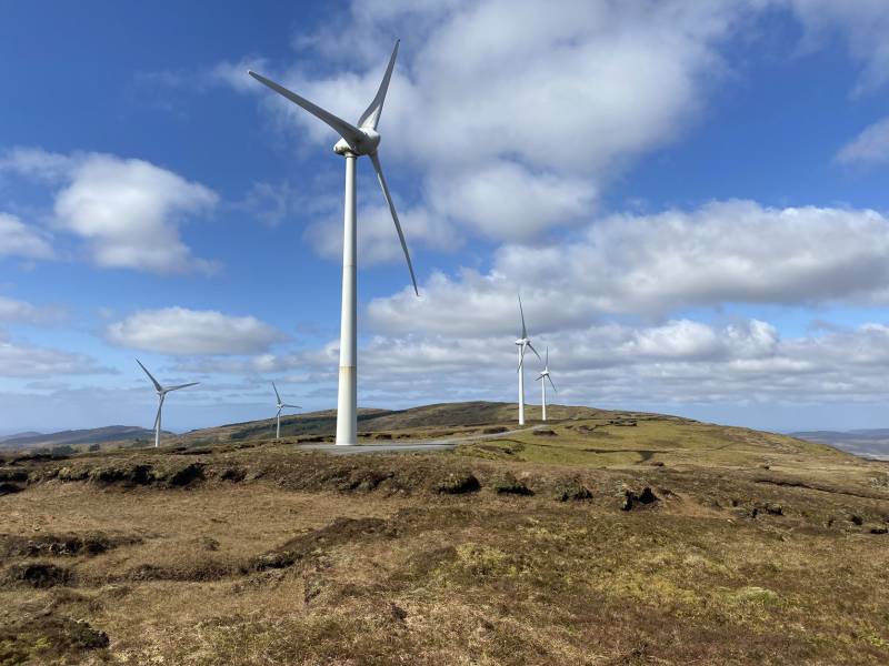
When the road swings sharply east, next to a wind turbine, you have the choice of bagging Mulnanaff or continuing on and ascending Crocknapeast to the NE.
NOTE: ALL information such as Ascent, Length and Creator time taken etc should be regarded as approximate. The creator's comments are opinions and may not be accurate or still correct.
Your time to complete will depend on your speed plus break time and your mode of transport. For walkers: Naismith's rule, an approximate though often inaccurate estimate, suggests a time of 3h 43m + time stopped for breaks
NOTE: It is up to you to ensure that your route is appropriate for you and your party to follow bearing in mind all factors such as safety, weather conditions, experience and access permission.
* Note: A GPS Height in the elevation profile is sourced from the device that recorded the track. An "SRTM" height is derived from a model of elevations for parts of the earth. More detail![]()
|
|
|
||
| MountainViews.ie, a Hill-walking Website for the island of Ireland. 2400 Summiteers, 1480 Contributors, maintainer of lists: Arderins, Vandeleur-Lynams, Highest Hundred, County Highpoints etc | |||