Welcome to MountainViews
If you want to use the website often please enrol (quick and free) at top right.
If you want to use the website often please enrol (quick and free) at top right.
Overview

For more map options click on any overview map area or any detail map feature.
Detail Map Features
Showing 6 items:
Binbane 453m, Binbane NE Top 439m, Cloghmeen Hill 429m,
2102, 18km
1979, 14km
5077, 4km
Binbane 453m, Binbane NE Top 439m, Cloghmeen Hill 429m,
Tracks:
Find Suggested Walks
Find hill, mountain, island, coastal feature.
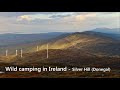
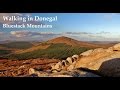
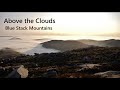
Videos

Recent Contributions
 Get Notifications
Get Notifications
Hag's Tooth: This might hurt
 No1Grumbler
Galtymore: Dawn on Galtymore
 DeirdreM
One of Irelnad`s finest routes
Keale Mountain: Hard to access the top
Half Glencoaghan
East Girt Hill: Short trek from West Girt Hill
 Fergalh
Traverse of Lackavrea
 glencree
West Girt Hill: Short trek to summit
 Fergalh
Belmore from NW - SOUTH route CLOSED
Hill of Stake: East trek along track to mines followed by wet heather bash
 Fergalh
Carrane from SSW
Fynloch Hill: Outlier of Kilpatrick Hills
 Fergalh
Conditions and Info
Use of MountainViews is governed by conditions and a privacy policy.
Read general information about the site.
Opinions in material here are not necessarily endorsed by MountainViews.
Hillwalking is a risk sport. Information in comments, walks, shared GPS tracks or about starting places may not be accurate for example as regards safety or access permission. You are responsible for your safety and your permission to walk.
See the credits and list definitions.
 Visit our Facebook page.
Video display
Bluestack Mountains
Area SW: Eany Beg Hills Subarea
Place count in area: 45,
OSI/LPS Maps: 11, 6
Highest place: Croaghgorm, 674m
Maximum height for area: 674 metres,
Maximum prominence for area: 541 metres,
Places in area Bluestack Mountains:
Cen: Reelan Hills:Altnapaste 364mGaugin Mountain 565mLacroagh 403mBoultypatrick 429mCroveenananta 476mCroaghubbrid 416mCroaghugagh 410m
N: Fintown Hills:Aghla Mountain South Top 589mAghla Mountain 593mScraigs 426mCroaghleheen 385m
NW: Glenties:Cloghercor South 301mDerkbeg Hill 332mDrumnalough Hill 282m
S: Belshade:Croaghgorm 674mCroaghgorm South-West Top 597mCroaghgorm East Top 594mArdnageer 642mArdnageer SW Top 626mBanagher Hill 392mCroaghbane 641mCroaghgorm Far South-West Top 561mCronamuck 444mCroaghbarnes 498.8mGlascarns Hill 578.3mMeenanea 435m
SE: Barnesmore:Brown's Hill 496.4mCloghervaddy 402mCroaghagranagh 440mCroaghanirwore 546.1mCroaghbrack 401mCroaghconnellagh 523mCroaghnageer 569.1mCroaghnageer East Top 543.5mCroaghnageer North-East Top 521mCroaghonagh 451m
SW: Eany Beg Hills:Binbane 453mBinbane NE Top 439mLavagh Beg 650mLavagh More 671mBinnasruell 505mCarnaween 521mCloghmeen Hill 429mSilver Hill 600mCullaghacro 476m
Note: this list of places includes island features such as summits, but not islands as such.
Highest place:
Croaghgorm, 674mPlaces in area Bluestack Mountains:
Cen: Reelan Hills:
Altnapaste 364mGaugin Mountain 565mLacroagh 403mBoultypatrick 429mCroveenananta 476mCroaghubbrid 416mCroaghugagh 410mN: Fintown Hills:
Aghla Mountain South Top 589mAghla Mountain 593mScraigs 426mCroaghleheen 385mNW: Glenties:
Cloghercor South 301mDerkbeg Hill 332mDrumnalough Hill 282mS: Belshade:
Croaghgorm 674mCroaghgorm South-West Top 597mCroaghgorm East Top 594mArdnageer 642mArdnageer SW Top 626mBanagher Hill 392mCroaghbane 641mCroaghgorm Far South-West Top 561mCronamuck 444mCroaghbarnes 498.8mGlascarns Hill 578.3mMeenanea 435mSE: Barnesmore:
Brown's Hill 496.4mCloghervaddy 402mCroaghagranagh 440mCroaghanirwore 546.1mCroaghbrack 401mCroaghconnellagh 523mCroaghnageer 569.1mCroaghnageer East Top 543.5mCroaghnageer North-East Top 521mCroaghonagh 451mSW: Eany Beg Hills:
Binbane 453mBinbane NE Top 439mLavagh Beg 650mLavagh More 671mBinnasruell 505mCarnaween 521mCloghmeen Hill 429mSilver Hill 600mCullaghacro 476mNote: this list of places includes island features such as summits, but not islands as such.

Bedrock type: Quartz & feldspar pebbles, green matrix, (Lough Mourne Formation)
According to OG this name is derived from Benn Bogaine or Benn Baghaine, 'peak of the Cenél Bogaine'. An Bhinn Bhán is the 724th highest place in Ireland. An Bhinn Bhán is the second most westerly summit in the Bluestack Mountains area.
Linkback: https://mountainviews.ie/summit/610/
COMMENTS for Binbane (An Bhinn Bhán) 1 of 1  Follow this place's comments

|
|
|
|
||
| MountainViews.ie, a Hill-walking Website for the island of Ireland. 2400 Summiteers, 1480 Contributors, maintainer of lists: Arderins, Vandeleur-Lynams, Highest Hundred, County Highpoints etc | |||