Cookies.
This website uses cookies, which are small text files that the website puts on your device to facilitate operation. Cookies help us provide a better service to you. They are used to track general user traffic information and to help the website function properly.
Features
Nearby features appear when you click the map.
Declutter tracks on map.
Place Search
Video
X
Pub: by
Bluestack Mountains Area , SW: Eany Beg Hills Subarea
Feature count in area: 45, all in Donegal, OSI/LPS Maps: 11, 6
Highest Place: Croaghgorm 674m

Starting Places (22) in area Bluestack Mountains:
An Leathchruach, Barnsmore Gap, Bensons Hill, Caldragh CP, Clogher South peak, Cruach Mhín an Neanta, Doobin, Eanybeg Water Bridge, Edergole Farm, Gaugin Mountain, Glennacree CP, Hillhead, Lough Finn West, Lough Magrath Beg NE, Lough Muck North, Meenaguse Lough, Sand Lough Forest Picnic Area, Scoil Náisúnta an Choimín, Sheskinlubanagh, Sruell Gap Farm, Sruell River Road, St Columbkilles Well and Altar

Summits & other features in area Bluestack Mountains:
Cen: Reelan Hills: Altnapaste 364m, Gaugin Mountain 565m, Lacroagh 403m, Boultypatrick 429m, Croveenananta 476m, Croaghubbrid 416m, Croaghugagh 410m
N: Fintown Hills: Aghla Mountain South Top 589m, Aghla Mountain 593m, Scraigs 426m, Croaghleheen 385m
NW: Glenties: Cloghercor South 301m, Derkbeg Hill 332m, Drumnalough Hill 282m
S: Belshade: Croaghgorm 674m, Croaghgorm South-West Top 597m, Croaghgorm East Top 594m, Ardnageer 642m, Ardnageer SW Top 626m, Banagher Hill 392m, Croaghbane 641m, Croaghgorm Far South-West Top 561m, Cronamuck 444m, Croaghbarnes 498.8m, Glascarns Hill 578.3m, Meenanea 435m
SE: Barnesmore: Brown's Hill 496.4m, Cloghervaddy 402m, Croaghagranagh 440m, Croaghanirwore 546.1m, Croaghbrack 401m, Croaghconnellagh 523m, Croaghnageer 569.1m, Croaghnageer East Top 543.5m, Croaghnageer North-East Top 521m, Croaghonagh 451m
SW: Eany Beg Hills: Binbane 453m, Binbane NE Top 439m, Lavagh Beg 650m, Lavagh More 671m, Binnasruell 505m, Carnaween 521m, Cloghmeen Hill 429m, Silver Hill 600m, Cullaghacro 476m

Note: this list of places may include island features such as summits, but not islands as such.
Rating graphic.
Carnaween, 521m Mountain Carn an Mhaoin A name in Irish,
Place Rating ..
Ir. Carn an Mhaoin [Seaghán ‘ac Meanman], 'cairn of the hero’, Donegal County in Ulster province, in Arderin Lists, Carnaween is the 505th highest place in Ireland.
Grid Reference G87597 89146, OS 1:50k mapsheet 11
Place visited by: 69 members, recently by: abeach, BleckCra, srr45, gdg, annem, AlanReid, walkingireland, Pepe, ilenia, eamonoc, arderincorbett, Grumbler, eoghancarton, Peter Walker, eryri
I visited this place: NO (You need to be a logged-in member for this.)
Longitude: -8.193347, Latitude: 54.750065, Easting: 187597, Northing: 389146, Prominence: 166m,  Isolation: 2.6km
ITM: 587552 889133
Bedrock type: Mylonitic, (Tectonic schist)
Notes on name: The hero referred to in the name Carn an Mhaoin is Diarmuid Ó Duibhne, a well-known character in the Fionn Cycle of tales. There is a local tradition of climbing this peak on the first Sunday in June, known as "Lá Charn an Mhaoin". This information comes from the writings of Seaghán ‘ac Meanman of Glenties (1886 – 1962). Many thanks to Ciarán Ó Duibhín for drawing our attention to this. Go raibh mile maith agat, a Chiaráin! This peak is in the townland of Disert (par. of Inver) and is named Craig on the 1st edition OS 6” map.
  Short or GPS IDs, 6 char: Crnwn, 10 char: Carnaween

Linkback: https://mountainviews.ie/summit/409/
Gallery for Carnaween (Carn an Mhaoin) and surrounds
Summary for Carnaween (Carn an Mhaoin): Simple ascent to fine summit.
Summary created by Colin Murphy 2013-11-26 14:13:33
            MountainViews.ie picture about Carnaween (<em>Carn an Mhaoin</em>)
Picture: Carn Lough from the southern slopes
From the south, drive through the village of Letterbarrow and continue for a mile or two till you come to the local soccer pitch. Turn left (signposted Disert Graveyard) and then right where there’s room to park on a grassy verge at A (G882 869). Head up the track and pass an abandoned farmhouse, continue over a ditch into open hillside in a NNW direction. The slope is relatively easy going for about 1km, although quite boggy in parts. The final couple of hundred metres ascent is quite steep, and finishes with a large rocky outcrop marking the summit. You will also find a metal cross atop a metal box, which contains a visitors book! Return the way you came, for a round trip of 2 hours.
Linkback: mountainviews.ie/summit/409/comment/5168/
Member Comments for Carnaween (Carn an Mhaoin)
Comment create / edit display placeholder

            MountainViews.ie picture about Carnaween (<em>Carn an Mhaoin</em>)
Picture: The King of The Mountain...
madfrankie on Carnaween
by madfrankie 4 Jun 2008
Last Sunday I saw Elvis on Carnaween. Read on, unbelievers...
As Carnaween is a bit of a western outlier, doing it on it’s own is not a bad idea, especially if time, weather or laziness is a factor.
From the south, drive through the village of Letterbarrow and continue for a mile or two till you come to the local soccer pitch. Turn left (signposted Disert Graveyard) and then right where there’s room to park on a grassy verge (A (G882 869)).
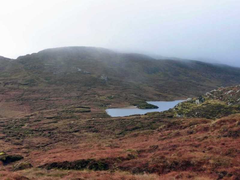
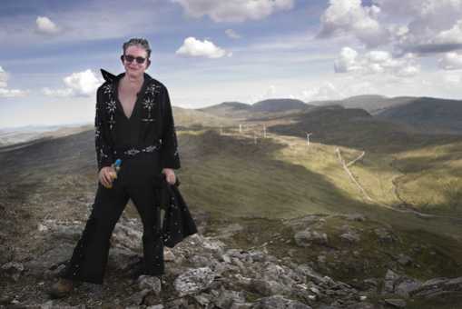
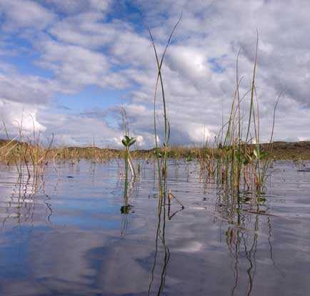
At the top of the track pass an abandoned farmhouse and continue over a ditch into open hillside. As we climbed the dry slopes we became aware of many people of all ages doing likewise, apparently an annual walk for the locals and part of The Frosses Summer Festival. A sheep fence provided a handrail ascending into a cleft between the cliff-bound summit and a minor knoll. Once at the top it was a brief ascent to the crowded summit where, bizarrely, were were met by dozens of Elvis impersonators and a man playing a fiddle.
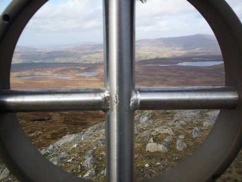
Besides the cairn and it’s illuminating cross, there is another steel cross and also a newly installed steel sculpture of a Fimnn McCool character. As we munched our sandwiches, we were witness to more Elvis’s in varying authenticity of garb sweatily emerging onto the smallish summit area. It would seem that it was all part of a fund-raising attempt for local cancer-treatment facilities.
Eventually the midges (it was a very crowded summit) forced us down by our ascent route, but as Simon3 suggests, it could easily be start of a longer walk across the lower western tops to Binbane (though be aware of steep ground on Carnaween’s western and southern slopes). Linkback: mountainviews.ie/summit/409/comment/3147/
Read Less
Read More

            MountainViews.ie picture about Carnaween (<em>Carn an Mhaoin</em>)
Picture: Looking north through Carnaween's Summit Cross
eflanaga on Carnaween
by eflanaga 21 Feb 2007
From Silver Hill's second and smaller cairn IB (G90694 91376) I took a bearing of 256 degrees to take me to Cullaghacro Top (476m) a little short of 2k to the southwest. The descent of Silver Hill, as for it's ascent, posed little difficulty. I then made for the clear green swathe which climbs Cullaghacro's eastern slope and found once I had negotiated a few peat hags and the fence at it's base that this was the easiest route of ascent. From Cullaghacro IC (G89582 90902) I veered off my initial route and took a bearing of 243 degrees over a spot height ID (G89494 90761), crossing over to, and contouring around the northern slopes of Meenacloghspar (climbed on outward leg), in order to avoid loosing unnecessary height. Passing the windfarm I crossed another fence and made my way laboriously through another wet peat hag strewn area. Eventually, as height was gained the ground firmed up and having passed Miley's Lough IE (G88477 89755) & a large crag I began to swing around to the northern spur leading up to Carnaween. A couple of relatively new, and well made, styles facilitated crossing of the now, seemingly compulsory fences. Carnaween's rugged outline can be best appreciated on this approach. Having gained the ridge I slipped around the heights and approached the summit cairn with its small Celtic style metal cross from the north. From the summit IF (G87597 89158) more spectacular views such those described so eloquently by GerryM below awaited. The descent of Carnaween's southern/southeastern aspect is hindered by some pretty precipitous cliffs although I did find a relatively easy route with a little scrambling to the east side of these. There follows on last fence to negotiate then a steep drop on a bearing of 119 to a and a lane (not shown on map). A small bridge and gate and short climb up on to the main track brought me quickly back to my starting point and the car. A very enjoyable walk which took 3.5 hours with only one very short stop. Linkback: mountainviews.ie/summit/409/comment/2624/
Read Less
Read More

            MountainViews.ie picture about Carnaween (<em>Carn an Mhaoin</em>)
Picture: Carnaween from wind turbines
gerrym on Carnaween
by gerrym 4 Jun 2005
(See Silver Hill for first part of walk) From Silver Hill it is a walk of some 4 km and 1.5 hours to the top of Carnaween to the SW. Drop down past a couple of small pools on the left, with the large loughs of Maghrath Beg and More below in the valley to the right. Cross a fairly recently constructed fence on ground which is a mixture of rock and wet grass. Walking in the direction of the wind turbines and their access roads - it is only when are right beside that can fully appreciate thier scale and hear the blades slicing through the air generating electricity. There is no doubt that they are an interesting diversion but cannot help thinking of the intrusion on the wilderness of the turbines themselves and the acccess roads crudely carved out of the landscape. Continue downhill from the turbines over pretty wet ground before the climb up Carnaween, where the going is on firmer grass with rock outcrops. Pick up marker posts with yellow tops and there are even stiles over a couple of fence lines on the way to the top. The reasoning becomes apparent at the rocky summit where there is a cairn with a metal cross - a place of pilgramage I presume. The views continue to be stunning and as is the most westerly summit in the Bluestacks gives a good view into the range, with an inkling of the deep gap of Struell, and further to the east the Barnesmore hills with thier masts and extensive wind farms. Good views out to sea from the sands at Maghera to Donegal Bay and the surrounding mounatainscape. The full extent of the hydro scheme is also laid out, from the lough created by the dammed river to where piped water renters the river at a hydro building. Despite being lower than most of the other hills in the Bluestacks this is a very interesting area and the hill is distinctive and has character in itself - first time I have have seen wind turbines up close and had to pull myself away from gazing up at and admiring them. Linkback: mountainviews.ie/summit/409/comment/1732/
Read Less
Read More

            MountainViews.ie picture about Carnaween (<em>Carn an Mhaoin</em>)
Picture: Lough Carn.
simon3 on Carnaween
by simon3 6 Oct 2007
Approaching Carnaween from the west, Cloghmeen Hill side you will encounter a stretch of the Bluestacks Way. It leaves the valley road to the north at a ruined house around G (G8517 8880), goes along the crest of the ridge to a stile at around H (G8681 8833) where it then takes off East. As of 2007 there is only a bare trace of a path following the route of the waymarked way.

One way to access the summit and Cloghmeen Hill is to start at the house mentioned.
South of the summit there is the peaceful reed filled water of Carn Lough where this picture was taken. It is surprisingly steep from the Lough to the summit. Linkback: mountainviews.ie/summit/409/comment/2853/
Read Less
Read More

            MountainViews.ie picture about Carnaween (<em>Carn an Mhaoin</em>)
Picture: Stormy weather over the Bluestacks.
Bad Weather Adding Drama To Great Views
by Aidy 14 Jan 2017
I used the commonly taken route from Disert Graveyard (worth a visit in its own right) over ground that was alternatively boggy or pretty steep. It was freezing cold in these parts, with a strong wind and heavy showers, sometimes turning to hail. I was trying a new poncho type thing as a waterproof cover that I hoped would be a quick way of protecting my camera and bag etc as well as myself, and it worked well until I got to the summit where the wind was so strong it completely tore it to shreds! On the face of it, it should have been a miserable enough experience,, but it was actually a brilliant walk. Carnaween presents a shapely profile from nearby summits, and despite the boggy ground, the rocky nature of the top is impressive. There are magnificent views into the rest of the Bluestacks and towards the coast, and the stormy weather and passing showers only added drama to the views. I was well rewarded for venturing out in bad conditions. Linkback: mountainviews.ie/summit/409/comment/18796/
Read Less
Read More
EDIT Point of Interest
text
Videos


Recent Contributions
x
Conditions and Info
Use of MountainViews is governed by conditions and a privacy policy.
Read general information about the site.
Opinions in material here are not necessarily endorsed by MountainViews.
Hillwalking is a risk sport. Information in comments, walks, shared GPS tracks or about starting places may not be accurate for example as regards safety or access permission. You are responsible for your safety and your permission to walk.
See the credits and list definitions.

OSi logo
OSNI/LPS logo
Open Street Map
(Various variations used.)
British summit data courtesy:
Database of British & Irish Hills