Members and Supporters, the MountainViews Committee requests your help to meet the costs of the website and of other activities such as insured events or publications.
Feature count in area: 45, all in Donegal,
OSI/LPS Maps: 11, 6
Highest Place: Croaghgorm 674m
Starting Places (22) in area Bluestack Mountains: An Leathchruach, Barnsmore Gap, Bensons Hill, Caldragh CP, Clogher South peak, Cruach Mhín an Neanta, Doobin, Eanybeg Water Bridge, Edergole Farm, Gaugin Mountain, Glennacree CP, Hillhead, Lough Finn West, Lough Magrath Beg NE, Lough Muck North, Meenaguse Lough, Sand Lough Forest Picnic Area, Scoil Náisúnta an Choimín, Sheskinlubanagh, Sruell Gap Farm, Sruell River Road, St Columbkilles Well and Altar
Summits & other features in area Bluestack Mountains: Cen: Reelan Hills: Altnapaste 364m, Gaugin Mountain 565m, Lacroagh 403m, Boultypatrick 429m, Croveenananta 476m, Croaghubbrid 416m, Croaghugagh 410m N: Fintown Hills: Aghla Mountain South Top 589m, Aghla Mountain 593m, Scraigs 426m, Croaghleheen 385m NW: Glenties: Cloghercor South 301m, Derkbeg Hill 332m, Drumnalough Hill 282m S: Belshade: Croaghgorm 674m, Croaghgorm South-West Top 597m, Croaghgorm East Top 594m, Ardnageer 642m, Ardnageer SW Top 626m, Banagher Hill 392m, Croaghbane 641m, Croaghgorm Far South-West Top 561m, Cronamuck 444m, Croaghbarnes 498.8m, Glascarns Hill 578.3m, Meenanea 435m SE: Barnesmore: Brown's Hill 496.4m, Cloghervaddy 402m, Croaghagranagh 440m, Croaghanirwore 546.1m, Croaghbrack 401m, Croaghconnellagh 523m, Croaghnageer 569.1m, Croaghnageer East Top 543.5m, Croaghnageer North-East Top 521m, Croaghonagh 451m SW: Eany Beg Hills: Binbane 453m, Binbane NE Top 439m, Lavagh Beg 650m, Lavagh More 671m, Binnasruell 505m, Carnaween 521m, Cloghmeen Hill 429m, Silver Hill 600m, Cullaghacro 476m
Note: this list of places may include island features such as summits, but not
islands as such.
Meenanea, 435mHill Mín an Fhia A name in Irish,
Place Rating ..
prob. Ir. Mín an Fhia [PDT], ‘mountain pasture of the deer’, Donegal County in Ulster province, in Carn Lists, Meenanea is the 786th highest place in Ireland.
Grid Reference H01049 91195,
OS 1:50k mapsheet 11 Place visited by: 20members, recently by: abeach, madfrankie, Colin Murphy, eamonoc, gerrym, melohara, noucamp, cody1, johncromie, Aidy, Fergalh, mark-rdc, Garmin, osullivanm, simon3
I visited this place: NO (You need to be a logged-in member for this.)
Longitude: -7.984485, Latitude: 54.76866, Easting: 201049, Northing: 391195,
Prominence: 30m, Isolation: 0.7km ITM: 600998 891186 Bedrock type: Leucogranite and porphyritic aplogranite, (Barnesmore Granite, G3 varieties of sheet complex) Notes on name: This peak is located in the very large townland of Eadargóil / Edergole.
Short or GPS IDs, 6 char: Mnn, 10 char: Meenanea Linkback: https://mountainviews.ie/summit/670/
Gallery for Meenanea (Mín an Fhia) and surrounds
Summary
for Meenanea (Mín an Fhia):
Bump on ridge with good views.
Summary created by simon3
2013-05-20 20:04:24
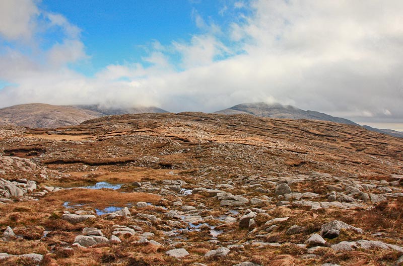
Picture: Meenanea from the North.
Meenanea is a summit of low prominence on the ridge from Cronamuck to Croaghbarnes.
It is most likely that it will be reached as part of a traverse along this ridge.
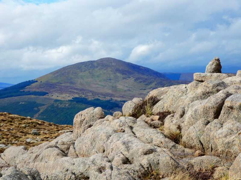
It has excellent views towards Croaghnageer and other hills to the SE as well as Gaugin Mountain and Croaghbane.
Like most of the ridge the granite rock underneath is near or on the surface.
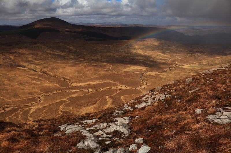
I visited Meenanea as the middle peak in, what was by my standards, a long, difficult walk from an unnamed road north of Lough Eske, over Croaghbarnes, and after Meenanea, to Cronamuck. By the time I got to the summit of Croaghbarnes, I already felt like I'd had a long walk over difficult terrain, but the views were amazing in this wild area right in the centre of the Bluestacks, and there wasn't too much descent and ascent to reach Meenanea to the northeast. I had been having great weather, but as I walked along the ridge between Croaghbarnes and Meenanea, admiring the beautifully bleak Owendoo Valley, a hail storm passed over, creating a rainbow and adding to an already ridiculously good view. I tried to capture it between the downpours, but a photo could never convey how elating it was to gaze on. It gave me renewed energy to make the short climb to the summit, marked by possibly the smallest cairn I've ever seen. The next stage, to Cronamuck would be a short jump. Linkback: mountainviews.ie/summit/670/comment/17928/
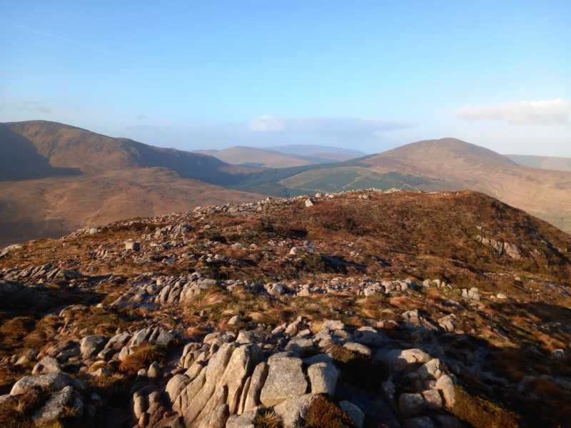
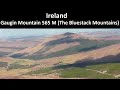
Picture: Small marker at summit, with Gaugin Mt in distance.
Remote and challenging!
by Colin Murphy
8 May 2023
Not for the faint-hearted, this remote summit sits in the centre of the Croaghbarnes ridge, and is usually accessed from the SW - see track 4871. Linkback: mountainviews.ie/summit/670/comment/23944/
Use of MountainViews is governed by conditions and a privacy policy.
Read general information about the site. Opinions in material here are not necessarily endorsed by MountainViews.
Hillwalking is a risk sport. Information in comments, walks, shared GPS tracks or about starting places may
not be accurate for example as regards safety or access permission. You are responsible for your safety and your permission to walk.
See the credits and list definitions.


 Our Facebook page.