Donation Request 2024
You do not have to be logged in to donate.
DONATE
Members and Supporters, the MountainViews Committee requests your help to meet the costs of the website and of other activities such as insured events or publications.You do not have to be logged in to donate.
Welcome to MountainViews
If you want to use the website often please enrol (quick and free) at top right.
If you want to use the website often please enrol (quick and free) at top right.
Overview

For more map options click on any overview map area or any detail map feature.
Detail Map Features
Showing 8 items:
Slieve Croob 534m, Slievenisky 446m, Cratlieve 429m,
1451, 10km
2453, 9km
4051, 5km
5017, 3km
2467, 2km
Slieve Croob 534m, Slievenisky 446m, Cratlieve 429m,
Tracks:
Find Suggested Walks
Find hill, mountain, island, coastal feature.
Videos
Recent Contributions
 Get Notifications
Get Notifications
Lake District: Dale Head Horseshoe
Crocknasharragh: Impressive views on nitial ascent.
 Colin Murphy
Crocknasharragh: Fine views on ascent
 Colin Murphy
Lake District: Coledale Horseshoe
Cunnigar: Short trek to summit
 Fergalh
Longish walk to isolated top
 Colin Murphy
Westtown Hill: Tramore's Highest Point
 DeirdreM
Knockbrinnea West Top: Eflanagan on the Knockbrinneas
 eflanaga
Ascending the Knockbrinneas from the north.
 simon3
Knockbrinnea West Top: Larger Twin
 Collaborative entry
Lobawn Loop - Clockwise avoids any steep ascent! Easy stream crossing.
Knockaunanattin West Top: Views, loughs and a navigational aid.
 simon3
Conditions and Info
Use of MountainViews is governed by conditions and a privacy policy.
Read general information about the site.
Opinions in material here are not necessarily endorsed by MountainViews.
Hillwalking is a risk sport. Information in comments, walks, shared GPS tracks or about starting places may not be accurate for example as regards safety or access permission. You are responsible for your safety and your permission to walk.
See the credits and list definitions.
 Visit our Facebook page.
Video display
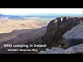
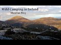
Mourne Mountains
Area N: Croob Subarea
Place count in area: 58,
OSI/LPS Maps: 20, 29, EW-CLY
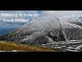
Highest place: Slieve Donard, 849m
Maximum height for area: 849 metres,
Maximum prominence for area: 821 metres,
Places in area Mourne Mountains:
Cen: Loughshannagh:Ben Crom 526mCarn Mountain 585.2mCarn Mountain North Top 553.7mDoan 592.6mOtt Mountain 526.8mSlieve Loughshannagh 617mSlieve Muck 670.4mSlievenaglogh 445m
E: Binnian:Slieve Binnian 745.9mSlieve Binnian East Top 639mSlieve Binnian North Top 678mSlieve Binnian North Tor 682.5mWee Binnian 460m
E: Donard:Chimney Rock Mountain 656mCrossone 540mMillstone Mountain 460mRocky Mountain 524mSlieve Donard 849m
E: Lamagan:Cove Mountain 654.8mSlieve Beg 595.9mSlievelamagan 702.2m
N: Bearnagh:Slieve Bearnagh 739mSlieve Bearnagh North Tor 680mSlieve Meelbeg 701.9mSlieve Meelmore 687m
N: Castlewellan:Slievenalargy 280mSlievenaslat 272m
N: Commedagh:Slieve Commedagh 767mSlieve Corragh 641.9mSlievenaglogh 584.4mSlievenaglogh East Top 571m
N: Croob:Cratlieve 429mSlieve Croob 534mSlievegarran 391mSlievenisky 446m
N: Rathfriland:Knockiveagh 235m
S: Kilkeel:Knockchree 306m
S: Rostrevor:Crenville 460mFinlieve 578mSlievemartin 485mSlievemeel 420mSlievemeen 472m
W: Hilltown:Gruggandoo 382mSlieveacarnane 296m
W: Slievemoughanmore:Crotlieve Mountain 347mEagle Mountain 638mRocky Mountain 404mShanlieve 626mSlievemoughanmore 560mTievedockaragh 473mWee Slievemoughan 428m
W: Spelga:Butter Mountain 500mCock Mountain 504mCock Mountain South-West Top 505mHen Mountain 354mPigeon Rock Mountain 534mPigeon Rock Mountain South Top 530mSlievenamiskan 444m
Note: this list of places includes island features such as summits, but not islands as such.
Highest place:
Slieve Donard, 849mPlaces in area Mourne Mountains:
Cen: Loughshannagh:
Ben Crom 526mCarn Mountain 585.2mCarn Mountain North Top 553.7mDoan 592.6mOtt Mountain 526.8mSlieve Loughshannagh 617mSlieve Muck 670.4mSlievenaglogh 445mE: Binnian:
Slieve Binnian 745.9mSlieve Binnian East Top 639mSlieve Binnian North Top 678mSlieve Binnian North Tor 682.5mWee Binnian 460mE: Donard:
Chimney Rock Mountain 656mCrossone 540mMillstone Mountain 460mRocky Mountain 524mSlieve Donard 849mE: Lamagan:
Cove Mountain 654.8mSlieve Beg 595.9mSlievelamagan 702.2mN: Bearnagh:
Slieve Bearnagh 739mSlieve Bearnagh North Tor 680mSlieve Meelbeg 701.9mSlieve Meelmore 687mN: Castlewellan:
Slievenalargy 280mSlievenaslat 272mN: Commedagh:
Slieve Commedagh 767mSlieve Corragh 641.9mSlievenaglogh 584.4mSlievenaglogh East Top 571mN: Croob:
Cratlieve 429mSlieve Croob 534mSlievegarran 391mSlievenisky 446mN: Rathfriland:
Knockiveagh 235mS: Kilkeel:
Knockchree 306mS: Rostrevor:
Crenville 460mFinlieve 578mSlievemartin 485mSlievemeel 420mSlievemeen 472mW: Hilltown:
Gruggandoo 382mSlieveacarnane 296mW: Slievemoughanmore:
Crotlieve Mountain 347mEagle Mountain 638mRocky Mountain 404mShanlieve 626mSlievemoughanmore 560mTievedockaragh 473mWee Slievemoughan 428mW: Spelga:
Butter Mountain 500mCock Mountain 504mCock Mountain South-West Top 505mHen Mountain 354mPigeon Rock Mountain 534mPigeon Rock Mountain South Top 530mSlievenamiskan 444mNote: this list of places includes island features such as summits, but not islands as such.

Bedrock type: Mudstone, greywacke & conglomerate, (Deep marine turbidite sequence)
The River Lagan rises on the northern slopes of Slieve Croob. The three parishes of Magherahamlet, Kilmegan and Drumgooland converge on the summit, which has excellent panoramic views, including a particularly fine view of the northern peaks in the Mourne Mountains. Until the mid-20th century, there was a tradition of climbing the mountain on Blaeberry Sunday at the end of July or beginning of August. This is clearly a survival of a Lughnasa tradition [see MacNeill, 155-56]. The summit cairn is locally known as the Twelve Cairns, but this seems to be a relatively modern name arising from damage causing the break-up of a single cairn into several smaller heaps. The name Slieve Croob has been interpreted as ‘mountain of the hoof’ from Ir. Sliabh Crúibe [DUPN]. However, there seems to be nothing in local folklore to support this, nor in the mountain’s shape. It is likely that the second element is Brittonic in origin and is related to Welsh crwb, meaning ‘lump’ or ‘hump’. This fits better with the topography and also accords with the fact that Cratlieve, a western satellite has the same meaning, containing crot, an Irish word also meaning ‘hump’. Two townlands on the northern slopes are called Drin and Dree, probably also of Brittonic origin, cf. Welsh dring ‘ascent, slope’. Dree is of the same origin as Drin, but the different form has arisen by loss of -ng- and compensatory lengthening, cf. Belcoo < Béal Cú < Béal Cúnga. It is possible that Drin and Dree were once a single unit. Slieve Croob is the 464th highest place in Ireland. Slieve Croob is the most northerly summit in the Mourne Mountains area.
Linkback: https://mountainviews.ie/summit/388/
COMMENTS for Slieve Croob (Sliabh Crúibe) 1 2 3 4 Next page >>  Follow this place's comments

|
|
|
|
||
| MountainViews.ie, a Hill-walking Website for the island of Ireland. 2400 Summiteers, 1480 Contributors, maintainer of lists: Arderins, Vandeleur-Lynams, Highest Hundred, County Highpoints etc | |||