This website uses cookies, which are small text files that the website puts on your device to facilitate operation. Cookies help us provide a better service to you. They are used to track general user traffic information and to help the website function properly.
Feature count in area: 58, all in Down,
OSI/LPS Maps: 20, 29, EW-CLY
Highest Place: Slieve Donard 849m
Starting Places (33) in area Mourne Mountains: Alex Steddom Tree, Aughrim Airstrip, Ben Crom Dam, Bloody Bridge Car Park, Carlingford Greenway, Carrick Little, Crocknafeola Wood, Crotlieve Mountain, Donard Car Park Newcastle, Drummanmore Picnic, Fofanny Reservoir, Forest Office CP, Gamekeepers Lodge CP, Happy Valley Trassey Rd, Hen Mountain CP, Leitrim Lodge CP, Mayo Road Corner, Meelmore Lodge, Newcastle Harbour, Ott CP, Red Bog Road, Rourkes Park, Sandy Brae, Silent Valley Reservoir Head Rd, Slieve Donard Trail Head, Slieve Foye Viewing Point, Slievefoy Forest CP, Spelga Dam E, Spelga Dam N, Spelga Dam S, Trassey Car Park, Two Mile River CP, Yellow Water Park
Summits & other features in area Mourne Mountains: Cen: Loughshannagh: Ben Crom 526m, Carn Mountain 585.2m, Carn Mountain North Top 553.7m, Doan 592.6m, Ott Mountain 526.8m, Slieve Loughshannagh 617m, Slieve Muck 670.4m, Slievenaglogh 445m E: Binnian: Slieve Binnian 745.9m, Slieve Binnian East Top 639m, Slieve Binnian North Top 678m, Slieve Binnian North Tor 682.5m, Wee Binnian 460m E: Donard: Chimney Rock Mountain 656m, Crossone 540m, Millstone Mountain 460m, Rocky Mountain 524m, Slieve Donard 849m E: Lamagan: Cove Mountain 654.8m, Slieve Beg 595.9m, Slievelamagan 702.2m N: Bearnagh: Slieve Bearnagh 739m, Slieve Bearnagh North Tor 680m, Slieve Meelbeg 701.9m, Slieve Meelmore 687m N: Castlewellan: Slievenalargy 280m, Slievenaslat 272m N: Commedagh: Slieve Commedagh 767m, Slieve Corragh 641.9m, Slievenaglogh 584.4m, Slievenaglogh East Top 571m N: Croob: Cratlieve 429m, Slieve Croob 534m, Slievegarran 391m, Slievenisky 446m N: Rathfriland: Knockiveagh 235m S: Kilkeel: Knockchree 306m S: Rostrevor: Crenville 460m, Finlieve 578m, Slievemartin 485m, Slievemeel 420m, Slievemeen 472m W: Hilltown: Gruggandoo 382m, Slieveacarnane 296m W: Slievemoughanmore: Crotlieve Mountain 347m, Eagle Mountain 638m, Rocky Mountain 404m, Shanlieve 626m, Slievemoughanmore 560m, Tievedockaragh 473m, Wee Slievemoughan 428m W: Spelga: Butter Mountain 500m, Cock Mountain 504m, Cock Mountain South-West Top 505m, Hen Mountain 354m, Pigeon Rock Mountain 534m, Pigeon Rock Mountain South Top 530m, Slievenamiskan 444m
Note: this list of places may include island features such as summits, but not
islands as such.
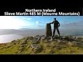
Slievemartin, 485mHill Sliabh Mártain A name in Irish,
Place Rating ..
, Down County in Ulster province, in Carn Lists, Slievemartin is the 613th highest place in Ireland.
Grid Reference J20120 17646,
OS 1:50k mapsheet 29 Place visited by: 170members, recently by: Carolineswalsh, MickM45, Florence, Dee68, archmeister, MisterMoe, dodser, finkey86, pcman, Oscar-mckinney, Andy1287, Jai-mckinney, atlantic73, Carolyn105, dregishjake
I visited this place: NO (You need to be a logged-in member for this.)
Short or GPS IDs, 6 char: Slvmrt, 10 char: Slvmrtn Linkback: https://mountainviews.ie/summit/498/
Gallery for Slievemartin (Sliabh Mártain) and surrounds
Summary
for Slievemartin (Sliabh Mártain):
Another fine little hill of the southern Mournes
Summary created by wicklore
2011-05-02 09:44:12
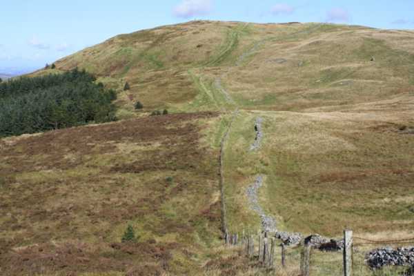
Picture: Slievemartin from Slievemeen
Slievemartin is another medium sized hill of the southern Mournes that has fantastic views of the surrounding countryside. Views range from the Cooleys across Carlingford Lough to the south and east, and to distant Slieve Binnian and Slieve Donard to the north. Many coastal and Lough-side villages are also visible, as are nearer small hills like Crenville, Gruggandoo, Tievedockeragh and Slievemeen.
Slievemartin is easily reached from the carpark at A (J196 174), where there is a notice board with maps, colour coded routes and general information. The car park is situated at about 250 metres, taking a lot of the sting out of the climb. Following well marked tracks will get you to the col at B (J202 174) between Slievemeen and Slievemartin in about 25 minutes. Another 10 minutes uphill brings you to the trig pillar on Slievemartin’s summit at C (J201 176). An easy walk recommended for beginners and children
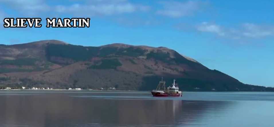
Patrick Zerkowski whets the appetite of the prospective walker with a very clear film of Slieve Martin and surrounding areas. Needless to say, given Slieve Martin's location on Carlingford Lough there are plenty of sea views. I like the fact that the early part of the walk is captured, showing the forest tracks: all very helpful and informative. A very useful piece: it does exactly what it says on the tin.
I climbed this mountain for the third time yesterday. Started off from the car park near the forest office in Rostrevor and followed the path up past Fiddlers Green and eventually came to Cloghmore Boulder. After leaving the forest, we simply followed the path up to the trig pillar at Slievemartin. Slievemartin offers very decent views across Carlingford Lough to Slieve Foye. Turning clockwise, Pierce's Castle, Cock mountain, Shanlieve and Eagle mountain of the Western Mournes come into view. Further afield, Binnian and Donard became visible. After short break, we headed toward Knockshee. After marshy terrain to start with, a well-trodden path enabled quick access to Knockshee, approx 2km from Slievemartin. Views extended toward Lamagan, Slievenaglogh, Commedagh, wee Binnian and Ben Crom as well as previously listed mountains from the summit. Thereafter, we simply re-traced our steps and headed back toward Rostrevor via Slievemartin. The full walk was 11.5km and took approx 4 hours. The only 'tricky' section is the path from Rostrevor to Cloghmore Boulder - the path does get narrower after leaving the car park and some trees had fallen across the path. Setting aside the path, this walk falls into the category of 'great views with minimal effort.' Slievemartin would be in my top 5 Mourne summits - the others being Doan, Slieve Binnian, Eagle mountain and Slieveloughshannagh. Linkback: mountainviews.ie/summit/498/comment/6612/
Read Less
Read More
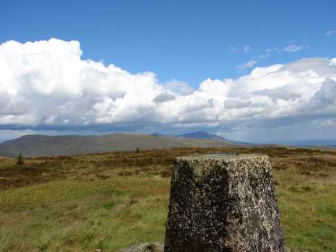
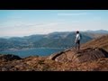
Picture: Slievemartin's trig pillar, with Slieve Donard and the southern Mournes in the distance.
csd on Slievemartin
by csd
29 Jul 2007
The easiest approach to Slievemartin is probably from the Rostrevor Forest Park car park at D (J195 173). From here it's easy to follow the tracks up to the summit of Slievemartin, even if it does appear you have to head in the opposite direction when setting off. It should take 45 mins or less to get to the summit; Slievemeen and Crenville are also eminently doable from this starting point. The stunning views from Slievemartin belie its relatively modest elevation: most of the Mournes are visible (including Donard), as well as great panoramas of the Cooleys and Slieve Gullion. Recommended. Linkback: mountainviews.ie/summit/498/comment/2785/
Read Less
Read More
three5four0 on Slievemartin
by three5four0
20 Jul 2008
After Crenville the slopes to Slievemartin were most welcome, a relative short stroll up a grassy slope, with a fence to cross to get to the summit. In the afternoon sun the views were good, with Knockshee looking as if it would give a good circuit along with Slievemeen. As for including Crenville (see my post), go there if you must and go prepared & soothe yourself later with a fine pint of real ale from the White Water Brewery . Onto Slievemeen Linkback: mountainviews.ie/summit/498/comment/3241/
Read Less
Read More
Picture: SCOTSMAN LOSES SIXPENCE NEAR SLIEVEMARTIN
Bleck Cra on Slievemartin
by Bleck Cra
29 Aug 2007
If proof were needed that the mountainview FROM the article is worth 10 times that OF the article, it is Slievemartin. In the SW of the magnificent Mourne Mountains (further and you drop into Carlingford Lough), it presents no redeeming features; in fact it presents no features at all other than the jetsam from a half-demolished communications tower and some stone or other to go and see, for those of us who like to go and see stones. Excepting a pretty jaunt off, through faery woodland, it exhibits no more than you expect from the fringe of the flock: woolly, cranky and not the brightest star in the firmament. “Beauty” is a word devalued by over and untrained use, but if it could be used only once, it could be used to describe the land and town scapes that cuckoon dull old Slievemartin. From the infamous and discomfiting Narrow Waters, through Warrenpoint and Rostrevor, a riviera of natural and domestic wealth and sophistication confidently flows. “Riviera” - there’s another one of these words. For those of us who have rotissed on the Cote D’Azur, in the reign of la Bardot, there can be no other Riviera - but this coastline, yes this Northern Irish coastline, is about as close as you can get: craggy promontaries against sunlit skylines, bold sharp seas to different worlds, heather-clad foothills; him and her sauntering from one sophisticated café and restaurant to the next, while Jennifer and Geoffrey carelessly go about for the millionth time today. Lee Ho. Genuinely European towns quite beyond the perspective of the entrenched North and increasingly revered by the discerning South - which is not really surprising, as from the scrapyard summit of said Slievemartin, Carlingford and Rostrevor are no farther apart than lovers across a table. Linkback: mountainviews.ie/summit/498/comment/2808/
Use of MountainViews is governed by conditions and a privacy policy.
Read general information about the site. Opinions in material here are not necessarily endorsed by MountainViews.
Hillwalking is a risk sport. Information in comments, walks, shared GPS tracks or about starting places may
not be accurate for example as regards safety or access permission. You are responsible for your safety and your permission to walk.
See the credits and list definitions.


 Our Facebook page.