This website uses cookies, which are small text files that the website puts on your device to facilitate operation. Cookies help us provide a better service to you. They are used to track general user traffic information and to help the website function properly.
Peter Walker: Track/3076 in area near Slieve Donard, Mourne Mountains (Ireland)
Mourne Seven Sevens
Ascent: 2682m,
Length: 31.1km,
Creator time taken: 9h 6m
Descent: 2669m,
Time predicted from Naismith's rule: 10h 41m + breaks
Click here to rate track
PlacesStart at Donard Car Park Newcastle (DonCPNc) J37410 30551, Slieve Donard, Slieve Bearnagh North Tor, Slieve Bearnagh, Slieve Meelmore, Slieve Meelbeg, Slieve Binnian North Tor, Slieve Binnian, Slievelamagan, Cove Mountain, Slieve Beg, end at Start
Track Rating ..
[RWD version 1 ]
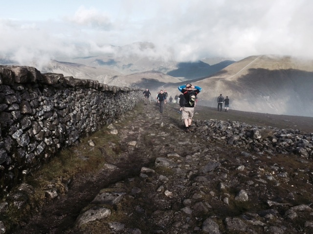
Seven Seveners on the summit slopes of Donard
2015's running of the annual Mourne Seven Sevens challenge walk (very well organised by the Spartan Red Sox club, to whom I tilt my hat approvingly) took place on 1st August in excellent conditions...cool and clear with just one minor little shower in the early afternoon.
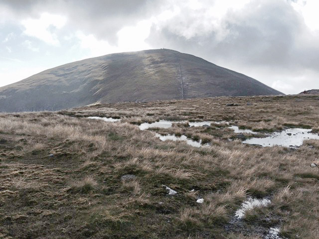
Slieve Donard
The track posted is the full route; sticklers should note that the electronic checkpoints aren'tallon the exact summits (Commedagh, Bearnagh and Binnian specifically being ascended to a point just below the top). In addition there are manned checkpoints in most of the cols. The Seven Sevens is not the longest of Ireland's challenge walks in distance, but a challenge it most definitely is on account of the large amount of really steep ascent and descent it packs into its (relatively) short distance. It starts with the longest climb possible in Norn Iron...practically from sea level to the top of Slieve Donard; also worthy of note and faint dread are the sharp climb up Bearnagh, the boggy section from Meelbeg alongside the Ben Crom River to the dam (prior knowledge is pretty useful here), the long stepped ascent to Binnian (over 500m of climbing) and the last horrendous flog up Lamagan. But most of it is on clear paths and there's plenty of fellow participants around to supply craic and sympathy.
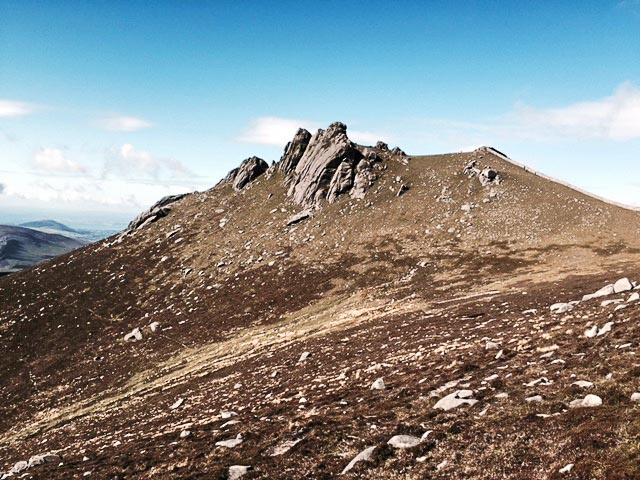
Slieve Bearnagh
On a personal note I haven't enjoyed a day in the hills as much as this for a very long time indeed; many thanks to BleckCra for roping me in and also turning in a remarkable performance for a man who swore he was shattered long before the halfway point. Also may I give a shout-out to our fellow travellers over the six 700m hills and one that's actually 680-odd-m that make up the Seven Sevens, John and Rob. And last but definitely not least, Tom, Mary, Michelle and Fiona who turned up to support us, which meant them spending more time in Newcastle on a Satuday than any sane person would wish to: it was all very much appreciated, especially Mary's congratulatory card and cake. And please, please spare a final thought for Everest ascentionist Dawson Stelfox, who is probably even now sat weeping into his sports drinks and wondering how he only managed to beat a middle-aged IT bloke by 110 minutes. Don't worry sir...my training tips are available on request. Divis, Cave Hill, Slieve Croob, crash dieting and demented carb loading the day before. You can't go wrong.
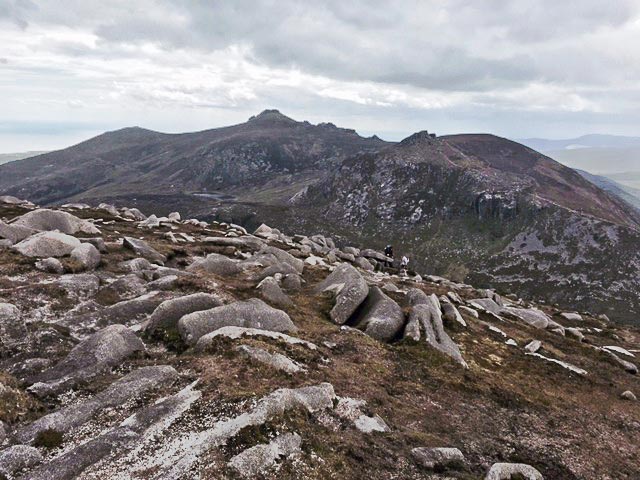
Slieve Binnian from Slieve Lamagan
Editing Details for track/3076
NOTE: ALL information such as Ascent, Length and Creator time taken etc should be regarded as approximate. The creator's comments are opinions and may not be accurate or still correct.
Your time to complete will depend on the speed of the slowest plus break time and your mode of transport.
NOTE: It is up to you to ensure that your route is appropriate for you and your party to follow bearing in mind all factors such as safety, weather conditions, experience and access permission.
Uploaded on: Sun, 2 Aug 2015 (13:11:17), Linkback: https://mountainviews.ie/track/3076/
* Note: A GPS Height in the elevation profile is sourced from the device that recorded the track. An "SRTM" height is derived from a model of elevations for parts of the earth. More detail
Use of MountainViews is governed by conditions and a privacy policy.
Read general information about the site. Opinions in material here are not necessarily endorsed by MountainViews.
Hillwalking is a risk sport. Information in comments, walks, shared GPS tracks or about starting places may
not be accurate for example as regards safety or access permission. You are responsible for your safety and your permission to walk.
See the credits and list definitions.


 Our Facebook page.