This website uses cookies, which are small text files that the website puts on your device to facilitate operation. Cookies help us provide a better service to you. They are used to track general user traffic information and to help the website function properly.
Peter Walker: Track/4575 in area near Slieve Donard, Mourne Mountains (Ireland)
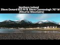
Donard and Commedagh from Newcastle
Ascent: 1070m,
Length: 13.7km,
Creator time taken: 4h29m
Descent: 1073m,
Time predicted from Naismith's rule: 4h 32m + breaks
Click here to rate track
PlacesStart at Donard Car Park Newcastle (DonCPNc) J37320 30471, Slieve Donard, end at Start
Track Rating ..
[RWD version 1 ]
Some Sundays you don't have the mental energy to be wildly creative with your route choices, and such days in the Mournes can often lead you to the fleshpots of the Donard Park car park in Newcastle. And so it was that The Team (get well soon Cra) assembled on a brisk but clear November morning, a couple of our number on the comeback trail, and the nominal leader on the day somewhat sore from a lot of running in the week. We didn't want things too hard, but we didn't want them too easy either, so we were going for a straightforward traverse of the range's two highest summits.
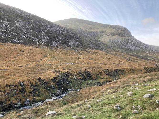
Donard from the Glen River
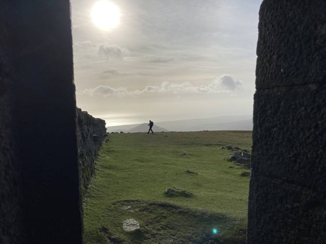
One thing that does need some energy is the ascent of Donard up the Glen River path, probably the longest continuous climb in Ireland. The built path means that the ground can get eaten up on the right sort of day, but today (while glorious in visibility terms) was beset by pockets of strong wind. So progress up the Glen was a bit staccato, but on attaining the Saddle at its head and discovering that the wind wasn't tearing over the far side of the Mourne Wall, we relaxed into the sharp pull up to the summit. It did get a bit blowier higher up, but fortunately it was directly behind up and a quick nip around the corner at the top saw us into calmer air.
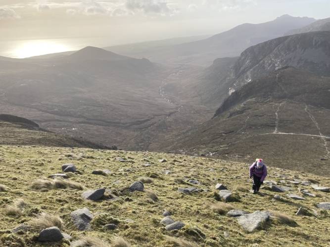
Commedagh from the upper slopes of Donard
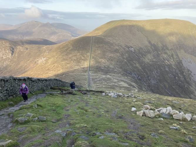
Down to the Bog of Donard: we were trying to avoid retracing ground wherever possible. A quick lunch stop then over the stile and along the Brandy Pad along the flanks of Donard. The wind was picking up as we kept going past the track rising back to the Saddle; that's the easiest way up Commedagh, but our modus operandi on this occasion kept us going to the col under Slieve Beg. From here it's a steady steepening pathless plod up to the Wall over Commedagh; excellent for building power endurance, especially now the wind had picked up to a destablising level. A lot of stumbles and swearing later we were all taking the unusual step of hiding from the gale in the tower on the top. (This is normally Northern Ireland's highest public toilet, so entering is a last resort).
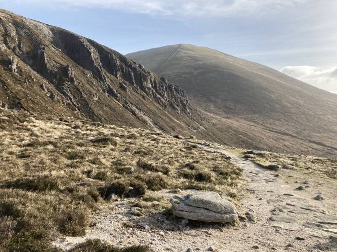
Donard from the Brandy Pad
The pull up onto Commedagh above the Annalong Valley
Looking out of Commedagh's tower
The original notion had been to descend over Shanslieve, but with that being a very open route we decided to go down the Wall to the Saddle instead. The buffeting diminished with the altitude, and it was an uneventful shlep back down the Glen to the start.
Editing Details for track/4575
NOTE: ALL information such as Ascent, Length and Creator time taken etc should be regarded as approximate. The creator's comments are opinions and may not be accurate or still correct.
Your time to complete will depend on the speed of the slowest plus break time and your mode of transport.
NOTE: It is up to you to ensure that your route is appropriate for you and your party to follow bearing in mind all factors such as safety, weather conditions, experience and access permission.
Uploaded on: Mon, 8 Nov 2021 (22:11:29), Linkback: https://mountainviews.ie/track/4575/
* Note: A GPS Height in the elevation profile is sourced from the device that recorded the track. An "SRTM" height is derived from a model of elevations for parts of the earth. More detail
Use of MountainViews is governed by conditions and a privacy policy.
Read general information about the site. Opinions in material here are not necessarily endorsed by MountainViews.
Hillwalking is a risk sport. Information in comments, walks, shared GPS tracks or about starting places may
not be accurate for example as regards safety or access permission. You are responsible for your safety and your permission to walk.
See the credits and list definitions.


 Our Facebook page.