Donation Request 2024
You do not have to be logged in to donate.
DONATE
Members and Supporters, the MountainViews Committee requests your help to meet the costs of the website and of other activities such as insured events or publications.You do not have to be logged in to donate.
Welcome to MountainViews
If you want to use the website often please enrol (quick and free) at top right.
If you want to use the website often please enrol (quick and free) at top right.
Overview

For more map options click on any overview map area or any detail map feature.
Detail Map Features
Find Suggested Walks
Find hill, mountain, island, coastal feature.
Videos
Recent Contributions
 Get Notifications
Get Notifications
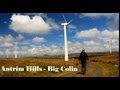
Crocknapeast: Long walk up windfarm roads.
 Collaborative entry
Double bag mostly on windfarm tracks.
 Colin Murphy
Mulnanaff: Longish walk up windfarm road.
 Collaborative entry
Good, relatively easy double bag
 Colin Murphy
Binbane NE Top: Simple bag from its neighbouring top.
 Collaborative entry
Binbane: Steepish approach to relatively easy Carn.
 Collaborative entry
Lake District: Dale Head Horseshoe
Crucknaree: Magnificent views!
 paddyhillsbagger
Lake District: Coledale Horseshoe
Dunranhill: Sika deer and sitka spruce
 hibby
hibby
Crocknasharragh: Impressive views on initial ascent.
 Colin Murphy
Longish walk to isolated top
 Colin Murphy
Conditions and Info
Use of MountainViews is governed by conditions and a privacy policy.
Read general information about the site.
Opinions in material here are not necessarily endorsed by MountainViews.
Hillwalking is a risk sport. Information in comments, walks, shared GPS tracks or about starting places may not be accurate for example as regards safety or access permission. You are responsible for your safety and your permission to walk.
See the credits and list definitions.
 Visit our Facebook page.
Video display
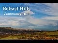
Antrim Hills
Area S: South Antrim Hills Subarea
Place count in area: 27,
OSI/LPS Maps: 14, 15, 4, 5, 8, 9
Highest place: Trostan, 550m
Maximum height for area: 550 metres,
Maximum prominence for area: 515 metres,
Places in area Antrim Hills:
Cen: Central Antrim Hills:Carncormick 436mCollin Top 429mCrockalough 402mMid Hill 440mSkerry Hill 459mSlieveanorra 508mSlievenahanaghan 418mSoarns Hill 403mTievebulliagh 402mTrostan 550m
Central Antrim Hills:Slievenanee 543m
N: North Antrim Hills:Carnanmore 379mCroaghan 417mCrockaneel 403mCross Slieve 206mKnocklayd 514mLannimore Hill 207m
N: Rathlin Island:Kilpatrick (Rathlin Island) 134m
S: Islandmagee:Donalds Carn 141mMuldersleigh Hill 131m
S: South Antrim Hills:Agnew's Hill 474mBig Collin 353mBlack Hill 381mCarnearny 319mDouglas Top 402mSlemish 437.9m
W: West Antrim:Long Mountain 215m
Note: this list of places includes island features such as summits, but not islands as such.
Highest place:
Trostan, 550mPlaces in area Antrim Hills:
Cen: Central Antrim Hills:
Carncormick 436mCollin Top 429mCrockalough 402mMid Hill 440mSkerry Hill 459mSlieveanorra 508mSlievenahanaghan 418mSoarns Hill 403mTievebulliagh 402mTrostan 550mCentral Antrim Hills:
Slievenanee 543mN: North Antrim Hills:
Carnanmore 379mCroaghan 417mCrockaneel 403mCross Slieve 206mKnocklayd 514mLannimore Hill 207mN: Rathlin Island:
Kilpatrick (Rathlin Island) 134mS: Islandmagee:
Donalds Carn 141mMuldersleigh Hill 131mS: South Antrim Hills:
Agnew's Hill 474mBig Collin 353mBlack Hill 381mCarnearny 319mDouglas Top 402mSlemish 437.9mW: West Antrim:
Long Mountain 215mNote: this list of places includes island features such as summits, but not islands as such.

Bedrock type: Olivine basalt lava, (Upper Basalt Formation)
The hill derives its name from a cairn at the summit. Ériu is a sovereignty goddess embodying Ireland. Éire is the Modern Irish form of this name. See Arderin in Slieve Bloom, which has a similar origin. Unfortunately, the cairn is overgrown and the formerly excellent view of Lough Neagh has been totally blocked by newly planted conifers. Tobernaveen Hill is a slightly lower hill to the west. Carnearny is recorded in the Annals of the Four Masters as the site of a battle in 912 AD where the local chieftain Loingsech Ua Lethlobhair (Lawlor) was defeated by Niall, son of Aedh Finnliath of Tyrone [LNP]. Carnearny is the 1115th highest place in Ireland. Carnearny is the most southerly summit in the Antrim Hills area.
Linkback: https://mountainviews.ie/summit/933/
COMMENTS for Carnearny (Carn Éireann) 1 of 1  Follow this place's comments

|
|
|
|
||
| MountainViews.ie, a Hill-walking Website for the island of Ireland. 2400 Summiteers, 1480 Contributors, maintainer of lists: Arderins, Vandeleur-Lynams, Highest Hundred, County Highpoints etc | |||