Donation Request 2024
You do not have to be logged in to donate.
DONATE
Members and Supporters, the MountainViews Committee requests your help to meet the costs of the website and of other activities such as insured events or publications.You do not have to be logged in to donate.
Welcome to MountainViews
If you want to use the website often please enrol (quick and free) at top right.
If you want to use the website often please enrol (quick and free) at top right.
Overview

For more map options click on any overview map area or any detail map feature.
Detail Map Features
Find Suggested Walks
Find hill, mountain, island, coastal feature.
Videos


Recent Contributions
 Get Notifications
Get Notifications
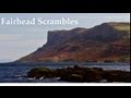
Crocknasharragh: Fine views on ascent
 Colin Murphy
Lake District: Dale Head Horseshoe
Crocknasharragh: Impressive views on nitial ascent.
 Colin Murphy
Lake District: Coledale Horseshoe
Cunnigar: Short trek to summit
 Fergalh
Longish walk to isolated top
 Colin Murphy
Westtown Hill: Tramore's Highest Point
 DeirdreM
Knockbrinnea West Top: Eflanagan on the Knockbrinneas
 eflanaga
Ascending the Knockbrinneas from the north.
 simon3
Knockbrinnea West Top: Larger Twin
 Collaborative entry
Lobawn Loop - Clockwise avoids any steep ascent! Easy stream crossing.
Knockaunanattin West Top: Views, loughs and a navigational aid.
 simon3
Conditions and Info
Use of MountainViews is governed by conditions and a privacy policy.
Read general information about the site.
Opinions in material here are not necessarily endorsed by MountainViews.
Hillwalking is a risk sport. Information in comments, walks, shared GPS tracks or about starting places may not be accurate for example as regards safety or access permission. You are responsible for your safety and your permission to walk.
See the credits and list definitions.
 Visit our Facebook page.
Video display
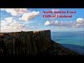
Antrim Hills
Area N: North Antrim Hills Subarea
Place count in area: 27,
OSI/LPS Maps: 14, 15, 4, 5, 8, 9
Highest place: Trostan, 550m
Maximum height for area: 550 metres,
Maximum prominence for area: 515 metres,
Places in area Antrim Hills:
Cen: Central Antrim Hills:Carncormick 436mCollin Top 429mCrockalough 402mMid Hill 440mSkerry Hill 459mSlieveanorra 508mSlievenahanaghan 418mSoarns Hill 403mTievebulliagh 402mTrostan 550m
Central Antrim Hills:Slievenanee 543m
N: North Antrim Hills:Carnanmore 379mCroaghan 417mCrockaneel 403mCross Slieve 206mKnocklayd 514mLannimore Hill 207m
N: Rathlin Island:Kilpatrick (Rathlin Island) 134m
S: Islandmagee:Donalds Carn 141mMuldersleigh Hill 131m
S: South Antrim Hills:Agnew's Hill 474mBig Collin 353mBlack Hill 381mCarnearny 319mDouglas Top 402mSlemish 437.9m
W: West Antrim:Long Mountain 215m
Note: this list of places includes island features such as summits, but not islands as such.
Highest place:
Trostan, 550mPlaces in area Antrim Hills:
Cen: Central Antrim Hills:
Carncormick 436mCollin Top 429mCrockalough 402mMid Hill 440mSkerry Hill 459mSlieveanorra 508mSlievenahanaghan 418mSoarns Hill 403mTievebulliagh 402mTrostan 550mCentral Antrim Hills:
Slievenanee 543mN: North Antrim Hills:
Carnanmore 379mCroaghan 417mCrockaneel 403mCross Slieve 206mKnocklayd 514mLannimore Hill 207mN: Rathlin Island:
Kilpatrick (Rathlin Island) 134mS: Islandmagee:
Donalds Carn 141mMuldersleigh Hill 131mS: South Antrim Hills:
Agnew's Hill 474mBig Collin 353mBlack Hill 381mCarnearny 319mDouglas Top 402mSlemish 437.9mW: West Antrim:
Long Mountain 215mNote: this list of places includes island features such as summits, but not islands as such.

Bedrock type: Columnar tholeiitic basalt lava, (Causeway Tholeiite Member)
With its characteristic conical shape, it can be recognised in many views from the northern part of County Antrim. The summit is surmounted by a cairn known as Carn an Truagh, interpreted in the Ordnance Survey Memoirs as 'cairn of the three', but the anglicised form is not compatible with this interpretation, and Fiachra Mac Gabhann described it as 'of unknown origin' in PNNI vol vii. Knocklayd is the third highest mountain in the Antrim Hills area and the 527th highest in Ireland. Knocklayd is the third highest point in county Antrim.
Linkback: https://mountainviews.ie/summit/428/
COMMENTS for Knocklayd (Cnoc Leithid) 1 2 3 Next page >>  Follow this place's comments

|
|
|
|
||
| MountainViews.ie, a Hill-walking Website for the island of Ireland. 2400 Summiteers, 1480 Contributors, maintainer of lists: Arderins, Vandeleur-Lynams, Highest Hundred, County Highpoints etc | |||