Cookies.
This website uses cookies, which are small text files that the website puts on your device to facilitate operation. Cookies help us provide a better service to you. They are used to track general user traffic information and to help the website function properly.
Features
Nearby features appear when you click the map.
Declutter tracks on map.
Place Search
Video
X
Pub: by
Antrim Hills Area , Cen: Central Antrim Hills Subarea
Feature count in area: 27, all in Antrim, OSI/LPS Maps: 14, 15, 4, 5, 8, 9
Highest Place: Trostan 550m

Starting Places (3) in area Antrim Hills:
Donalds Carn, Rathlin Island Ferry Port, Whitehead Golf Club

Summits & other features in area Antrim Hills:
Cen: Central Antrim Hills: Carncormick 436m, Collin Top 429m, Crockalough 402m, Mid Hill 440m, Skerry Hill 459m, Slieveanorra 508m, Slievenahanaghan 418m, Soarns Hill 403m, Tievebulliagh 402m, Trostan 550m
Central Antrim Hills: Slievenanee 543m
N: North Antrim Hills: Carnanmore 379m, Croaghan 417m, Crockaneel 403m, Cross Slieve 206m, Knocklayd 514m, Lannimore Hill 207m
N: Rathlin Island: Kilpatrick (Rathlin Island) 134m
S: Islandmagee: Donalds Carn 141m, Muldersleigh Hill 131m
S: South Antrim Hills: Agnew's Hill 474m, Big Collin 353m, Black Hill 381m, Carnearny 319m, Douglas Top 402m, Slemish 437.9m
W: West Antrim: Long Mountain 215m

Note: this list of places may include island features such as summits, but not islands as such.
Rating graphic.
Collin Top, 429m Hill Collann A name in Irish,
Place Rating ..
, Antrim County in Ulster province, in Carn Lists, Collin Top is the 810th highest place in Ireland.
Grid Reference D21815 16816, OS 1:50k mapsheet 9
Place visited by: 43 members, recently by: trostanite, PPruzina, Colin Murphy, Paddym99, garybuz, Dave68, Kilcoobin, Andy1287, LorraineG60, MichaelG55, eamonoc, Fergalh, scapania, Ulsterpooka, Peter Walker
I visited this place: NO (You need to be a logged-in member for this.)
Longitude: -6.097977, Latitude: 54.983934, Easting: 321815, Northing: 416816, Prominence: 34m,  Isolation: 2km
ITM: 721737 916801
Bedrock type: Olivine basalt lava, (Upper Basalt Formation)
Notes on name: Along the east coast of Ireland there is a cluster of names anglicised as Collin/Collon from Irish collann, meaning 'a height'. See also Big Collin (Co. Antrim) and Collon Hill (Co. Wicklow). They may ultimately show the same root as Lat. collis, Fr. colline and Eng. hill.
  Short or GPS IDs, 6 char: ClnTp, 10 char: Collin Top

Linkback: https://mountainviews.ie/summit/691/
Gallery for Collin Top (Collann) and surrounds
Summary for Collin Top (Collann): Rough, energy-sapping ascent
Summary created by simon3, Colin Murphy 2023-10-03 07:47:11
            MountainViews.ie picture about Collin Top (<em>Collann</em>)
Picture: The summit cairn & memorial cross to 3 men who died here 1907
One approach is to start from the Cargan Dam car park at A (D19239 17217). Cross the dam and turn left, crossing two stiles and following a narrow trail along the south side of the reservoir, crossing over a small bridge to roughly B (D19759 17078), where you can strike out in a SE direction towards the summit. The climb is gentle (roughly 140m over 2km) but the terrain is very rough and covered in knee-high heather and grass almost the whole way. Aim for a fence running SW from Collin and upon reaching this, follow it up the grassy incline to the summit. Allow 1.45 car to top.
Linkback: mountainviews.ie/summit/691/comment/5450/
Member Comments for Collin Top (Collann)
Comment create / edit display placeholder

three5four0 on Collin Top
by three5four0 7 Nov 2008
Footnote

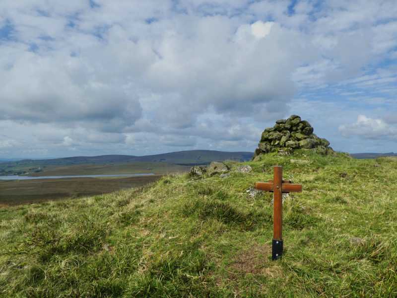
For those of strong legs and the will to go the following may be of interest. After Collin Top why not continue onto the coast?, you could go to Crockravar, then Altmore Burn, descend the Ulster Way into Glenariff and follow it along the Glenariff river to Waterfoot. However, I believe this is the better way to go. From Collin Top descend to the Dungonnell Road (track), either follow the Dungonnell Way into Glenariff Forest (C (D198 184)), taking the trails down to the Waterfall Restaurant, or follow the Collin Burn down (one slight steep section) into the forest (fence to cross) and onto the Waterfall Trail, turn right, cross the foot bridge and follow through the forest and down to the river, cross another footbridge beside a large waterfall, turn right, cross another bridge and go right to bring you out in to the carpark of the Waterfall Restaurant (with bar) D (D216 206). Have a couple of pints of Guinness and girded your loins for the final part of the day. Back to the last footbridge, but don't cross, follow the Waterfall trail straight ahead (on the right hand side of the river) after several waterfalls (including the main one) the trail crosses to the left hand side of the river and climbs up steps, before crossing to the right hand again (after a junction). Shortly after crossing to the right hand side of the river again, a trail breaks off right & leads up to the A43 (E (D209 206)), the exit is wire fenced, but there is a gap left to walk through on the right. A short distance on the right, on the opposite side of the road, is the lane to take past Parkmore Farm (farm marked on the 50,000 map but not on the new 1:25000, though the lane is on the new map). Continue to the end of the lane, going left at the last buildings (gate(just a track from here)). Continue on through another gate and along the hillside to the cliff edge, follow this, crossing several fences to Lurigethan. Descend via the old pathway (F (D228 257)) into rough hillside fields with some gorse, once down towards a main boundary turn left across some steepish slopes. You are aiming for G (D224 262), as there is an overgrown lane here, with a gate to the road (B14). On your right there is a road junction, going north east from here (from the B14) is a lane that takes you all the way into Cushendun (via a set of steps (going left) at the end of the lane around H (D238 275)). Chose your pub and have a few drinks in celebration of a fine days walk.

It may be advisable to carry both the new 1:25000 Glens Map & the old sheets 5 & 9, as some features are on one but not the other. Also , you could pick up Crockalough on the way to Lurigethan, if time & energy permit. Linkback: mountainviews.ie/summit/691/comment/3433/
Read Less
Read More

            MountainViews.ie picture about Collin Top (<em>Collann</em>)
Picture: Looking north-west from Collin Top summit towards Slievenanee and Trostan
Collin Top
by slemish 13 Apr 2010
Climbed Collin Top today for the first time - it's a liitle gem, hidden away behind its more well-known and higher neighbour Mid Hill. I parked at a gate on the Dungonnell reservoir service road (C (D198 184)). The knobbly summit of Collin Top can be seen ahead in the distance - it looks a bit like a small version of Slieve Binnian in the Mournes. Climb directly onto the hillside from here heading towards the summit and you soon reach the lonely and windswept lochan known as Loughgarve. There is a great view to the north looking down the vast glacial valley that is Glenariff. From Loughgarve it's a fairly easy climb up the rest of the hill to the 429m summit of Collin Top which is marked by a large cairn. The views from here can be good to excellent depending on the weather. Virtually the whole Antrim plateau is visible on a good day as is the Kintyre coast. The twin domes of Slievenanee and Trostan are particularly prominent to the north-west and Slemish and Agnew's Hill to the south with Lough Neagh in the distance. Mid Hill blocks the view west towards the Sperrins. You can continue on to Mid Hill from here if desired but I returned to the car by the same route. All in all an easy and very peaceful walk - you can be up and down in an hour and a half. Linkback: mountainviews.ie/summit/691/comment/4612/
Read Less
Read More

three5four0 on Collin Top
by three5four0 7 Nov 2008
See Mid Hill & Carncormick for the start of this walk.

From Mid, descend to the fence running north east and follow it through some soft & wet ground, over a wide ring contour & a final short slope to the summit of Collin Top. Which is rather pap like and is a dry oasis in a sea of bog. The views of Crockalough, Lurigethan , the Glenariff escarpment and out to Scotland are all equally fine. I once camped with a friend beside the Inver river, just to the north of Collin Top, and was kept awake by small fish jumping all night long. Which was no hardship, as it was a rare crystal clear night with the stars on show. With the highlight being a huge meteor, which look large enough to devastate a small village, tearing across the night sky.

Follow a fence north west through yet more wet ground, before swinging north over a 350 metre oval contour line to the river flowing out of Loughgarve (v.small band of rocky ground to descend before the small stream) and onto the track. Follow this track all the way Ballsallagh Bridge and then follow Gorthageeragh Road south east to the Knockanully Road and Martinstown and your car.

This gives a 14.5 mile round route from Martinstown - Carncormick - Mid Hill - Collin Top - Martinstown. Nicky apologises for the road walking at the end of the day of his suggested route, but it passes quickly and when we walked the route the views of the hillsides and the trees were quite magnificent in their autumnal colours.
Linkback: mountainviews.ie/summit/691/comment/3432/
Read Less
Read More
EDIT Point of Interest
text
Videos


Recent Contributions
x
Conditions and Info
Use of MountainViews is governed by conditions and a privacy policy.
Read general information about the site.
Opinions in material here are not necessarily endorsed by MountainViews.
Hillwalking is a risk sport. Information in comments, walks, shared GPS tracks or about starting places may not be accurate for example as regards safety or access permission. You are responsible for your safety and your permission to walk.
See the credits and list definitions.

OSi logo
OSNI/LPS logo
Open Street Map
(Various variations used.)
British summit data courtesy:
Database of British & Irish Hills