This website uses cookies, which are small text files that the website puts on your device to facilitate operation. Cookies help us provide a better service to you. They are used to track general user traffic information and to help the website function properly.
Feature count in area: 27, all in Antrim,
OSI/LPS Maps: 14, 15, 4, 5, 8, 9
Highest Place: Trostan 550m
Starting Places (3) in area Antrim Hills: Donalds Carn, Rathlin Island Ferry Port, Whitehead Golf Club
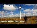
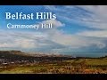
Summits & other features in area Antrim Hills: Cen: Central Antrim Hills: Carncormick 436m, Collin Top 429m, Crockalough 402m, Mid Hill 440m, Skerry Hill 459m, Slieveanorra 508m, Slievenahanaghan 418m, Soarns Hill 403m, Tievebulliagh 402m, Trostan 550m Central Antrim Hills: Slievenanee 543m N: North Antrim Hills: Carnanmore 379m, Croaghan 417m, Crockaneel 403m, Cross Slieve 206m, Knocklayd 514m, Lannimore Hill 207m N: Rathlin Island: Kilpatrick (Rathlin Island) 134m S: Islandmagee: Donalds Carn 141m, Muldersleigh Hill 131m S: South Antrim Hills: Agnew's Hill 474m, Big Collin 353m, Black Hill 381m, Carnearny 319m, Douglas Top 402m, Slemish 437.9m W: West Antrim: Long Mountain 215m
Note: this list of places may include island features such as summits, but not
islands as such.
Agnew's Hill, 474mHill
Place Rating ..
, Antrim County in Ulster province, in Carn Lists, Agnew's Hill is the 653rd highest place in Ireland.
Grid Reference D32732 01806,
OS 1:50k mapsheet 9 Place visited by: 81members, recently by: sprog, trostanite, Paddym99, Sperrinwalker, garybuz, Colin Murphy, Matrim, Carolyn105, Bernieor, madfrankie, Dave68, Krumel, eflanaga, Kilcoobin, Andy1287
I visited this place: NO (You need to be a logged-in member for this.)
Longitude: -5.934481, Latitude: 54.846408, Easting: 332732, Northing: 401806,
Prominence: 289m, Isolation: 8.3km ITM: 732651 901794 Bedrock type: Olivine basalt lava, (Upper Basalt Formation) Notes on name: Agnew's Hill is probably the peak marked as Benwellerorie on Mercator's map of SE Ulster, 1595. Rory's Glen is a townland on the SE slopes, named after Rory Ogue McQuillan [OSM, vol. x, p. 118]. Benwellerorie may represent an anglicisation of *Binn Mhaol Ruairí, 'Rory's bare peak'. The English name is derived from the Agnews (Ir. Ó Gníomh), a family of Scottish stock who came to prominence in this area in the 17th century after the decline of the McQuillan's fortunes.
Short or GPS IDs, 6 char: AgnwHl, 10 char: Agnews Hil Linkback: https://mountainviews.ie/summit/533/
Gallery for Agnew's Hill and surrounds
Summary
for Agnew's Hill :
Short climb.
Summary created by simon3, paddyhillsbagger
2018-06-01 19:53:52
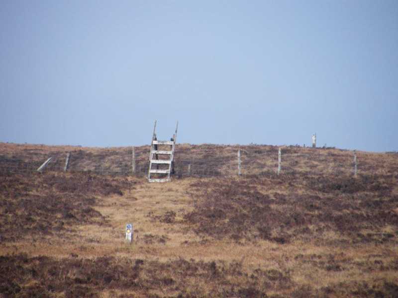
Picture: Summit plateau furniture
Turning left off the A36 from Larne at Kilwaughter leads you up to the Old Freehold area at the foot of Agnew's Hill at over 300m. There are a few single car parking spots before and after the starting point at A (D329 028) where the Ulster Way crosses the road. Climb over the style and follow the Ulster Way posts to the summit plateau. There is a short steep haul followed by a gentle climb on soft to boggy terrain common to the Antrim Hills. A couple of styles help you over the fences. The cairn is soon reached but the actual summit is further south. Take your pick of another style or an Ulster Way post. Up and down in about an hour. An easy bag.
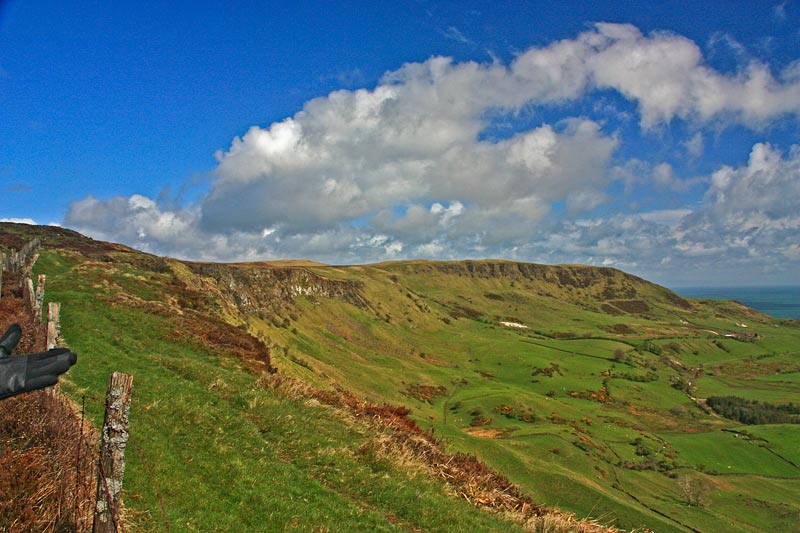
North of the summit and over a road is the 2km long arc of Sallagh Braes, a spectacular semicircle of a valley where the higher ground to the west (left) falls away towards the sea.
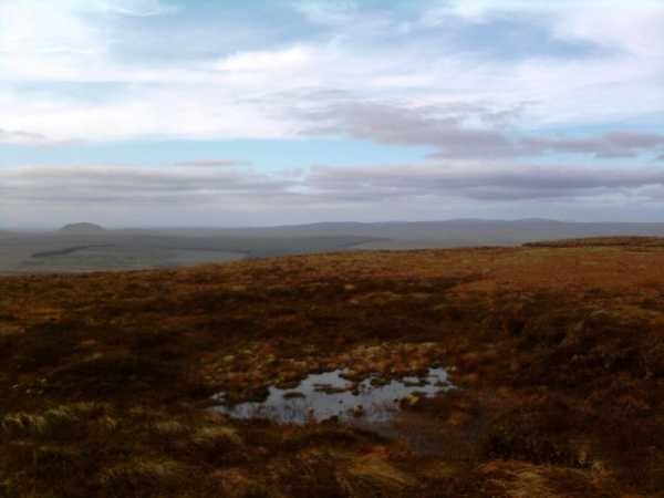
Picture: Looking north-west from the windswept summit of Agnew's Hill
slemish on Agnew's Hill
by slemish
7 Oct 2009
Agnew's Hill is somewhat underrated in my opinion. At an impressive 474m it is the fifth highest in Antrim, much higher than its more celebrated neighbour Slemish. I climbed it today for the first time on a beautifully clear afternoon. I took the A36 from Larne before turning right onto the Starbog road. The hill looks particularly impressive when approached from this direction as it drops steeply on this side. There is space to park at a little lay-by at Old Freehold, about 200m east of where the Ulster way crosses the Starbog road (B (D329 028)). From here it's less than 150 vertical metres to the summit. Quite boggy on the initial approach but it soon dries up as you ascend. The climb was steep at first but got much easier after about 400m. I was very surprised to meet four grazing cows at about 430m, although they didn't seem in the least concerned by my presence. Agnew's Hill has quite a broad flat top which descends dramatically via rocky bluffs towards Larne. On a clear day like today the views from here were excellent. I could clearly make out the Ayrshire coast behind Ailsa Craig and Kintyre to the left. I would agree with pdtempan, the cairn on top of Agnew's Hill is by no means the highest point but from here the view from south-west to north-west was stunning with many Antrim summits visible - Carnearny, Big Collin, Slemish, Carncormick, Slievenanee and Trostan. The distant Sperrins loomed through the haze to the west, the outline of Slieve Gallion in particular easy to pick out. It was incredibly windy on top and I foolishly thought that it being early October, I could forgo the hat and gloves. Five minutes on the summit showed the folly of my ways so I quickly descended to the car by the same route. Total trip - an easy 1 hour walk. Linkback: mountainviews.ie/summit/533/comment/4191/
Read Less
Read More
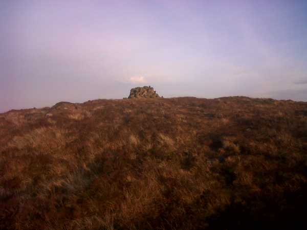
Picture: Cairn on Agnew's Hill
Summit from Starbog
by volsung
14 Nov 2011
Another beautiful November Saturday afternoon. Had planned to climb Slievetrue but the Woodburn forest area is now out of bounds due to a fungal infestation affecting the larch plantations there. So headed off to Agnew’s Hill instead. Started where the Antrim Hills Way crosses the Starbog Road. There is a stile on the left as you travel up from Larne direction. The stile is dedicated to Hugh Munnis, a local walker and historian who died in 2008 and helped popularise walking in the area. It was Hugh Munnis who informed the East Antrim Ramblers where the name ‘Starbog’ originated. Apparently it was named to commemorate the passing of a large fireball or meteorite in 1902 which passed over the area and landed near Crumlin. Bits of it are preserved in the National History Museum, London.
It’s quite a steep climb following the line of the fence. It was pretty boggy so I was soaked in muck and glaar by the time I reached the summit cairn. This cairn is probably not the highest point on the hill as pointed out by previous commentators. I spotted a suspicious looking lunch box among the stones which turned out to be a ‘geocache’. It was late afternoon when I arrived at the top and the light was dimming. There were views of Islandmagee, Slemish and Capanagh Wood below me. Ravens croaked and the sound of shotguns firing could be heard (hopefully not at the ravens!)
To the west I viewed a lovely sunset and to the east the light of The Maidens winked up. Descent was more problematic than the ascent. I nearly cowped twice. The whole jaunt took about an hour. A pleasant way to spend an autumn afternoon. Linkback: mountainviews.ie/summit/533/comment/6627/
Read Less
Read More
pdtempan on Agnew's Hill
by pdtempan
26 May 2008
Wot, no comments? Let's see about that! Agnew's Hill is the highest hill in Mid-Antrim, being higher than Slemish. It presents a broad line of east-facing crags when seen from Larne, which give it a rather sombre look, especially in the afternoon. Probably the most important thing to say about Agnew's Hill is that it is now open for business again. The access problem on the Ulster Way has been resolved, and walkers are welcome again. When we climbed it, we arrived from the north, having already visited Sallagh Braes. The summit is a short haul of about 1 mile from Star Bog Road at Old Freehold. There is a cairn on the summit plateau, but we were not convinced that it marked the actual summit. A point about 200m further south near a stile appeared to be higher. The view is good, but not exceptional, as Agnew's Hill is rather too far removed from the sea and other hills to give a very dominant position. Due to the severe wind, we did not dawdle on top, but returned by our line of ascent and walked the road back to Larne. We did not explore the southern approach via Shane's Hill. Overall Agnew's Hill is definitely worth climbing, at least once, but it is outclassed by the lower hills to the north which offer more variety and better coastal views. Linkback: mountainviews.ie/summit/533/comment/3123/
Read Less
Read More
Picture: Sunset (sort of) over Agnew's.
Nice little climb
by Colin Murphy
28 Nov 2022
The final top in a 4-top bagging day in Antrim Hills. This is a nice little hill with a fine aspect when viewed from the east, with a plunging slope dropping about 170m. A track (not bad but in poor condition in parts) leads most of the way to the summit from the north. A cairn of sorts becomes visible near top, although the actual unmarked high point is 200m further south. The sun was declining as I reached the top and luckily the great skies parted briefly. I imagine this summit offers decent views on fine days, but mine were limited. Still, a nice climb of about 150m ascent is worth the effort. Linkback: mountainviews.ie/summit/533/comment/23767/
Use of MountainViews is governed by conditions and a privacy policy.
Read general information about the site. Opinions in material here are not necessarily endorsed by MountainViews.
Hillwalking is a risk sport. Information in comments, walks, shared GPS tracks or about starting places may
not be accurate for example as regards safety or access permission. You are responsible for your safety and your permission to walk.
See the credits and list definitions.


 Our Facebook page.