Welcome to MountainViews
If you want to use the website often please enrol (quick and free) at top right.
If you want to use the website often please enrol (quick and free) at top right.
Overview

For more map options click on any overview map area or any detail map feature.
Detail Map Features
Showing 20 of a total of 29 items:
Slieve Binnian 745.9m, Slieve Bearnagh 739m, Slievelamagan 702.2m, Slieve Meelbeg 701.9m, Slieve Meelmore 687m, Slieve Binnian North Tor 682.5m, Slieve Bearnagh North Tor 680m, Slieve Binnian North Top 678m, Slieve Muck 670.4m, Slieve Loughshannagh 617m,
4004, 16km
2384, 14km
3936, 14km
4299, 13km
3378, 13km
2404, 12km
3326, 11km
4583, 10km
3088, 9km
2032, 8km
Slieve Binnian 745.9m, Slieve Bearnagh 739m, Slievelamagan 702.2m, Slieve Meelbeg 701.9m, Slieve Meelmore 687m, Slieve Binnian North Tor 682.5m, Slieve Bearnagh North Tor 680m, Slieve Binnian North Top 678m, Slieve Muck 670.4m, Slieve Loughshannagh 617m,
Tracks:
Find Suggested Walks
Find hill, mountain, island, coastal feature.
Videos

Recent Contributions
 Get Notifications
Get Notifications
Hill of Stake: East trek along track to mines followed by wet heather bash
 Fergalh
Carrane from SSW
Fynloch Hill: Outlier of Kilpatrick Hills
 Fergalh
More EastWest names added for summits.
Donations Drive, now finished.
Duncolm: Long trek followed by short sharp climb
 Fergalh
Knocklettragh from north
Auchineden Hill: Small detour to the Whangei rock feature must be included in th
 Fergalh
Arroo from east
Goatfell [Goat Fell]: Long but worthwhile trek
 Fergalh
Corkindale Law: Short trek to summit
 Fergalh
Double bag mostly on windfarm tracks.
 Colin Murphy
Conditions and Info
Use of MountainViews is governed by conditions and a privacy policy.
Read general information about the site.
Opinions in material here are not necessarily endorsed by MountainViews.
Hillwalking is a risk sport. Information in comments, walks, shared GPS tracks or about starting places may not be accurate for example as regards safety or access permission. You are responsible for your safety and your permission to walk.
See the credits and list definitions.
 Visit our Facebook page.
Video display
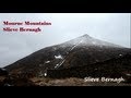
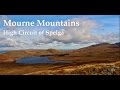
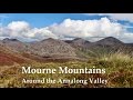
Mourne Mountains
Area Cen: Loughshannagh Subarea
Place count in area: 58,
OSI/LPS Maps: 20, 29, EW-CLY
Highest place: Slieve Donard, 849m
Maximum height for area: 849 metres,
Maximum prominence for area: 821 metres,
Places in area Mourne Mountains:
Cen: Loughshannagh:Ben Crom 526mCarn Mountain 585.2mCarn Mountain North Top 553.7mDoan 592.6mOtt Mountain 526.8mSlieve Loughshannagh 617mSlieve Muck 670.4mSlievenaglogh 445m
E: Binnian:Slieve Binnian 745.9mSlieve Binnian East Top 639mSlieve Binnian North Top 678mSlieve Binnian North Tor 682.5mWee Binnian 460m
E: Donard:Chimney Rock Mountain 656mCrossone 540mMillstone Mountain 460mRocky Mountain 524mSlieve Donard 849m
E: Lamagan:Cove Mountain 654.8mSlieve Beg 595.9mSlievelamagan 702.2m
N: Bearnagh:Slieve Bearnagh 739mSlieve Bearnagh North Tor 680mSlieve Meelbeg 701.9mSlieve Meelmore 687m
N: Castlewellan:Slievenalargy 280mSlievenaslat 272m
N: Commedagh:Slieve Commedagh 767mSlieve Corragh 641.9mSlievenaglogh 584.4mSlievenaglogh East Top 571m
N: Croob:Cratlieve 429mSlieve Croob 534mSlievegarran 391mSlievenisky 446m
N: Rathfriland:Knockiveagh 235m
S: Kilkeel:Knockchree 306m
S: Rostrevor:Crenville 460mFinlieve 578mSlievemartin 485mSlievemeel 420mSlievemeen 472m
W: Hilltown:Gruggandoo 382mSlieveacarnane 296m
W: Slievemoughanmore:Crotlieve Mountain 347mEagle Mountain 638mRocky Mountain 404mShanlieve 626mSlievemoughanmore 560mTievedockaragh 473mWee Slievemoughan 428m
W: Spelga:Butter Mountain 500mCock Mountain 504mCock Mountain South-West Top 505mHen Mountain 354mPigeon Rock Mountain 534mPigeon Rock Mountain South Top 530mSlievenamiskan 444m
Note: this list of places includes island features such as summits, but not islands as such.
Highest place:
Slieve Donard, 849mPlaces in area Mourne Mountains:
Cen: Loughshannagh:
Ben Crom 526mCarn Mountain 585.2mCarn Mountain North Top 553.7mDoan 592.6mOtt Mountain 526.8mSlieve Loughshannagh 617mSlieve Muck 670.4mSlievenaglogh 445mE: Binnian:
Slieve Binnian 745.9mSlieve Binnian East Top 639mSlieve Binnian North Top 678mSlieve Binnian North Tor 682.5mWee Binnian 460mE: Donard:
Chimney Rock Mountain 656mCrossone 540mMillstone Mountain 460mRocky Mountain 524mSlieve Donard 849mE: Lamagan:
Cove Mountain 654.8mSlieve Beg 595.9mSlievelamagan 702.2mN: Bearnagh:
Slieve Bearnagh 739mSlieve Bearnagh North Tor 680mSlieve Meelbeg 701.9mSlieve Meelmore 687mN: Castlewellan:
Slievenalargy 280mSlievenaslat 272mN: Commedagh:
Slieve Commedagh 767mSlieve Corragh 641.9mSlievenaglogh 584.4mSlievenaglogh East Top 571mN: Croob:
Cratlieve 429mSlieve Croob 534mSlievegarran 391mSlievenisky 446mN: Rathfriland:
Knockiveagh 235mS: Kilkeel:
Knockchree 306mS: Rostrevor:
Crenville 460mFinlieve 578mSlievemartin 485mSlievemeel 420mSlievemeen 472mW: Hilltown:
Gruggandoo 382mSlieveacarnane 296mW: Slievemoughanmore:
Crotlieve Mountain 347mEagle Mountain 638mRocky Mountain 404mShanlieve 626mSlievemoughanmore 560mTievedockaragh 473mWee Slievemoughan 428mW: Spelga:
Butter Mountain 500mCock Mountain 504mCock Mountain South-West Top 505mHen Mountain 354mPigeon Rock Mountain 534mPigeon Rock Mountain South Top 530mSlievenamiskan 444mNote: this list of places includes island features such as summits, but not islands as such.

Bedrock type: Granite granophyre, (Mourne Mountains granite)
There is no record of an actual fort here, so the name probably comes from the imagined resemblence of the craggy summit to a fortress. For origin of name, see PNNI for info on Maol Chobha. Doan is the 311th highest place in Ireland.
Linkback: https://mountainviews.ie/summit/290/
COMMENTS for Doan (Dún Maol Chobha) 1 2 3 4 5 Next page >>  Follow this place's comments

|
|
|
|
||
| MountainViews.ie, a Hill-walking Website for the island of Ireland. 2400 Summiteers, 1480 Contributors, maintainer of lists: Arderins, Vandeleur-Lynams, Highest Hundred, County Highpoints etc | |||