This website uses cookies, which are small text files that the website puts on your device to facilitate operation. Cookies help us provide a better service to you. They are used to track general user traffic information and to help the website function properly.
rhw: Track/5081 in area near Cnoc Leitreach, Achill & Corraun (Ireland)
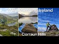
Knocklettragh from north
Ascent: 389m,
Length: 3.7km,
Creator time taken: 1h40m
Descent: 444m,
Time predicted from Naismith's rule: 1h 23m + breaks
Click here to rate track
PlacesStart at F78184 01638, Knocklettragh, end at Start
Track Rating ..
[RWD version 1 ]
From N, Tonragee school, good parking, good track, runs out pretty soon (alternative parking available just before junction). Take L branch, soon deteriorating to faint path, then gain NE ridge, initially steep, easy terrain to summit cairn
Editing Details for track/5081
NOTE: ALL information such as Ascent, Length and Creator time taken etc should be regarded as approximate. The creator's comments are opinions and may not be accurate or still correct.
Your time to complete will depend on the speed of the slowest plus break time and your mode of transport.
NOTE: It is up to you to ensure that your route is appropriate for you and your party to follow bearing in mind all factors such as safety, weather conditions, experience and access permission.
Uploaded on: Sun, 5 May 2024 (19:19:29), Linkback: https://mountainviews.ie/track/5081/
* Note: A GPS Height in the elevation profile is sourced from the device that recorded the track. An "SRTM" height is derived from a model of elevations for parts of the earth. More detail
Use of MountainViews is governed by conditions and a privacy policy.
Read general information about the site. Opinions in material here are not necessarily endorsed by MountainViews.
Hillwalking is a risk sport. Information in comments, walks, shared GPS tracks or about starting places may
not be accurate for example as regards safety or access permission. You are responsible for your safety and your permission to walk.
See the credits and list definitions.


 Our Facebook page.