Welcome to MountainViews
If you want to use the website often please enrol (quick and free) at top right.
If you want to use the website often please enrol (quick and free) at top right.
Overview

For more map options click on any overview map area or any detail map feature.
Detail Map Features
Find Suggested Walks
Find hill, mountain, island, coastal feature.
Videos


Recent Contributions
 Get Notifications
Get Notifications
Carricktriss Gorse: Safe access to this hill no longer seems possible
 TommyMc
Binnion: Tullagh Bay and Rockstown Harbour
 Jim_Brady
Donations Drive, now finished.
Good, relatively easy double bag
 Colin Murphy
Crocknapeast: Long walk up windfarm roads.
 Collaborative entry
Mulnanaff: Longish walk up windfarm road.
 Collaborative entry
Lake District: Dale Head Horseshoe
Double bag mostly on windfarm tracks.
 Colin Murphy
Binbane NE Top: Simple bag from its neighbouring top.
 Collaborative entry
Lake District: Coledale Horseshoe
Binbane: Steepish approach to relatively easy Carn.
 Collaborative entry
Crucknaree: Magnificent views!
 paddyhillsbagger
Conditions and Info
Use of MountainViews is governed by conditions and a privacy policy.
Read general information about the site.
Opinions in material here are not necessarily endorsed by MountainViews.
Hillwalking is a risk sport. Information in comments, walks, shared GPS tracks or about starting places may not be accurate for example as regards safety or access permission. You are responsible for your safety and your permission to walk.
See the credits and list definitions.
 Visit our Facebook page.
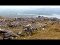
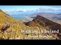
Video display
Slieve Mish
Area W: Aughils Subarea
Place count in area: 16,
OSI/LPS Maps: 71, EW-DC, EW-DE
Highest place: Baurtregaum, 849.7m
Maximum height for area: 849.7 metres,
Maximum prominence for area: 643 metres,
Places in area Slieve Mish:
Cen: Baurtregaum:Baurtregaum 849.7mBaurtregaum Far NE Top 601.2mBaurtregaum NE Top 818.5mBaurtregaum NW Top 723mCaherconree 835mCastle Hill 600mGearhane 792m
E: Barnanageehy:Barnanageehy 561m
W: Aughils:Beenduff 515mCaherbla 585.2mEmlagh 483mKnockbrack 459mKnockmore 565mLack Mountain 465mMoanlaur 566m
W: Camp:Corrin 332m
Note: this list of places includes island features such as summits, but not islands as such.
Highest place:
Baurtregaum, 849.7mPlaces in area Slieve Mish:
Cen: Baurtregaum:
Baurtregaum 849.7mBaurtregaum Far NE Top 601.2mBaurtregaum NE Top 818.5mBaurtregaum NW Top 723mCaherconree 835mCastle Hill 600mGearhane 792mE: Barnanageehy:
Barnanageehy 561mW: Aughils:
Beenduff 515mCaherbla 585.2mEmlagh 483mKnockbrack 459mKnockmore 565mLack Mountain 465mMoanlaur 566mW: Camp:
Corrin 332mNote: this list of places includes island features such as summits, but not islands as such.

Bedrock type: Conglomerate with metamorphic clasts, (Inch Conglomerate Formation)
This is the highest of a number of peaks on a ridge stretching NE from Inch. Moanlaur is the 375th highest place in Ireland.
Linkback: https://mountainviews.ie/summit/332/
COMMENTS for Moanlaur (Móin Láir) 1 2 Next page >>  Follow this place's comments

|
|
|
|
||
| MountainViews.ie, a Hill-walking Website for the island of Ireland. 2400 Summiteers, 1480 Contributors, maintainer of lists: Arderins, Vandeleur-Lynams, Highest Hundred, County Highpoints etc | |||