Members and Supporters, the MountainViews Committee requests your help to meet the costs of the website and of other activities such as insured events or publications.
Feature count in area: 16, all in Kerry,
OSI/LPS Maps: 71, EW-DC, EW-DE
Highest Place: Baurtregaum 849.7m
Starting Places (15) in area Slieve Mish: Caherconree Scenic Route, Derrymore West Trail, Doonore South, Emlagh Cross, Emlagh Wood, Feighatidura Cove, Glanaskagheen Wood, Greenlawn Cross, Laharn Viewpoint, Lougher, Maum Cross, Maumnahaltora Cross, R561 Lissaroe, Tonavane Cross, Tonavane Walk Kerry Camino
Summits & other features in area Slieve Mish: Cen: Baurtregaum: Baurtregaum 849.7m, Baurtregaum Far NE Top 601.2m, Baurtregaum NE Top 818.5m, Baurtregaum NW Top 723m, Caherconree 835m, Castle Hill 600m, Gearhane 792m E: Barnanageehy: Barnanageehy 561m W: Aughils: Beenduff 515m, Caherbla 585.2m, Emlagh 483m, Knockbrack 459m, Knockmore 565m, Lack Mountain 465m, Moanlaur 566m W: Camp: Corrin 332m
Note: this list of places may include island features such as summits, but not
islands as such.
Gearhane, 792mMountain An Géarán A name in Irish,
Place Rating ..
(Ir. An Géarán [OSI], 'the fang'), Kerry County in Munster province, in Arderin Beg, Vandeleur-Lynam, Irish Best Hundred Lists, Gearhane is the 49th highest place in Ireland.
Grid Reference Q73317 08255,
OS 1:50k mapsheet 71 Place visited by: 190members, recently by: rhw, maoris, SeanPurcell, chelman7, Tuigamala, ToughSoles, Kaszmirek78, davsheen, eugeneryan959, Sarahjb, overthehill67, bagoff, Krzysztof_K, GerSomers, Moses
I visited this place: NO (You need to be a logged-in member for this.)
Longitude: -9.854034, Latitude: 52.2115, Easting: 73317, Northing: 108255,
Prominence: 17m, Isolation: 0.9km ITM: 473297 608257 Bedrock type: Purple cross-bedded sandstone, (Cappagh Sandstone Formation) Notes on name: Between Gearhane and the summit of Caherconree are two rock features known as Finn Mac Cool's Table and Finn Mac Cool's Chair.
Short or GPS IDs, 6 char: Grh792, 10 char: Gearhan792 Linkback: https://mountainviews.ie/summit/47/
Gallery for Gearhane (An Géarán) and surrounds
Summary
for Gearhane (An Géarán):
Ascent from the Derrymore Valley
Summary created by Colin Murphy
2013-06-04 11:30:20
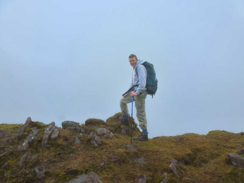
Picture: The high point of Gearhane
Park at DerMor Tr (Q743 107), where the narrow road turns to the left, beside a nearby a house, and where there is just room for a couple of cars. Head up the track at the side of the house and you will reach a stile which leads onto the open mountain. Follow a faint path to the right of the gorge of the Derrymore River, until you reach Derrymore Lough high up in the glen. Turn NW for about 700m, the ground becoming increasingly steep as you near the summit, but mostly firm underfoot. It eventually eases up at about 760m ascent. The summit is a long narrow mound covered in grass and rocks, otherwise unmarked. Time to reach summit, approximately 2 hours.
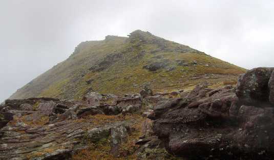
I took this photo on the ridge between Caherconree and Gearhane.
The sandstone conglomerate formations in the foreground are quite striking in appearance. Behind is the rocky summit area of Gearhane. Linkback: mountainviews.ie/summit/47/comment/2153/
Read Less
Read More
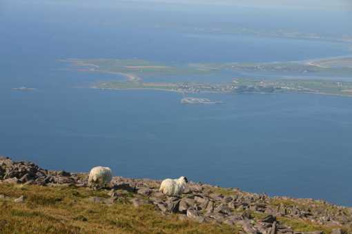
Picture: Fenit from Gearhane
Peter Walker on Gearhane
by Peter Walker
12 Sep 2007
It's a long, joint-mangling descent from Gearhane to the foot of the Derrymore Glen; in retrospect, it's probably better to do Bautregaum to Gearhane in the other direction, and then descend the glen. Either way, a beautiful walk on a clear day. Linkback: mountainviews.ie/summit/47/comment/2825/
Read Less
Read More
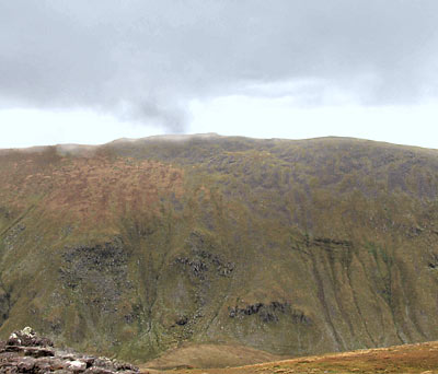
Picture: Gearhane's long ridge from the east.
simon3 on Gearhane
by simon3
5 Nov 2005
An excellent point to start for much of the southern Slieve Mish area is at DerMor Tr (Q74224 10770). Going west out of Tralee on the N86 after about 11k you encounter a hump-backed bridge ("Derrymore Bridge"). Turn left shortly afterwards into a fairly narrow road which you can follow until it ends. There's a limited amount of parking here. Go past a pebble dashed house and there is path leading to open land.
Once there Gearhane is directly ahead. It's a steep pull up, slightly easier to the left as you face it (the NE ridge).
As you rise you can get glimpses of the Derrymore valley and a good view of the graceful conical Barrtregaum NW summit. Gearhane becomes a narrow North South ridge around 800m long. The summit itself has a few outcrops, one of which has a small cairn beside it which is probably the highest point. On a good day, views open out right down the Dingle peninsula and to the north Kerry coast.
There is another Gearhane on the Dingle peninsula just south of Brandon of 803m. Out of curiousity I wondered is it possible to see the other from here. The other is 26.6km west, however Beenoskee is in the way, (16km away).. The top of Beenoskee at 826m is higher than either Gearhane. According to my measurements you would be able to see one from the other, because the line of sight goes slightly south of the summit of Beenoskee at a point where it is around 700m high. Perhaps someone can oblige with a photo! Linkback: mountainviews.ie/summit/47/comment/2030/
Read Less
Read More
paul_a_newton on Gearhane
by paul_a_newton
27 Feb 2005
Excellent views down to the bay and well worth taking the slight detour while doing the Caherconree - Bautreggaum horseshoe. Very easy saddle between that and Caherconree. Linkback: mountainviews.ie/summit/47/comment/1500/
Read Less
Read More
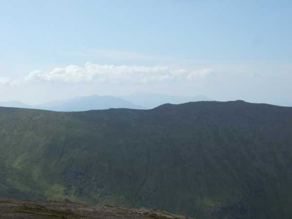
Picture: View from Bartregaum along the Gearhane ridge
Simon's theory on the view westward
by stargazer
15 Aug 2010
In response to Simon's query regarding photos of Gearhane/Brandon Group from Gearhane/Slieve Mish I took this photo on a smashing August Sunday. Whilst it does not give the actual view Westward from Gearhane/SM it gives the view over Gearhane ridge and towards the Brandon Group. If I am not mistaken you can spot Brandon to the right, Brandon Peak and Gearhane/BG in the distance. From this perspective I would say that a similar view should be possible from Gearhane/SM. I will stand corrected on this of course! Linkback: mountainviews.ie/summit/47/comment/6016/
Use of MountainViews is governed by conditions and a privacy policy.
Read general information about the site. Opinions in material here are not necessarily endorsed by MountainViews.
Hillwalking is a risk sport. Information in comments, walks, shared GPS tracks or about starting places may
not be accurate for example as regards safety or access permission. You are responsible for your safety and your permission to walk.
See the credits and list definitions.


 Our Facebook page.