Donation Request 2024
You do not have to be logged in to donate.
DONATE
Members and Supporters, the MountainViews Committee requests your help to meet the costs of the website and of other activities such as insured events or publications.You do not have to be logged in to donate.
Welcome to MountainViews
If you want to use the website often please enrol (quick and free) at top right.
If you want to use the website often please enrol (quick and free) at top right.
Overview

For more map options click on any overview map area or any detail map feature.
Detail Map Features
Find Suggested Walks
Find hill, mountain, island, coastal feature.
Videos

Recent Contributions
 Get Notifications
Get Notifications
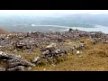
Crocknapeast: Long walk up windfarm roads.
 Collaborative entry
Double bag mostly on windfarm tracks.
 Colin Murphy
Mulnanaff: Longish walk up windfarm road.
 Collaborative entry
Good, relatively easy double bag
 Colin Murphy
Binbane NE Top: Simple bag from its neighbouring top.
 Collaborative entry
Binbane: Steepish approach to relatively easy Carn.
 Collaborative entry
Lake District: Dale Head Horseshoe
Crucknaree: Magnificent views!
 paddyhillsbagger
Lake District: Coledale Horseshoe
Dunranhill: Sika deer and sitka spruce
 hibby
hibby
Crocknasharragh: Impressive views on initial ascent.
 Colin Murphy
Longish walk to isolated top
 Colin Murphy
Conditions and Info
Use of MountainViews is governed by conditions and a privacy policy.
Read general information about the site.
Opinions in material here are not necessarily endorsed by MountainViews.
Hillwalking is a risk sport. Information in comments, walks, shared GPS tracks or about starting places may not be accurate for example as regards safety or access permission. You are responsible for your safety and your permission to walk.
See the credits and list definitions.
 Visit our Facebook page.
Video display
Slieve Mish
Area Cen: Baurtregaum Subarea
Place count in area: 16,
OSI/LPS Maps: 71, EW-DC, EW-DE
Highest place: Baurtregaum, 849.7m
Maximum height for area: 849.7 metres,
Maximum prominence for area: 643 metres,
Places in area Slieve Mish:
Cen: Baurtregaum:Baurtregaum 849.7mBaurtregaum Far NE Top 601.2mBaurtregaum NE Top 818.5mBaurtregaum NW Top 723mCaherconree 835mCastle Hill 600mGearhane 792m
E: Barnanageehy:Barnanageehy 561m
W: Aughils:Beenduff 515mCaherbla 585.2mEmlagh 483mKnockbrack 459mKnockmore 565mLack Mountain 465mMoanlaur 566m
W: Camp:Corrin 332m
Note: this list of places includes island features such as summits, but not islands as such.
Highest place:
Baurtregaum, 849.7mPlaces in area Slieve Mish:
Cen: Baurtregaum:
Baurtregaum 849.7mBaurtregaum Far NE Top 601.2mBaurtregaum NE Top 818.5mBaurtregaum NW Top 723mCaherconree 835mCastle Hill 600mGearhane 792mE: Barnanageehy:
Barnanageehy 561mW: Aughils:
Beenduff 515mCaherbla 585.2mEmlagh 483mKnockbrack 459mKnockmore 565mLack Mountain 465mMoanlaur 566mW: Camp:
Corrin 332mNote: this list of places includes island features such as summits, but not islands as such.

Bedrock type: Aeolian sandstone, (Kilmurry Sandstone Formation)
A narrow but easily passable ridge connects this peak to its higher neighbour, Baurtregaum. Caherconree is named after a stone fort situated two-thirds of the way up its western flank, overlooking the mountain road called Bóthar na gCloch ('road of the stones'). This is an inland promontory-fort, consisting of a natural projecting ledge surrounded on three sides by steep cliffs, the fourth side being defended by a stone wall. In legend this is the fort of Cú Roí mac Daire, hero of Munster, who was able to make it spin around at night to perplex any attackers looking for the entrance. The best known story connected with it relates how Cú Chulainn attacked the fort with the aid of Blathnaid, the daughter of the king of Man, whom Cú Roí had taken, none too willingly, for his wife. Blathnaid taunted Cú Roí that his fort was too small for such a magnificent chieftain as himself, and when the walls were down during the construction of bigger fort, she poured milk in a stream (now the Finglas River, from Ir. An Fhionnghlaise, 'the white stream') as a signal to Cú Chulainn that the moment was right to attack. For a fuller account of the story, see The Dingle Peninsula by Steve MacDonogh, pp. 31-33. Nor is this the hill's only legendary association. The summit is known as Fin Mac Cool's Table, while a rock feature on the northern ridge connecting to Gearhane is called Fin Mac Cool's Chair. Caherconree is the second highest mountain in the Slieve Mish area and the 27th highest in Ireland.
Linkback: https://mountainviews.ie/summit/26/
COMMENTS for Caherconree (Cathair Conraoi) 1 2 3 Next page >>  Follow this place's comments

|
|
|
|
||
| MountainViews.ie, a Hill-walking Website for the island of Ireland. 2400 Summiteers, 1480 Contributors, maintainer of lists: Arderins, Vandeleur-Lynams, Highest Hundred, County Highpoints etc | |||