Guestuser: Login or enrol?
- Home
- Main Display
- Main Display (Old)
- Find a Walk
- Display INTRODUCTION
- DONATE
- Click below for your
profile & contributions
guestuser- New
- Tracks, Walks
- Challenge
- Community
- Lists & Logs
- Popular Lists:
- County Highpoints
- Range & Area Highpoints
- Local 100
- Highest Hundred
- Vandeleur-Lynams
- Arderins
- Carns
- Best rated
- Irish 900 up
- Irish Island
- Munros
- All Lists
- Shorter Irish
- County Highpoints
- Range & Area Highpoints
- Highest Hundred
- Local 100
- Local 100 (pre2014)
- Local Historical Cultural
- Best rated
- Irish 900 up
- Larger Irish
- Arderins
- Arderin Begs
- Arderins + Arderin Begs
- Vandeleur-Lynams
- Vandeleur-Lynams + Arderins
- Carns
- Binnions
- Highest 50 per Province
- Island Features
- Irish Island
- Coastal Hills
- Irish 600 up
- Irish 500 up
- British
- Munros
- British 600 up
- British 500-600
- British Marilyns
- Comprehensive
- All Irish summits
- All Irish features
- All British summits
- All Britain+ Ireland
- Special
- Analysis List
- Simple Irish Listings
- Simple Irish & British Listings
-
- More
- Motley Views
Welcome to MountainViews
If you want to use the website often please enrol (quick and free) at top right.OverviewFor more map options click on any overview map area or any detail map feature.Detail Map FeaturesShowing 7 items:
Mid Hill 440m, Collin Top 429m, Soarns Hill 403m,Tracks:2676, 19km 1449, 18km 4304, 15km 4936, 12km Find Suggested Walks
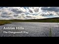
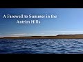
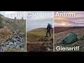
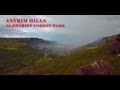
Find hill, mountain, island, coastal feature.Videos
Recent Contributions
 Get Notifications
Beennaman: Stunning views from the peak
Rathinny: Short steep trek to summit
Lake District: High Stile Ridge
Great Sugar Loaf: Old friend
Lake District: Lonscale Fell
Coolmore: Follow the way of the cross
North Wicklow from Curtlestown after massive felling.
Benwiskin South Top: Sunrise view from Diarmuid and Gráinne’s cave, Gleniff Hors
Bealick
Carran: Several approachs
Hills above Sneem
Camlough Mountain: Along the beaten track
Conditions and Info
Use of MountainViews is governed by conditions and a privacy policy.
Read general information about the site.
Opinions in material here are not necessarily endorsed by MountainViews.
Hillwalking is a risk sport. Information in comments, walks, shared GPS tracks or about starting places may not be accurate for example as regards safety or access permission. You are responsible for your safety and your permission to walk.
See the credits and list definitions.Video displayAntrim Hills Area Cen: Central Antrim Hills SubareaPlace count in area: 27, OSI/LPS Maps: 14, 15, 4, 5, 8, 9
Highest place: Trostan, 550m
Maximum height for area: 550 metres, Maximum prominence for area: 515 metres,
Places in area Antrim Hills:
Cen: Central Antrim Hills:Carncormick 436mCollin Top 429mCrockalough 402mMid Hill 440mSkerry Hill 459mSlieveanorra 508mSlievenahanaghan 418mSoarns Hill 403mTievebulliagh 402mTrostan 550m
Central Antrim Hills:Slievenanee 543m
N: North Antrim Hills:Carnanmore 379mCroaghan 417mCrockaneel 403mCross Slieve 206mKnocklayd 514mLannimore Hill 207m
N: Rathlin Island:Kilpatrick (Rathlin Island) 134m
S: Islandmagee:Donalds Carn 141mMuldersleigh Hill 131m
S: South Antrim Hills:Agnew's Hill 474mBig Collin 353mBlack Hill 381mCarnearny 319mDouglas Top 402mSlemish 437.9m
W: West Antrim:Long Mountain 215m
Note: this list of places includes island features such as summits, but not islands as such.
Antrim County in NI and in Ulster Province, in Carn List, Olivine basalt lava Bedrock
Height: 429m OS 1:50k Mapsheet: 9 Grid Reference: D21815 16816
Place visited by 43 members. Recently by: trostanite, PPruzina, Colin Murphy, Paddym99, garybuz, Dave68, Kilcoobin, Andy1287, LorraineG60, MichaelG55, eamonoc, Fergalh, scapania, Ulsterpooka, Peter WalkerI have visited this place: NO (You need to be a logged-in member to change this.)Longitude: -6.097977, Latitude: 54.983934 , Easting: 321815, Northing: 416816 Prominence: 34m, Isolation: 2km
ITM: 721737 916801 , GPS IDs, 6 char: ClnTp, 10 char: Collin Top
Bedrock type: Olivine basalt lava, (Upper Basalt Formation)
Along the east coast of Ireland there is a cluster of names anglicised as Collin/Collon from Irish collann, meaning 'a height'. See also Big Collin (Co. Antrim) and Collon Hill (Co. Wicklow). They may ultimately show the same root as Lat. collis, Fr. colline and Eng. hill. Collin Top is the 810th highest place in Ireland.
Linkback: https://mountainviews.ie/summit/691/COMMENTS for Collin Top (Collann) 1 of 1  Follow this place's comments
 Height layer: © MapTiler

MountainViews.ie, a Hill-walking Website for the island of Ireland. 2500 Summiteers, 1480 Contributors, maintainer of lists such as: Arderins, Vandeleur-Lynams, Highest Hundred, County Highpoints etc

 DeirdreM
 Fergalh
 hibby
hibby
 Fergalh
 simon3
 Mountain_Mac
 Collaborative entry
 Colin Murphy
 Visit our Facebook page.