Cookies. This website uses cookies, which are small text files that the website puts on your device to facilitate operation. Cookies help us provide a better service to you. They are used to track general user traffic information and to help the website function properly.

Click to hide this notice for 30 days.
Welcome to MountainViews
If you want to use the website often please enrol (quick and free) at top right.
Overview
Detail
Zoom: ??
For more map options click on any overview map area or any detail map feature.
Find Suggested Walks
Find hill, mountain, island, coastal feature.
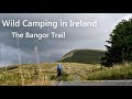
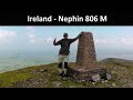
Videos


Recent Contributions
Get Notifications

Carricktriss Gorse: Safe access to this hill no longer seems possible

Binnion: Tullagh Bay and Rockstown Harbour

Donations Drive, now finished.

Good, relatively easy double bag

Crocknapeast: Long walk up windfarm roads.

Mulnanaff: Longish walk up windfarm road.

Lake District: Dale Head Horseshoe

Double bag mostly on windfarm tracks.

Binbane NE Top: Simple bag from its neighbouring top.

Lake District: Coledale Horseshoe

Binbane: Steepish approach to relatively easy Carn.

Crucknaree: Magnificent views!

Conditions and Info
Use of MountainViews is governed by conditions and a privacy policy.
Read general information about the site.
Opinions in material here are not necessarily endorsed by MountainViews.
Hillwalking is a risk sport. Information in comments, walks, shared GPS tracks or about starting places may not be accurate for example as regards safety or access permission. You are responsible for your safety and your permission to walk.
See the credits and list definitions.
Video display
Nephin Begs Area   E: Birreencorragh Subarea
Place count in area: 28, OSI/LPS Maps: 22, 23, 30, 31, CBW, EW-ACC, EW-WNN, EW-WNS 
Highest place:
Slieve Carr, 721m
Maximum height for area: 721 metres,     Maximum prominence for area: 646 metres,

Note: this list of places includes island features such as summits, but not islands as such.
Rating graphic.
Birreencorragh South Top Mountain Birín Corrach (mullach theas) A name in Irish, also Birreen Corrough Beg an extra EastWest name in English For origin of name, see Birreencorragh. Mayo County in Connacht Province, in Arderin List, Mixed schists, minor basic metavolcanics Bedrock

Height: 564m OS 1:50k Mapsheet: 31 Grid Reference: G02431 03076
Place visited by 113 members. Recently by: kernowclimber, mcrtchly, Kaszmirek78, SeanPurcell, Carolineswalsh, jimmel567, srr45, tonio22, Krzysztof_K, NualaB, abcd, Timmy.Mullen, Carolyn105, Oscar-mckinney, Wes
I have visited this place: NO (You need to be a logged-in member to change this.)

Longitude: -9.487397, Latitude: 53.967777 , Easting: 102431, Northing: 303076 Prominence: 59m,  Isolation: 1.9km
ITM: 502408 803078,   GPS IDs, 6 char: BrncSt, 10 char: BrncrgSthT
Bedrock type: Mixed schists, minor basic metavolcanics, (Bunaveela Lough Formation)

Named Berreen Corrough Beg on Bald's map of Co. Mayo (1830). Previously Glenlara in MV.   Birreencorragh South Top is the 381st highest place in Ireland. Birreencorragh South Top is the second most easterly summit in the Nephin Begs area.

Linkback: https://mountainviews.ie/summit/335/
COMMENTS for Birreencorragh South Top (Birín Corrach (mullach theas)) 1 2 Next page >>  
Follow this place's comments
MountainViews.ie Picture about mountain Birreencorragh South Top (<i>Birín Corrach (mullach theas)</i>) in area Nephin Begs, Ireland
Picture: Bireencorragh South as seen from West Top
 
An isolated gem in North Mayo
Short Summary created by jackill, Colin Murphy  30 Jul 2012
Park at the end of a long forest rack at G 0349 0239 starA (info courtesy of csd), although the track has deteriorated badly in a couple of spots and care is needed if you don’t want to damage the underside of your car! There is room to park here for 2-3 cars. Head north up a very steep slope for about 300m and the summit will be visible about 1km away to the NW. From here it is easy going, with the ground underfoot fairly solid and covered in nice short grass. On a good day the summit can be reached in less than an hour. A fine top in it's own right with great views of Bireencorragh itself, but it can also be the first stop on a wonderful 4-5 top horseshoe encompassing Bireencorragh West Top, Mount Eagle (optional), Bireencorragh and Knockaffertagh - a walk of about seven hours. Linkback: https://mountainviews.ie/summit/335/comment/5095/
 
MountainViews.ie Picture about mountain Birreencorragh South Top (<i>Birín Corrach (mullach theas)</i>) in area Nephin Begs, Ireland
Picture: Glenlara from the slopes of Buckoogh
gerrym on Birreencorragh South Top, 2005
by gerrym  24 Sep 2005
Firstly, many thanks to csd for the starting point to this walk - a long drive through forest tracks, mostly of good quality, gaining several hundred feet by the parking spot giving great views down to Lough Beltra. Continue along the track on foot passing abandoned forestry equipment onto open hillside. Climb uphill parallel to the forest alongside a fast flowing stream - glimpses of a buzzard here as it left the camoflague of the hillside to be visible against the skyline. When reach the ridge the mountainscape to the south across Clew Bay starts to come into focus. Cross a fenceline and it is not far to the rocky summit area (after 1000ft of climb). As mentioned there are a line of three summit cairns heading in the direction of Birreencorragh. There are stupendous views in all directions from the top, most notably SW to the ridge and dome of Croagh Patrick backed by the line of the Sheefrey Hills and the rugged top of Mweelra. Straight across the valley is the heavily forested slopes of Buckoogh with the bigger hills of the range stretching in a line up to Slievecar, Slievemore on Achill just gets a look in from behind Glennamong. To the N& E the remainder of the horse shoe curves gracefully up to the summit of Birreencorragh and down to Knockaffertagh on the other side of the valley, backed by the mighty presence of Nephin. The clarity of a northerly breeze also brought into view the steep sea cliffs of Slieve League up across Donegal Bay (if I hadn't strayed from the Sperrins I wouldn't have to keep comparing all these other wonderful panoramas). There is good going as drop down slightly to the col over grass and a few peat hags. (see NW Top for next part of horse shoe) Linkback: https://mountainviews.ie/summit/335/comment/1963/
Your Score: Very useful <<  >>Average
 
MountainViews.ie Picture about mountain Birreencorragh South Top (<i>Birín Corrach (mullach theas)</i>) in area Nephin Begs, Ireland
Picture: The Glenlara Ridge
 
CaptainVertigo on Birreencorragh South Top, 2005
by CaptainVertigo  4 Aug 2005
Glenlara's long wide ridge is the southern approach to Birreencorragh. When I walked and ran this route in June the early morning Atlantic westerlies were whipping cloud across my path. The huge canvass brightened and darkened in spasms and the views in all directions were breathtaking. The photo below shows Glenlara and the long ridge, as seen from the western slopes of Birreencorragh. Linkback: https://mountainviews.ie/summit/335/comment/1851/
Your Score: Very useful <<  >>Average
 
MountainViews.ie Picture about mountain Birreencorragh South Top (<i>Birín Corrach (mullach theas)</i>) in area Nephin Begs, Ireland
csd on Birreencorragh South Top, 2004
by csd  18 Oct 2004
Glenlara makes an ideal first stop on a Glenlara - Birreencorragh - Knockaffertagh horseshoe. It's possible to drive along the forest tracks to park at a clearing at G 0349 0239 starA. The OS map isn't 100% accurate, but if you keep going as far as you can go in a normal car you'll find it easily enough. You then tackle the steep climb north behind your car up onto the eastern shoulder of Glenlara. There are three cairns in the vicinity of the summit, marking the spine of the ridge. Nice views from the summit including a wide sweep from Nephin to Buckoogh. Picture shows the summit area and the ridge walk on to Birreencorragh (right, in cloud). Linkback: https://mountainviews.ie/summit/335/comment/1251/
Your Score: Very useful <<  >>Average
 
MountainViews.ie Picture about mountain Birreencorragh South Top (<i>Birín Corrach (mullach theas)</i>) in area Nephin Begs, Ireland
 
csd on Birreencorragh South Top, 2004
by csd  18 Oct 2004
A picture of the highest cairn, looking NE with Knockaffertagh in the background and Nephin behind that. Continuing north from the summit leads to a pleasant ridge walk towards Birreencorragh. Linkback: https://mountainviews.ie/summit/335/comment/1252/
Your Score: Very useful <<  >>Average
 
MountainViews.ie Picture about mountain Birreencorragh South Top (<i>Birín Corrach (mullach theas)</i>) in area Nephin Begs, Ireland
Picture: Birrencorragh South Top from Spot Ht 340
eflanaga on Birreencorragh South Top, 2007
by eflanaga  5 Oct 2007
I decided to start this horseshoe walk from an area known as Gortnaheilta IG03989 99921 in order to add the two to three hundred metres climb which the route described below would deny me. This was because I have had limited walking this year and having been over seven weeks since my last walk. I felt I needed to maximise the climb available. I parked to the side of the road just above a lane (where there is room for one, possibly two cars on the grass verge). I took lane to it’s end roughly 1k passing cottage before making way up onto the hill following stream & fence (until turn in latter) from which it is a short climb to spot height 340m. From here you can continue to follow the fence up to within 800m of Birrencorragh's small rocky southern summit which my GPS reading IG02437 03060 suggests it is some 150 metres further south than indicated on OS Map .The views as already described below are spectacular, particularly on a day (like the one I had) when visibility was excellent and the land and coast were bathed in wonderful Autumn sunshine. The remainder of the horseshoe is laid out before you from the summit cairn including the next summit on the walk - Birrencorragh West Top Linkback: https://mountainviews.ie/summit/335/comment/2854/
Your Score: Very useful <<  >>Average
 
COMMENTS for Birreencorragh South Top (Birín Corrach (mullach theas)) 1 2 Next page >>
(End of comment section for Birreencorragh South Top (Birín Corrach (mullach theas)).)

OSi logo OSNI/LPS logo
Some mapping:
Open Street Map
(Various variations used.)
British summit data courtesy:
Database of British & Irish Hills
(Creative Commons Licence)
MountainViews.ie, a Hill-walking Website for the island of Ireland. 2400 Summiteers, 1480 Contributors, maintainer of lists: Arderins, Vandeleur-Lynams, Highest Hundred, County Highpoints etc