Donation Request 2024

DONATE
Members and Supporters, the MountainViews Committee requests your help to meet the costs of the website and of other activities such as insured events or publications.

You do not have to be logged in to donate.

Welcome to MountainViews
If you want to use the website often please enrol (quick and free) at top right.
Overview
Detail
Zoom: ??
For more map options click on any overview map area or any detail map feature.
Find Suggested Walks
Find hill, mountain, island, coastal feature.
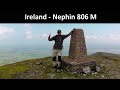
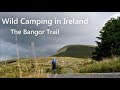
Videos


Recent Contributions
Get Notifications

Lake District: Dale Head Horseshoe

Crocknasharragh: Impressive views on nitial ascent.

Crocknasharragh: Fine views on ascent

Lake District: Coledale Horseshoe

Cunnigar: Short trek to summit

Longish walk to isolated top

Westtown Hill: Tramore's Highest Point

Knockbrinnea West Top: Eflanagan on the Knockbrinneas

Ascending the Knockbrinneas from the north.

Knockbrinnea West Top: Larger Twin

Lobawn Loop - Clockwise avoids any steep ascent! Easy stream crossing.

Knockaunanattin West Top: Views, loughs and a navigational aid.

Conditions and Info
Use of MountainViews is governed by conditions and a privacy policy.
Read general information about the site.
Opinions in material here are not necessarily endorsed by MountainViews.
Hillwalking is a risk sport. Information in comments, walks, shared GPS tracks or about starting places may not be accurate for example as regards safety or access permission. You are responsible for your safety and your permission to walk.
See the credits and list definitions.
Video display
Nephin Begs Area   E: Birreencorragh Subarea
Place count in area: 28, OSI/LPS Maps: 22, 23, 30, 31, CBW, EW-ACC, EW-WNN, EW-WNS 
Highest place:
Slieve Carr, 721m
Maximum height for area: 721 metres,     Maximum prominence for area: 646 metres,

Note: this list of places includes island features such as summits, but not islands as such.
Rating graphic.
Birreencorragh Mountain Birín Corrach A name in Irish, also Birrin Corrough an extra EastWest name in English (Ir. Birín Corrach [logainm.ie], 'rocky little spike') Mayo County in Connacht Province, in Arderin, Vandeleur-Lynam, Irish Highest Hundred Lists, Quartzites and psammitic schists. Bedrock

Height: 698m OS 1:50k Mapsheet: 23/31 Grid Reference: G02455 05007
Place visited by 179 members. Recently by: kernowclimber, mcrtchly, Kaszmirek78, rhw, Magic, Carolineswalsh, McPaj, ToughSoles, srr45, tonio22, Jimmy600leavey, ochils_trekker, Krzysztof_K, NualaB, abcd
I have visited this place: NO (You need to be a logged-in member to change this.)

Longitude: -9.487758, Latitude: 53.985185 , Easting: 102455, Northing: 305007 Prominence: 583m,  Isolation: 1km,   Has trig pillar
ITM: 502425 805016,   GPS IDs, 6 char: Brncrg, 10 char: Brncrgh
Bedrock type: Quartzites and psammitic schists., (Nephin Formation)

The element birín is rare in Irish names, but also occurs unqualified in Birreen, an outlier of Croaghmoyle. Walks: for a route to the summit from the N, see Whilde & Simms, New Irish Walk Guide - West and North, 70.   Birreencorragh is the third highest mountain in the Nephin Begs area and the 118th highest in Ireland.

Linkback: https://mountainviews.ie/summit/112/
COMMENTS for Birreencorragh (Birín Corrach) 1 2 Next page >>  
Follow this place's comments
MountainViews.ie Picture about mountain Birreencorragh (<i>Birín Corrach</i>) in area Nephin Begs, Ireland
Picture: pic:CaptainVertigo - the south face
 
Shapely, remote mountain surrounded by fine valleys and great views.
Short Summary created by markmjcampion, aidand, Onzy  18 Apr 2021
Birreencorragh is situated near Newport in the SE Nephins in an area of steep-sided valleys. It sits at the apex of the Glendorragha Valley and has a remote feel. It's a spectacular mountain when seen from the S and NW, while it slopes gently enough along a narrow ridge directly N and curls northeastwards towards Knockaffertagh to encircle the valley. There are extensive views over the rest of the nearby Nephins, Achill, Clew Bay and further afield to the Sligo hills and the Bluestacks.

S. Park on forest tracks either at G04207 02672 starA and G03490 02390 starB. From the second of these spaces head north up a grassy rise towards G03523 02708 starC, W to Birreencorragh S Top and north to B itself. 1.5hrs max to the top.

SE. Park with care at G05396 01129 starD and follow a track to the N, crossing the stream and thus gaining the lower slopes of Knockakaffertagh. Aim for the spot height G05896 04099 starE and after dropping to the col head over to the top of K. From here, it's an long but easy walk around the head of the Glendorragha valley to reach the summit of B. Allow 2.5hrs+

These routes can be combined into a circuit of Glendorragha which should take between 5 and 6 hours.

N. Park either at G01240 07167 starF or at G04156 09869 starG. Whichever you chose, aim for the N spur and be prepared for a steep pull.

Notable tracks incl track/2958, track/3865 and track/2754 which is a 20k circuit with 1,100m ascent. Linkback: https://mountainviews.ie/summit/112/comment/4872/
 
MountainViews.ie Picture about mountain Birreencorragh (<i>Birín Corrach</i>) in area Nephin Begs, Ireland
Picture: Just.....beautiful
Shapely summit welcomes bootless buffoon
by wicklore  8 Apr 2021
This is a view of the rather shapely upper slopes of Birreencorragh as viewed from the col to the south west. In particular, the photo was taken from near spot height 587 meters. From this point it is a 111 meters haul up to the summit over a distance of circa 400 metres. The slope is a mixture of scree and patches of grass at first, and gets quite steep and rocky for the last 50 metres ascent. ......

On the day that I climbed Birreencorragh in mid-August I started hiking at 6:30am. Bleary-eyed I opened the boot of the car to pull out my rucksack, hiking poles and…and discovered that my hiking boots were not there. I glanced at my runners and gazed forlornly up at the lung-bursting, steep wet slope that marks the start of the initial route up to Birreencorragh South Top when setting out from 03490 02390 starB. I never complete hikes in runners, and ALWAYS depend on my trusty boots for keeping my feet and ankles dry & unbroken. I made a bargain with myself that I would walk slowly and the first time I slipped on wet grass or heather, or my feet twisted in any risky direction that I would stop and go back. I have a keen interest in not becoming a mountain rescue statistic.

As it transpired I had a lovely hike, catching the sunrise over Nephin, enjoying clear early morning views across the Mayo landscape, and even managed to keep my feet relatively dry. I was much more alert when negotiating the upper scree slope on Birreencorragh, and extra vigilant not to step in boggy patches. All-in-all I made great time visiting the three Birreencorragh summits, and the most challenging part was not slipping onto my backside on the descent to the car on that first/last wet grassy slope. As for forgetting my boots – some things only have to happen once and then they won’t happen again. I now add ‘bring boots’ to my mental list when preparing for a hike, next to ‘remember to breathe’ and ‘put one foot in front of the other in order to move’. One swallow doesn’t make a summer, and time will tell if it was a sign of age or just the super-early rising-time that caused me to forget my boots. All I can do in the meantime is give a rueful chuckle and shake my head as I put my car keys in my boots or hang the boots off the front door handle the night before a hike. If necessary I’ll even start wearing them to bed! Linkback: https://mountainviews.ie/summit/112/comment/20651/
Your Score: Very useful <<  >>Average
 
MountainViews.ie Picture about mountain Birreencorragh (<i>Birín Corrach</i>) in area Nephin Begs, Ireland
Picture: long sweeping N ridge of Birreencorragh
 
Approach from the south
by gerrym  8 Apr 2021
My approach to Birreencorragh was from the col with Glenlara to the S. This gives a great appreciation of the very steep E slopes, partially covered in scree, dropping down into Glendorragha. As you climb, the distinctive form of Clare Island becomes perfectly framed between the hills of Buckoogh and Bengorm. The NW ridge drops down off the main ridge and it is well worth the short detour for another view of this many-faced mountain. As you near the summit the ground becomes scree-covered which gets larger for the last section. At the top there are the remains of a trig pillar and a shelter cairn where i had a bite to eat out of the wind. There is an even more expansive view from here as to that described from Glenlara - can now see Croughaun and Menawn on Achill to add to Slievemore, the Sligo mtns are also now visible beyond Nephin along with the Bluestacks in Donegal and more of the hills to the SW in Connemara. With the clarity of visibility I could see the beginnings of hills to the SE - Wicklow? Drop down N along the broad ridge, the ground levels and becomes very stoney as you pass three small cairns. When reach the fourth cairn, topped by a white rock, can either continue along the N ridge or turn to the NE and drop down, again a broad and stony ridge as you head straight for the bulk of Nephin. Pass 2 more marker cairns, at the second head E and drop down gently at first but then more steeply to the col with Knockaffertagh. Birreencorragh is a fantastic mountain and the horseshoe walk lets you glimpse all of its facets - it is quite different from the various compass points. Linkback: https://mountainviews.ie/summit/112/comment/1965/
Your Score: Very useful <<  >>Average
 
MountainViews.ie Picture about mountain Birreencorragh (<i>Birín Corrach</i>) in area Nephin Begs, Ireland
Picture: The Notorious South Face of the Birreencorragh
CaptainVertigo on Birreencorragh, 2005
by CaptainVertigo  3 Aug 2005
I relived the opening scene from The English Patient, flying low and steady over the desert south of Birreencorragh.Sadly the transport wasn't a Tiger Moth, nor was my headpiece particularly Fiennes. The drone was merely the computer's fan, and the windscreen was framing Google Earth software. Still I was drawn back to that morning in June when I stole out at first light and drove on empty roads to the southern base, ascended a wet grassy step, galloped along the spine of the beast that slept at her feet, and then , gloriously, was assumed body and soul onto the heavenly peak. I saw Nephin peeping sheepishly from behind Knockaffertagh, and Lough Conn shimmered and seemed suspended high in the air. To the south west lay Clew bay and the thousand frozen whales stopped momentarily on a seaward trajectory. Alone , without Map, compass, GPS, whistle,food or oxygen; alone on the awesome south face of Birreencorragh :"this most excellent canopy, the
air, look you, this brave o'erhanging firmament, this majestical
roof fretted with golden fire". Linkback: https://mountainviews.ie/summit/112/comment/1850/
Your Score: Very useful <<  >>Average
 
MountainViews.ie Picture about mountain Birreencorragh (<i>Birín Corrach</i>) in area Nephin Begs, Ireland
 
csd on Birreencorragh, 2004
by csd  18 Oct 2004
The approach to the summit from the western slopes is fairly steep and rocky; we tackled it as part of a Glenlara - Birreencorragh - Knockaffertagh horseshoe. The summit area itself is rocky and consists of a windbreak fashioned from these rocks and what looks like a demolished trig pillar in the middle of a large stone cairn. Unfortunately the summit was fog-bound when we reached it, so this picture is from the SW near Glenlara. If planning to do this horseshoe, be extra careful in the fog. There are two spurs north of the summit, and you need to take the right-hand one. We misjudged and ended up with an hour's detour to get back on course! Linkback: https://mountainviews.ie/summit/112/comment/1254/
Your Score: Very useful <<  >>Average
 
MountainViews.ie Picture about mountain Birreencorragh (<i>Birín Corrach</i>) in area Nephin Begs, Ireland
Picture: Glenamong (L) and Birreencorragh.Seen from Ben Gorm.
Gateway to the Nephin Begs
by ochils_trekker  27 Sep 2023
Birreencorragh is probably one of the more accessible of the higher Nephin Begs in my limited knowledge and experience; having walked only a couple of the others so far. My visit coincided with glorious weather in early September 2023, and I used Simms and Whilde's "Walk Guide - West of Ireland" as my reference for access and parking, which proved to be very reliable. So I approached from the NE , turning off the Castlebar-Bangor road R312 at an unsignposted crossroads at G 042 118 starH and then left immediately after crossing the Deel River towards the townland of Glendavoolagh, which is also marked on a stone at the turnoff. Follow this narrow road as it progresses into the narrowing valley, Park at G 022 096 starI . Dropping down to the river, I found the crossing fairly straightforward after a few days of dry weather. There is then a short and reasonably steep pull up through heather until the gradient eases off fairly quickly. Thereafter the ascent is over decent, firm ground, as one makes progress up the gentle N-S spur to reach the natural break point with a cairn and the remnants of the fenceline at G 021 071 starJ which disappears for the rest of the climb. The summit was clearly visible from here in the conditions I had, but I think there were a couple of small waymarking cairns as far as I recall, for more inclement conditions. The view on the ascent opens up the whole of the northern section of the Nephin Begs, with Slieve Carr and Nephin Beg prominent in view, and Lough Feeagh and the undulating ridge walk from Ben Gorm to Corranabinnia off to the west. I completed the circuit to return via the West Top (551 mtrs) G 014 049 starK and down the S-N ridge towards the Deel River (incidentally, the main salmon spawning stream for the mighty River Moy- most productive salmon river in Europe) and the farmstead over good firm ground. I should mention that after crossing the river and approaching the farm, I saw a notice on the gate which is clearly to deter unauthorised entry and with safety disclaimers etc. Fair enough. After some scanning around, I found that there was a stile in the fence running up the W side of the hill on the E side of the farm. Crossing the stile, there was an open gate across a small field, and then it was just a case of walking across to the river where it met the public track and crossing a wooden gate cum stile after negotiating the river. It is then just a walk down the public road to the start point. In summary, I would call this route a thoroughly enjoyable introduction to the Nephin Begs with no great access problems, and not too long an undertaking of 5-6 hours at a comfortable pace, but with still a sense of the vast openness of this beautiful mountain range. Linkback: https://mountainviews.ie/summit/112/comment/24042/
Your Score: Very useful <<  >>Average
 
COMMENTS for Birreencorragh (Birín Corrach) 1 2 Next page >>
(End of comment section for Birreencorragh (Birín Corrach).)

OSi logo OSNI/LPS logo
Some mapping:
Open Street Map
(Various variations used.)
British summit data courtesy:
Database of British & Irish Hills
(Creative Commons Licence)
MountainViews.ie, a Hill-walking Website for the island of Ireland. 2400 Summiteers, 1480 Contributors, maintainer of lists: Arderins, Vandeleur-Lynams, Highest Hundred, County Highpoints etc