Donation Request 2024

DONATE
Members and Supporters, the MountainViews Committee requests your help to meet the costs of the website and of other activities such as insured events or publications.

You do not have to be logged in to donate.

Welcome to MountainViews
If you want to use the website often please enrol (quick and free) at top right.
Overview
Detail
Zoom: ??
For more map options click on any overview map area or any detail map feature.
Find Suggested Walks
Find hill, mountain, island, coastal feature.
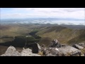
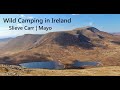
Videos


Recent Contributions
Get Notifications

Crocknapeast: Long walk up windfarm roads.

Double bag mostly on windfarm tracks.

Mulnanaff: Longish walk up windfarm road.

Good, relatively easy double bag

Binbane NE Top: Simple bag from its neighbouring top.

Binbane: Steepish approach to relatively easy Carn.

Lake District: Dale Head Horseshoe

Crucknaree: Magnificent views!

Lake District: Coledale Horseshoe

Dunranhill: Sika deer and sitka spruce

Crocknasharragh: Impressive views on initial ascent.

Longish walk to isolated top

Conditions and Info
Use of MountainViews is governed by conditions and a privacy policy.
Read general information about the site.
Opinions in material here are not necessarily endorsed by MountainViews.
Hillwalking is a risk sport. Information in comments, walks, shared GPS tracks or about starting places may not be accurate for example as regards safety or access permission. You are responsible for your safety and your permission to walk.
See the credits and list definitions.
Video display
Nephin Begs Area   Cen: Glennamong Subarea
Place count in area: 28, OSI/LPS Maps: 22, 23, 30, 31, CBW, EW-ACC, EW-WNN, EW-WNS 
Highest place:
Slieve Carr, 721m
Maximum height for area: 721 metres,     Maximum prominence for area: 646 metres,

Note: this list of places includes island features such as summits, but not islands as such.
Rating graphic.
Glennamong Mountain Barr Ghleann na Monga A name in Irish, also Mamer Dougher, also Curranyarry an extra EastWest name in English Mayo County in Connacht Province, in Arderin, Vandeleur-Lynam, Irish Best Hundred Lists, Psammitic schists, quartzites Bedrock

Height: 628m OS 1:50k Mapsheet: 23/30 Grid Reference: F91309 05874
Place visited by 122 members. Recently by: rhw, srr45, Carolyn105, ToughSoles, muddypaws, abeach, Krzysztof_K, Wes, mrfleetfoot, johncusack, shnackbox, a3642278, eoghancarton, elizauna, ryanguinness10
I have visited this place: NO (You need to be a logged-in member to change this.)

Longitude: -9.658453, Latitude: 53.990776 , Easting: 91309, Northing: 305874 Prominence: 139m,  Isolation: 1.4km
ITM: 491245 805887,   GPS IDs, 6 char: Glnmng, 10 char: Glennamong
Bedrock type: Psammitic schists, quartzites, (Anaffrin Formation)

The name makes no sense as applied to a summit. However, nearby is the Glennamong River, S.E. of the summit, flowing into L. Feeagh, so Glennamong is clearly the valley through which the river flows. OSNB mentions it only as a townland name, not that of a peak, so the error may have arisen at the stage of printing the 6 map. Walks: for a route taking in Bengorm, Corranabinnia and Glennamong, see Whilde & Simms, New Irish Walk Guide - West and North, 72-73.   Glennamong is the 243rd highest place in Ireland.

Linkback: https://mountainviews.ie/summit/232/
COMMENTS for Glennamong (Barr Ghleann na Monga) 1 2 Next page >>  
Follow this place's comments
MountainViews.ie Picture about mountain Glennamong (<i>Barr Ghleann na Monga</i>) in area Nephin Begs, Ireland
 
Nephin Begs - a serious hiking challenge!
by bryanmccabe  10 May 2010
Another of those peaks with an alluring name! Started the hike at the carpark at F 968 056 starA beside the Brogan Carroll Bothy shown in gerrym's photo, followed the Bangor Trail to the bridge crossing the river at F 948 065 starB before heading roughly in a straight line to the spot height 384 on the ridge which curves towards Glennamong. The final climb from just west of Glennamong East top (spot height 415) to Glennamong itself is initially steep before levelling off. The highest point is not at the cairn but a little further north. We continued to take in Nephin Beg; 3 OS maps were actually required for this hike! Our descent to the Bangor Trail followed the broad ridge running roughly NE; we took a line towards the little lake just south of spot height 256. Care should be taken of the steep gradients to the left in poor visibility. The loss in height is considerable (470m approx), all of which needed to be regained as Nephin Beg and Glennamong have virtually the same elevation.
The photo is taken from near the summit of Glennamong looking into the west Mayo wilderness. Croaghaun and Slievemore on Achill Island are visible in the centre of the picture. The Icelandic ash plume that has been wreaking havoc with flight schedules was also very visible to the west and north. Also prominent from the summit were Benbulbin and the Bluestacks. The whole hike took over 8 hours and was a big effort to bag just two Vandaleur-Lynams; consistent with comments from ahendroff and others that this mountain range is probably the most remote in Ireland. This also served as a reconnaissance trip to have a look at Slieve Carr (the most remote of the Nephin Begs) - I think I'll be bringing the mountain bike for the Western Way as well as the hiking boots!! Linkback: https://mountainviews.ie/summit/232/comment/4694/
Your Score: Very useful <<  >>Average
 
MountainViews.ie Picture about mountain Glennamong (<i>Barr Ghleann na Monga</i>) in area Nephin Begs, Ireland
Picture: View from the summit
Remote and stunning
by Colin Murphy  29 May 2012
These mountains are among the most remote in Ireland and Glennamong is a long haul no matter which approach you choose to take. The shortest and possibly easiest route is probably from the east along the Bangor Trail, parking at 974 054 starC, taking the track on the west of the road that joins with the Western Way, which eventually forks into the Bangor Trail. Follow this NW for about 6km to point 935 074 starD then SW up the gently rising slope for a further 3km. From the summit (marked by a triangular stone and not the cairn nearby) a vast plain extends to the west and north affording amazing views all the way to the western tip of Achill Island. The views to the south and east are equally impressive. It's a long haul, but on a fine day, well worth the effort. Linkback: https://mountainviews.ie/summit/232/comment/6832/
Your Score: Very useful <<  >>Average
 
MountainViews.ie Picture about mountain Glennamong (<i>Barr Ghleann na Monga</i>) in area Nephin Begs, Ireland
Picture: Looking back towards Corranabinnia
 
Looking back towards Corranabinnia
by Colin Murphy  29 May 2012
Whatever way you look, the landscape is stunning. Linkback: https://mountainviews.ie/summit/232/comment/6833/
Your Score: Very useful <<  >>Average
 
MountainViews.ie Picture about mountain Glennamong (<i>Barr Ghleann na Monga</i>) in area Nephin Begs, Ireland
Picture: eastern corrie
gerrym on Glennamong, 2005
by gerrym  27 Aug 2005
(part 2). The ridge climbs up to point 415 which is quite rocky and gave good views across the Bawinduff River valley to the montsrous looking hills of Nephin Beg and Glencar, the tops of which were obscured by cloud but the lower slopes dappled with sunlight. The remainder of this walk was also laid out to the S towards Corranabinnia and the ridge leading to Ben Gorm. There is a drop down from point 415m to an area of peat hags where cross a fence at the thoughtfully piled stones and then start the climb to the summit. Encountered a fox here which kept close tabs on me as it climbed before eventually disappearing. As height is gained the views open out over the surrounding hills to Clew Bay to the S and the peat lowlands away to the N. The summit is a rocky area with a small cairn. It was windy, cold and misty here with little to see until dropped down slightly to the S - fantastic panoramas then opened out over the bogland to the Atlantic and Achill Island with the immediate bulk of Corranabinnia disappearing upward into the mist and down to the double corrie loughs on its NW flank. Cross an area of stone and eroded peat on the descent from the summit, keeping to the edge of the corrie in the pic, where there is a fairly well defined track. I was drawn towards a massive glacial boulder sitting in contrast to its surroundings before heading for the slight drop to the col with Corranabinnia. (see for next part of walk). Linkback: https://mountainviews.ie/summit/232/comment/1914/
Your Score: Very useful <<  >>Average
 
MountainViews.ie Picture about mountain Glennamong (<i>Barr Ghleann na Monga</i>) in area Nephin Begs, Ireland
 
simon3 on Glennamong, 2003
by simon3  30 Aug 2003
Glennamong forms the northerly summit of a horseshoe walk starting from NW of Lough Feagh. From it there are fine views in many directions. This picture shows Nephin on the skyline to the right of the cairn. To the right again is Birreencorragh, a convoluted mountain with a long central north south ridge and various smaller ridges leading off to West (Mount Eagle) and East (Knockaffertagh). Viewed from Glennamong, which is to its west, the profile of the central NS ridge is well displayed. Only just visible in the small version of this picture is Lough Conn, some 25k away.

The cairn shown here is perhaps 40m south of the summit. Linkback: https://mountainviews.ie/summit/232/comment/626/
Your Score: Very useful <<  >>Average
 
MountainViews.ie Picture about mountain Glennamong (<i>Barr Ghleann na Monga</i>) in area Nephin Begs, Ireland
Picture: Brogan Carroll Bothy
gerrym on Glennamong, 2005
by gerrym  27 Aug 2005
Travelled to the Nephin Begs after climbing Nephin earlier in the day - a drive through some great countryside and a rough forest road into Letterkeen Wood which cuts through the heart of the range.

There are ample parking opportunities in the wood with a hostel and laybys for picnics, I parked at one of these at roughly 975054 starE. There is a standing stone here with a plaque comemerating the contribution of locals who emigrated to America. I walked back up the track, turning left and following the signs for the Western Way and Bangor Trail. There were great views here W towards Buckoogh and Birreencorragh which were bathed in late evening sunshine, giving me some great pictures. Arrive at the bothy and detailed information boards for both of the waymarked trails. The bothy is sizeable inside and would provide decent if basic shelter for ther night. Continue along, crossing footbridge over the Altaconey River on the Bangor Way and passing an area next to the river used for camping, which I made use of the next day. The track is well worn and easy to follow alongside the river initially, with forest to the right. Gradual climb before a steeper section to a crest where take ridge off to the left which leads to the summit of Glennamong (eventually). It was getting pretty dark so I camped down for the night on the high ground here in heavy mist. Linkback: https://mountainviews.ie/summit/232/comment/1913/
Your Score: Very useful <<  >>Average
 
COMMENTS for Glennamong (Barr Ghleann na Monga) 1 2 Next page >>
(End of comment section for Glennamong (Barr Ghleann na Monga).)

OSi logo OSNI/LPS logo
Some mapping:
Open Street Map
(Various variations used.)
British summit data courtesy:
Database of British & Irish Hills
(Creative Commons Licence)
MountainViews.ie, a Hill-walking Website for the island of Ireland. 2400 Summiteers, 1480 Contributors, maintainer of lists: Arderins, Vandeleur-Lynams, Highest Hundred, County Highpoints etc