Guestuser: Login or enrol?
- Home
- Main Display
- Main Display (Old)
- Find a Walk
- Display INTRODUCTION
- DONATE
- Click below for your
profile & contributions
guestuser- New
- Tracks, Walks
- Challenge
- Community
- Lists & Logs
- Popular Lists:
- County Highpoints
- Range & Area Highpoints
- Local 100
- Highest Hundred
- Vandeleur-Lynams
- Arderins
- Carns
- Best rated
- Irish 900 up
- Irish Island
- Munros
- All Lists
- Shorter Irish
- County Highpoints
- Range & Area Highpoints
- Highest Hundred
- Local 100
- Local 100 (pre2014)
- Local Historical Cultural
- Best rated
- Irish 900 up
- Larger Irish
- Arderins
- Arderin Begs
- Arderins + Arderin Begs
- Vandeleur-Lynams
- Vandeleur-Lynams + Arderins
- Carns
- Binnions
- Highest 50 per Province
- Island Features
- Irish Island
- Coastal Hills
- Irish 600 up
- Irish 500 up
- British
- Munros
- British 600 up
- British 500-600
- British Marilyns
- Comprehensive
- All Irish summits
- All Irish features
- All British summits
- All Britain+ Ireland
- Special
- Analysis List
- Simple Irish Listings
- Simple Irish & British Listings
-
- More
- Motley Views
Welcome to MountainViews
If you want to use the website often please enrol (quick and free) at top right.OverviewFor more map options click on any overview map area or any detail map feature.Detail Map FeaturesShowing 8 items:
Mullaghaneany 627m, Meenard Mountain 620m, Oughtmore 569m, Spelhoagh 568m,Tracks:3161, 16km 2143, 13km 1398, 12km 1415, 7km Find Suggested Walks
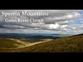
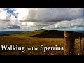
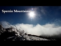
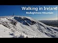
Find hill, mountain, island, coastal feature.Videos
Recent Contributions
 Get Notifications
Tods Knowe: Long and heather bash descent to summit
Broad Law: Do not approach on a misty day
Kilbrony Park Ramble
Broad Law: Straight forward track to the summit
East Cairn Hill: Two summits on this hill 500 metres apart
Knocknakilton & Cummeen, Dingle Penninsula
West Cairn Hill: Follow the wall
Cairnpapple Hill: Head for Ballinacrieff Hill
Croaghnageer and Croghanirwore
Crocknasleigh: short hill with long views
9 km walk around Mullaghmeen Woods April 2025
Knocknacloghoge: Knocknaclochoge in the early summer
Conditions and Info
Use of MountainViews is governed by conditions and a privacy policy.
Read general information about the site.
Opinions in material here are not necessarily endorsed by MountainViews.
Hillwalking is a risk sport. Information in comments, walks, shared GPS tracks or about starting places may not be accurate for example as regards safety or access permission. You are responsible for your safety and your permission to walk.
See the credits and list definitions.Video displaySperrin Mountains Area NE Cen: Glenelly North East SubareaPlace count in area: 64, OSI/LPS Maps: 12, 13, 6, 7, 8
Highest place: Sawel, 678m
Maximum height for area: 678 metres, Maximum prominence for area: 657 metres,
Places in area Sperrin Mountains:
E: Magherafelt Hills:Slieve Gallion NE Top 493.6m
E: Magherafelt Hills:Slieve Gallion 526.6m
N: Claudy Hills:Crockdooish 321mCurradrolan Hill 270mEglish 277mLetterlogher 249mMullaghmeash Hill 244mSlieveboy 259mStraid Hill 303m
NE Cen: Glenelly North East:Barnes Top 456mCraigagh Hill 460mCrockbrack 526.1mKnockanbane Mountain 441mMeenard Mountain 620mMeenard Mtn W Top 480mMullaghaneany 627mMullaghash 480mMullaghsallagh 485mOughtmore 569mSpelhoagh 568m
NE: Glenshane North:Benbradagh 465mBoviel Top 454mCarn Hill 448mCarntogher 464mMoneyoran Hill 414m
NE: Glenshane South:Bohilbreaga 478mCoolnasillagh Mountain 423mCorick Mountain 430mCrockalougha 407mMullaghmore 550mWhite Mountain 537m
NW Cen: Glenelly North West:Dart Mountain 619mDart Mountain North-West Top 525mLearmount Mountain 489mLearmount Mountain South Top 492mMullaghasturrakeen 581mMullaghcarbatagh 517mMullaghclogha 635mMullaghclogher 572mMullaghdoo 568mSawel 678m
NW: Maheramason Hills:Clondermot Hill 220mGortmonly Hill 218mSlievekirk 370m
SE Cen: Glenelly South East:Carnanelly 562mCarnanelly West Top 503.4mMullaghbane 467mMullaghturk 416m
SE: Cookstown Hills:Cregganconroe 300mFir Mountain 362mOughtmore 382m
SW Cen: Glenelly South West:Clogherny Top 408mCraignamaddy 385mCrocknamoghil 335mMullaghbolig 442mSpaltindoagh 420m
SW: Mullaghcarn:Curraghchosaly Mountain 416mMullaghcarn 542mMullaghcarn South Top 525m
SW: Newtownstewart Hills:Bessy Bell 420mMullaghcroy 242m
W: Strabane:Balix Hill 403mKnockavoe 296mOwenreagh Hill 400m
Note: this list of places includes island features such as summits, but not islands as such.
(Ir. poss. Mullach an Ionaidh [DUPN†], 'summit of the wonder') Derry/ Tyrone County in NI and in Ulster Province, in Arderin, Vandeleur-Lynam Lists, Psammite & semipellite Bedrock
Height: 627m OS 1:50k Mapsheet: 13 Grid Reference: H68523 98619
Place visited by 181 members. Recently by: SeanPurcell, therealcrow, nupat, NualaB, orlaithfitz, bowler, Aidan_Ennis, discovering_dann, rhw, Prem, Bob-the-juggler, ToughSoles, Tricia-Mulligan, Lgr, MickM45I have visited this place: NO (You need to be a logged-in member to change this.)Longitude: -6.934824, Latitude: 54.830559 , Easting: 268523, Northing: 398619 Prominence: 302m, Isolation: 1.2km
ITM: 668438 898595 , GPS IDs, 6 char: Mlghnn, 10 char: Mlghnny
Bedrock type: Psammite & semipellite, (Dart Formation)
The OS Memoirs give two local versions of the name but state that the meaning is not understood. Mullaghaneany is the third highest mountain in the Sperrin Mountains area and the 247th highest in Ireland. Mullaghaneany is the second highest point in county Derry and also the third highest in Tyrone.
Linkback: https://mountainviews.ie/summit/234/COMMENTS for Mullaghaneany (Mullach an Ionaidh) 1 of 1  Follow this place's comments
 Height layer: © MapTiler

MountainViews.ie, a Hill-walking Website for the island of Ireland. 2500 Summiteers, 1480 Contributors, maintainer of lists such as: Arderins, Vandeleur-Lynams, Highest Hundred, County Highpoints etc

 Fergalh
 Fergalh
 Fergalh
 Fergalh
 Fergalh
 Fergalh
 Peter Walker
 Collaborative entry
 ceadeile
 glencree
 Visit our Facebook page.