Cookies.
This website uses cookies, which are small text files that the website puts on your device to facilitate operation. Cookies help us provide a better service to you. They are used to track general user traffic information and to help the website function properly.
Features
Nearby features appear when you click the map.
Declutter tracks on map.
Place Search
Video
X
Pub: by
Sperrin Mountains Area , NE: Glenshane South Subarea
Feature count in area: 64, by county: Derry: 34, Tyrone: 39, of which 9 are in both Derry and Tyrone, OSI/LPS Maps: 12, 13, 6, 7, 8
Highest Place: Sawel 678m

Starting Places (21) in area Sperrin Mountains:
Altinure Road, Banagher Glen Nature Reserve, Barnes Gap Car Park, Crocknakin, Drumnaspar Picnic CP, Glenchiel Road, Glenedra Bridge, Glenelly Road, Parkreagh, Goles Road, Lough Ouske, Moneyneany Village, Moydamlaght Forest, Moydamlaght Road, Mullaghmore, Mullaghbane, Spaltindoagh, Sperrin Hamlet, Sperrin Heritage Centre, Sperrin Heritage Centre W, Sperrin Road, Barnes Top, Sperrin Road, Glashagh Bridge, Sperrin Road, Sperrin

Summits & other features in area Sperrin Mountains:
E: Magherafelt Hills: Slieve Gallion NE Top 493.6m
E: Magherafelt Hills: Slieve Gallion 526.6m
N: Claudy Hills: Crockdooish 321m, Curradrolan Hill 270m, Eglish 277m, Letterlogher 249m, Mullaghmeash Hill 244m, Slieveboy 259m, Straid Hill 303m
NE Cen: Glenelly North East: Barnes Top 456m, Craigagh Hill 460m, Crockbrack 526.1m, Knockanbane Mountain 441m, Meenard Mountain 620m, Meenard Mtn W Top 480m, Mullaghaneany 627m, Mullaghash 480m, Mullaghsallagh 485m, Oughtmore 569m, Spelhoagh 568m
NE: Glenshane North: Benbradagh 465m, Boviel Top 454m, Carn Hill 448m, Carntogher 464m, Moneyoran Hill 414m
NE: Glenshane South: Bohilbreaga 478m, Coolnasillagh Mountain 423m, Corick Mountain 430m, Crockalougha 407m, Mullaghmore 550m, White Mountain 537m
NW Cen: Glenelly North West: Dart Mountain 619m, Dart Mountain North-West Top 525m, Learmount Mountain 489m, Learmount Mountain South Top 492m, Mullaghasturrakeen 581m, Mullaghcarbatagh 517m, Mullaghclogha 635m, Mullaghclogher 572m, Mullaghdoo 568m, Sawel 678m
NW: Maheramason Hills: Clondermot Hill 220m, Gortmonly Hill 218m, Slievekirk 370m
SE Cen: Glenelly South East: Carnanelly 562m, Carnanelly West Top 503.4m, Mullaghbane 467m, Mullaghturk 416m
SE: Cookstown Hills: Cregganconroe 300m, Fir Mountain 362m, Oughtmore 382m
SW Cen: Glenelly South West: Clogherny Top 408m, Craignamaddy 385m, Crocknamoghil 335m, Mullaghbolig 442m, Spaltindoagh 420m
SW: Mullaghcarn: Curraghchosaly Mountain 416m, Mullaghcarn 542m, Mullaghcarn South Top 525m
SW: Newtownstewart Hills: Bessy Bell 420m, Mullaghcroy 242m
W: Strabane: Balix Hill 403m, Knockavoe 296m, Owenreagh Hill 400m

Note: this list of places may include island features such as summits, but not islands as such.
Rating graphic.
Crockalougha, 407m Hill Cnoc an Locha A name in Irish,
Place Rating ..
(prob. Ir. Cnoc an Locha [PDT], 'hill of the lake'), Derry County in Ulster province, in Carn Lists, Crockalougha is the 913th highest place in Ireland.
Grid Reference C71553 01141, OS 1:50k mapsheet 8
Place visited by: 33 members, recently by: Tricia-Mulligan, Paddym99, garybuz, Sperrinwalker, wintersmick, Colin Murphy, Kilcoobin, Hoverla, trostanite, eamonoc, Wilderness, Fergalh, pearnett, LorraineG60, MichaelG55
I visited this place: NO (You need to be a logged-in member for this.)
Longitude: -6.886763, Latitude: 54.8529, Easting: 271553, Northing: 401141, Prominence: 73m,  Isolation: 2.3km
ITM: 671486 901129
Bedrock type: Psammite & semipellite, (Dart Formation)

  Short or GPS IDs, 6 char: Crcklg, 10 char: Crcklgh

Linkback: https://mountainviews.ie/summit/797/
Gallery for Crockalougha (Cnoc an Locha) and surrounds
Summary for Crockalougha (Cnoc an Locha): Dull summit, limited views.
Summary created by Colin Murphy 2021-10-26 15:16:37
            MountainViews.ie picture about Crockalougha (<em>Cnoc an Locha</em>)
Picture: A lovely sunset on an unlovely hill.
Parking for multiple cars across the road from A (H72550 99700). Follow the meandering track north to point B (C72207 00786). Keep an eye out for a straight, grassy line running NW towards the summit. This will help you avoid about 500m of heather-trudging. When this ends head directly up the remainder of the slop through knee-deep heather and uneven ground. The summit is a flat area, unmarked by anything other than a fence, with views limited by trees to the south.
Linkback: mountainviews.ie/summit/797/comment/5556/
Member Comments for Crockalougha (Cnoc an Locha)
Comment create / edit display placeholder

            MountainViews.ie picture about Crockalougha (<em>Cnoc an Locha</em>)
Picture: Walker on way down from Crockalougha
Crockalougha
by Harry Goodman 26 Oct 2021
As I was in the area on 13 April to climb a couple of other hills and was passing Crockalougha,the last remaining top on my Local 100 List, I took trhe opportunity to climb it. I parked at the large cleared area off the B40 A (H72550 99700), mentioned by dr_banuska and found it an excellent starting point for the walk. I took the good track directly across the road going NNE in the direction of Crockalougha. This path winds its way very gently across the hillside to peter out near some turf cuttings B (C72207 00786) in an area known as Altdoo or Black Glen. While the track is not marked on the OS 50,000 Sheet 8 it is clearly shown on the Sperrins Activity Map 1:25,000 Series a map that is invaluable for anyone wanting to plan routes in this area. From the turf cuttings I headed NW up the gentle heathery slope to the top of the hill, with frequent ups and downs and in and out through peat hags. As often is the case in the Sperrins the top is a large fairly flat area with, in my view, the high point C (C71565 01164) just before a fence running from E to W and then S along the forest edge. However to be sure of standing on the higest point one can quite easily tramp around the various competing clumps of heather! Like dr_banuska I also came across the small cement marker stone but am unsure of its purpose. As the Tyrone/ Derry County boundry line does not pass over this hill it must serve as a marker for some other purpose. Views N, E and W are restricted but the aspect to the S is much more open with the distant Belfast Hills clearly visable along with a number of Sperrin Tops. When there I also noticed a tiny lough to the NE down the slope by the forest edge but in the interests of time did not visit it. For a little variety, rather than totally retrace by steps, I decided to go SE directly down to my start point meeting the track taken on by outward route at D (C72246 00220) and followed it out to the road. An excellent short walk of some 4k that can be taken as a stopping off point on the way to visit other Sperrins Tops and comfortably coverd in about an hour. Linkback: mountainviews.ie/summit/797/comment/4633/
Read Less
Read More

thisbliss on Crockalougha
by thisbliss 14 Sep 2007
As the OS map suggests, this mountain is covered on almost 3 sides by forest, but decided to climb it anyway. Parked at forest track entrance out the moneyneena-dungiven road (E (C726 022)) Walked down the track into the altnaheglish valley which leads onto a good walk round banagher dam. The forest round this part has been harvested in the last year or so. Where the track does a u-turn, following the river, i continued on almost straight in the direction of crockalougha. Getting up the initial bank after crossing the river is no slouch of a job. A stick being a must which are handy to come by thanks to the remains of the deforestation. Once into the woods i just blindly headed off in the general direction knowing as long as i veered left i would come out in the clearing. As it happened i pretty much came out bang on top of crockalougha. The view is kind of limited at the top, (although mullaghmore, lough neagh and sl gallion do suffice!), but i really enjoyed the walk up as it combined the climb with also the eerie silence and isolation of walking through the woods, something about that feeling of raw nature i guess. Any-who, had lunch at the top and then followed the edge of the forest to (F (C723 014)) where there was a small lake not marked on the map but have noticed from mullaghmore before. After that found the source of the altnaheglish river and followed it back to where i left the forest track. As i said enjoyed the walk loads, took about an hour all in, and also managed to get loads of dried free wood for camp fire that night - nice! Linkback: mountainviews.ie/summit/797/comment/2833/
Read Less
Read More

            MountainViews.ie picture about Crockalougha (<em>Cnoc an Locha</em>)
Picture: Crockalougha summit, with Mullaghmore left and Slieve Gallion beyond, right
dr_banuska on Crockalougha
by dr_banuska 30 Mar 2010
PART 1: I'd already climbed most of the higher surrounding hills so rather than do a trip just for this one, I made it more interesting by including it in a lengthy circuit of the huge expanse of Banagher Forest, taking in the well-known dam and Altnaheglish Reservoir.

Unlike thisbliss, I approached from the south. Travelling from Draperstown/Moneyneany, I took the B40 towards Feeny and shortly after reaching the crest of the hill, turned into a large cleared area on the left which had some rubbish dumped in it. There was a good deal of broken glass in one part but I steered clear and didn't have any problems. It's literally just across the road from the good track that runs up Crockalougha, at 
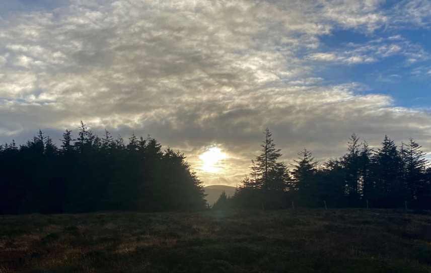
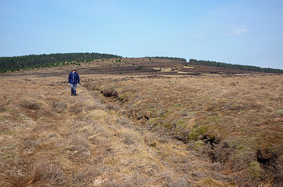
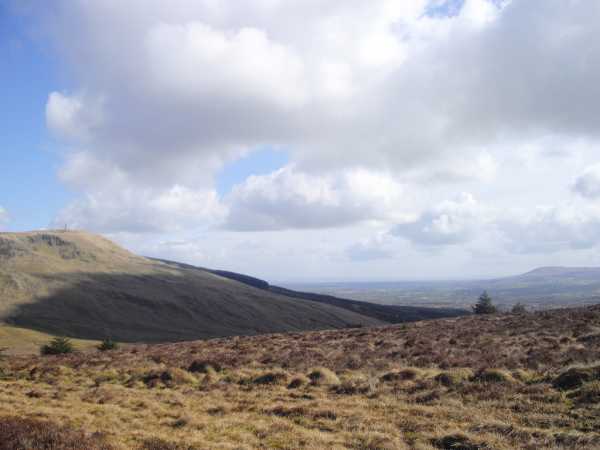
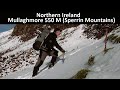
G (H726 997). I crossed the road and headed uphill via the track. Just before this petered out, I veered off and headed onto open hillside. This started off very easygoing but got more tussocky and uneven as I approached the summit. As thisbliss says, the summit area is largely surrounded by the forest, limiting views. However, I could see Mullaghmore to the E, Slieve Gallion to the SE and between them, Lough Neagh and the Belfast Hills beyond, plus part of the main Sperrins chain to the S. There was a L'derry Corporation boundary stone close to the summit, which I had also seen on some of those neighbouring hills.

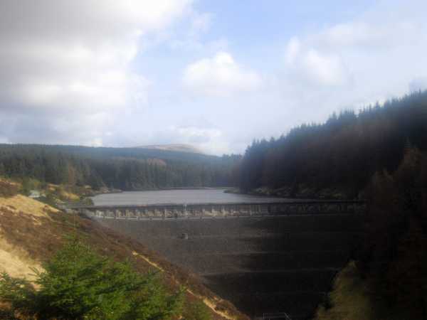
I then headed downhill a little, crossed the fence and entered the forest at an obvious firebreak I'd spotted just a few mins earlier on the way up. I have the 1:25 Activity map which very helpfully shows all the lines of clearing in the forest, and using this I was able to navigate N towards the Altnaheglish River. I emerged from the forest, quite unexpectedly, on a height overlooking the reservoir with Altahullion Windfarm far beyond - quite a sight. I carefully made my way downhill towards the river and the track which runs along its far side, crossing the tiny river and reaching the track about H (C714 024). I then followed the track W along the river, ignoring another track going off to the left, and followed it around as it hugged the eastern side of the reservoir. You gain in height so there are fantastic views across the reservoir, which is much larger than you might think. Finally I came to Banagher Dam and had a look around before having a quick lunch. Continued below. Linkback: mountainviews.ie/summit/797/comment/4555/
Read Less
Read More

            MountainViews.ie picture about Crockalougha (<em>Cnoc an Locha</em>)
Picture: Banagher Dam & Altnaheglish Reservoir surrounded by Banagher Forest
dr_banuska on Crockalougha
by dr_banuska 30 Mar 2010
PART 2: I then continued W along the track through the pretty Banagher Glen, the track once again closely following the Altnaheglish River down below. It may be possible to upslope again onto Streeve Mtn (390m) then down through the forest again to the other side, but seeing as I had the dog with me it didn't seem worth the hassle as I could see there were fences to negotiate.

After some time the track crosses the river again, and then shortly afterwards the Glenadra River, with a waterfall on your left at I (C674 043). There's an Environment Agency board telling how when St. Patrick banished the snakes from Ireland, one particularly large one escaped and may still be living in the deep pool below! Just after the waterfall, a track joins from your left. I followed this track uphill along the Glenadra River, ignoring a turn-off to the left after a short distance. Further on, you cross the river and the track forks again, I took the right fork which continues to closely follow the river. You're almost level with it now and this is a very pretty part of the walk. After a while you pass a small water treatment plant and then shortly after, the track ends at the water's edge where there seem to be the remains of a stone bridge (the map shows the track crossing the river) at J (C692 018). I crossed here as it's very shallow, though I did get a little wet - might be slightly better upstream a short distance. From here it's a short distance back to the main road at K (C701 007), close to the entrance to Altbritain Forest on the other side of the road. From here it was about 20 mins' brisk walk back to the car.

It'd be possible to park at Altbritain or elsewhere along the circuit - even the main parking facility for the dam on the Dungiven side (though I think this is only open in summer months). Besides the broken glass, my choice was situated close to a blind corner, so not ideal. In any case, I would highly recommend this route, or a variation on it, if you have a number of hours to spare. Apart from the initial slog uphill towards the summit (almost forgot about poor Crockalougha), you're mostly pretty level and on good tracks. It was definitely one of my more memorable Sperrins expeditions, with the views and the varied terrain. It's probably best if you have the 1:25 map, though. Linkback: mountainviews.ie/summit/797/comment/4556/
Read Less
Read More
EDIT Point of Interest
text
Videos


Recent Contributions
x
Conditions and Info
Use of MountainViews is governed by conditions and a privacy policy.
Read general information about the site.
Opinions in material here are not necessarily endorsed by MountainViews.
Hillwalking is a risk sport. Information in comments, walks, shared GPS tracks or about starting places may not be accurate for example as regards safety or access permission. You are responsible for your safety and your permission to walk.
See the credits and list definitions.

OSi logo
OSNI/LPS logo
Open Street Map
(Various variations used.)
British summit data courtesy:
Database of British & Irish Hills