This website uses cookies, which are small text files that the website puts on your device to facilitate operation. Cookies help us provide a better service to you. They are used to track general user traffic information and to help the website function properly.
Sperrin MountainsArea, NE: Glenshane South
Subarea
Feature count in area: 64, by county: Derry: 34, Tyrone: 39, of which 9 are in both Derry and Tyrone,
OSI/LPS Maps: 12, 13, 6, 7, 8
Highest Place: Sawel 678m
Starting Places (21) in area Sperrin Mountains: Altinure Road, Banagher Glen Nature Reserve, Barnes Gap Car Park, Crocknakin, Drumnaspar Picnic CP, Glenchiel Road, Glenedra Bridge, Glenelly Road, Parkreagh, Goles Road, Lough Ouske, Moneyneany Village, Moydamlaght Forest, Moydamlaght Road, Mullaghmore, Mullaghbane, Spaltindoagh, Sperrin Hamlet, Sperrin Heritage Centre, Sperrin Heritage Centre W, Sperrin Road, Barnes Top, Sperrin Road, Glashagh Bridge, Sperrin Road, Sperrin
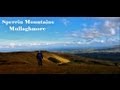
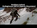
Summits & other features in area Sperrin Mountains: E: Magherafelt Hills: Slieve Gallion NE Top 493.6m E: Magherafelt Hills: Slieve Gallion 526.6m N: Claudy Hills: Crockdooish 321m, Curradrolan Hill 270m, Eglish 277m, Letterlogher 249m, Mullaghmeash Hill 244m, Slieveboy 259m, Straid Hill 303m NE Cen: Glenelly North East: Barnes Top 456m, Craigagh Hill 460m, Crockbrack 526.1m, Knockanbane Mountain 441m, Meenard Mountain 620m, Meenard Mtn W Top 480m, Mullaghaneany 627m, Mullaghash 480m, Mullaghsallagh 485m, Oughtmore 569m, Spelhoagh 568m NE: Glenshane North: Benbradagh 465m, Boviel Top 454m, Carn Hill 448m, Carntogher 464m, Moneyoran Hill 414m NE: Glenshane South: Bohilbreaga 478m, Coolnasillagh Mountain 423m, Corick Mountain 430m, Crockalougha 407m, Mullaghmore 550m, White Mountain 537m NW Cen: Glenelly North West: Dart Mountain 619m, Dart Mountain North-West Top 525m, Learmount Mountain 489m, Learmount Mountain South Top 492m, Mullaghasturrakeen 581m, Mullaghcarbatagh 517m, Mullaghclogha 635m, Mullaghclogher 572m, Mullaghdoo 568m, Sawel 678m NW: Maheramason Hills: Clondermot Hill 220m, Gortmonly Hill 218m, Slievekirk 370m SE Cen: Glenelly South East: Carnanelly 562m, Carnanelly West Top 503.4m, Mullaghbane 467m, Mullaghturk 416m SE: Cookstown Hills: Cregganconroe 300m, Fir Mountain 362m, Oughtmore 382m SW Cen: Glenelly South West: Clogherny Top 408m, Craignamaddy 385m, Crocknamoghil 335m, Mullaghbolig 442m, Spaltindoagh 420m SW: Mullaghcarn: Curraghchosaly Mountain 416m, Mullaghcarn 542m, Mullaghcarn South Top 525m SW: Newtownstewart Hills: Bessy Bell 420m, Mullaghcroy 242m W: Strabane: Balix Hill 403m, Knockavoe 296m, Owenreagh Hill 400m
Note: this list of places may include island features such as summits, but not
islands as such.
Bohilbreaga, 478mHill Buachaill Bréige A name in Irish,
Place Rating ..
(prob. Ir. Buachaill Bréige [PDT], 'false shepherd' (a cairn or rock resembling human figure), Derry County in Ulster province, in Carn Lists, Bohilbreaga is the 639th highest place in Ireland.
Grid Reference C75955 00211,
OS 1:50k mapsheet 8 Place visited by: 49members, recently by: Tricia-Mulligan, Colin Murphy, ElaineM76, Paddym99, Sperrinwalker, garybuz, wintersmick, Kilcoobin, bogmanpol, tinycoyle, eamonoc, David-Guenot, Fergalh, trostanite, LorraineG60
I visited this place: NO (You need to be a logged-in member for this.)
Short or GPS IDs, 6 char: Bhlbrg, 10 char: Bhlbrg Linkback: https://mountainviews.ie/summit/523/
Gallery for Bohilbreaga (Buachaill Bréige) and surrounds
Summary
for Bohilbreaga (Buachaill Bréige):
Flat boggy top with interesting views.
Summary created by Colin Murphy, simon3
2023-04-24 15:54:01
Picture: Small crag around 900m SW of top.
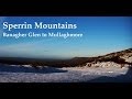
An easy inclusion if you are visiting Mullaghmore. This top can be reached from the forest entrance and parking at around Moydamlaght Forest (H7407 9865). Using the Waymarked Way, exit the forest at around A (H7494 9929) and head NE for the top, 1.3k NE. There are a few gullies, tracks and minor crags en route.
The plain, boggy summit is unmarked by any cairn, however it has an interesting view over Tyrone and mid-Ulster.
It is also possible to approach this hill from the east via Coolnasillagh - see Track 4862.
Picture: Pretty uninspiring approach to the summit.
From Glenshane Forest
by dino
28 Mar 2014
One of the strangest little hills I've climbed! I came from the North having parked at a forest gate on the A6 Glenshane Road and walked in through Glenshane Forest. The approach from the little grotto at the edge of the forest is barely visible but has a couple of simple signposts. The ground above the forest is very wet and boggy and there is extensive evidence of peat harvesting operations. The top has great views in all directions but it's hard to identify. I plumped in the end for the lone post standing forlornly on the edge of a peat hag. This top was completed as part of a 20km circuit which I will upload as a route. Linkback: mountainviews.ie/summit/523/comment/15946/
Read Less
Read More
Picture: An Buachail Breaga
The Lying Boy & The Priests Chair
by sperrinlad
30 May 2016
walked this from irelands highest pub (ponderosa) on the Glensahne pass. we walked down the road to the entrance to the Glenshane forest, and followed the track though the forest until we reached the Grotto where you can find an old 17th century mass rock known as 'the priests chair' where we stopped to take in the history. from here we made our way towards the highest part of the forest behind the grotto and crossed the fence at the corner.
from here there is several boggy areas before reaching the summit of Bohilbreaga, with amazing view across midulster and the sperrins you could see as far as the black mountains in belfast.
**Bohilbreaga from the irish 'an buachail Breaga' meaning 'the lying boy' a reference to the lookout for the pilgrims who were saying mass at the priests chair below the summit during the penal era in Ireland. the story says how the young boy was caught by soldiers on the hunt for the priest and saved their lives by lying to them about their whereabouts. Linkback: mountainviews.ie/summit/523/comment/18551/
Use of MountainViews is governed by conditions and a privacy policy.
Read general information about the site. Opinions in material here are not necessarily endorsed by MountainViews.
Hillwalking is a risk sport. Information in comments, walks, shared GPS tracks or about starting places may
not be accurate for example as regards safety or access permission. You are responsible for your safety and your permission to walk.
See the credits and list definitions.


 Our Facebook page.