This website uses cookies, which are small text files that the website puts on your device to facilitate operation. Cookies help us provide a better service to you. They are used to track general user traffic information and to help the website function properly.
Sperrin MountainsArea, NE Cen: Glenelly North East
Subarea
Feature count in area: 64, by county: Derry: 34, Tyrone: 39, of which 9 are in both Derry and Tyrone,
OSI/LPS Maps: 12, 13, 6, 7, 8
Highest Place: Sawel 678m
Starting Places (21) in area Sperrin Mountains: Altinure Road, Banagher Glen Nature Reserve, Barnes Gap Car Park, Crocknakin, Drumnaspar Picnic CP, Glenchiel Road, Glenedra Bridge, Glenelly Road, Parkreagh, Goles Road, Lough Ouske, Moneyneany Village, Moydamlaght Forest, Moydamlaght Road, Mullaghmore, Mullaghbane, Spaltindoagh, Sperrin Hamlet, Sperrin Heritage Centre, Sperrin Heritage Centre W, Sperrin Road, Barnes Top, Sperrin Road, Glashagh Bridge, Sperrin Road, Sperrin
Summits & other features in area Sperrin Mountains: E: Magherafelt Hills: Slieve Gallion NE Top 493.6m E: Magherafelt Hills: Slieve Gallion 526.6m N: Claudy Hills: Crockdooish 321m, Curradrolan Hill 270m, Eglish 277m, Letterlogher 249m, Mullaghmeash Hill 244m, Slieveboy 259m, Straid Hill 303m NE Cen: Glenelly North East: Barnes Top 456m, Craigagh Hill 460m, Crockbrack 526.1m, Knockanbane Mountain 441m, Meenard Mountain 620m, Meenard Mtn W Top 480m, Mullaghaneany 627m, Mullaghash 480m, Mullaghsallagh 485m, Oughtmore 569m, Spelhoagh 568m NE: Glenshane North: Benbradagh 465m, Boviel Top 454m, Carn Hill 448m, Carntogher 464m, Moneyoran Hill 414m NE: Glenshane South: Bohilbreaga 478m, Coolnasillagh Mountain 423m, Corick Mountain 430m, Crockalougha 407m, Mullaghmore 550m, White Mountain 537m NW Cen: Glenelly North West: Dart Mountain 619m, Dart Mountain North-West Top 525m, Learmount Mountain 489m, Learmount Mountain South Top 492m, Mullaghasturrakeen 581m, Mullaghcarbatagh 517m, Mullaghclogha 635m, Mullaghclogher 572m, Mullaghdoo 568m, Sawel 678m NW: Maheramason Hills: Clondermot Hill 220m, Gortmonly Hill 218m, Slievekirk 370m SE Cen: Glenelly South East: Carnanelly 562m, Carnanelly West Top 503.4m, Mullaghbane 467m, Mullaghturk 416m SE: Cookstown Hills: Cregganconroe 300m, Fir Mountain 362m, Oughtmore 382m SW Cen: Glenelly South West: Clogherny Top 408m, Craignamaddy 385m, Crocknamoghil 335m, Mullaghbolig 442m, Spaltindoagh 420m SW: Mullaghcarn: Curraghchosaly Mountain 416m, Mullaghcarn 542m, Mullaghcarn South Top 525m SW: Newtownstewart Hills: Bessy Bell 420m, Mullaghcroy 242m W: Strabane: Balix Hill 403m, Knockavoe 296m, Owenreagh Hill 400m
Note: this list of places may include island features such as summits, but not
islands as such.
Craigagh Hill, 460mHill Creigeach A name in Irish,
Place Rating ..
, Derry County in Ulster province, in Carn Lists, Craigagh Hill is the 696th highest place in Ireland.
Grid Reference H71712 98784,
OS 1:50k mapsheet 13 Place visited by: 57members, recently by: Tricia-Mulligan, Paddym99, Sperrinwalker, garybuz, Carolyn105, annem, dodser, Colin Murphy, wintersmick, Kilcoobin, pmeldrum, IndyMan, dregish, wicklore, ilenia
I visited this place: NO (You need to be a logged-in member for this.)
Longitude: -6.884951, Latitude: 54.831674, Easting: 271712, Northing: 398784,
Prominence: 35m, Isolation: 1.3km ITM: 671640 898769 Bedrock type: Psammite & semipellite, (Glenelly Formation) Notes on name: Name explained as rocky hill in OSRNB
Short or GPS IDs, 6 char: Crg460, 10 char: CrgghHil Linkback: https://mountainviews.ie/summit/586/
Gallery for Craigagh Hill (Creigeach) and surrounds
Summary
for Craigagh Hill (Creigeach):
Last of the line
Summary created by simon3, march-fixer
2012-10-01 17:09:11
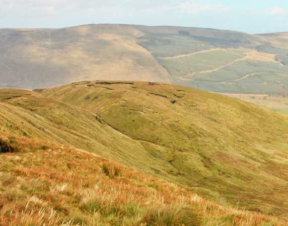
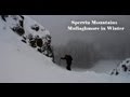
Picture: Craigagh mid ground, Mullaghmore on the skyline.
Separated from Oughtmore and Spot Height 568 by a small steep col it looks down over the B40 road and over to Crockalougha. The summit is in reasonable danger of being harvested for peat!
Access it from the B40 at around A (H718 997) by way of a reasonable track virtually all the way to the summit. There is extensive peat cutting all down the north flank.
There is a very picturesque little lake hidden in the col, just west of the summit, which would make a lovely summer resting place, providing the wind was not too strong through the gap!
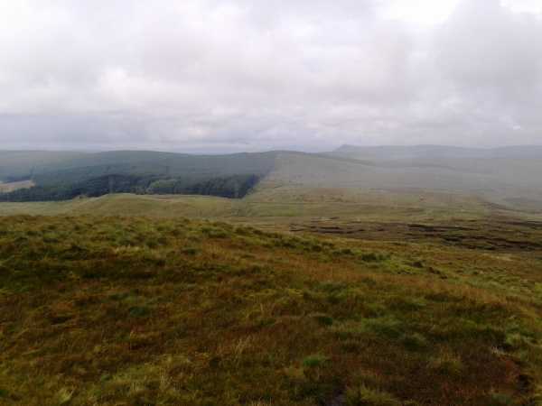
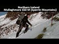
Picture: Looking north from the summit of Craigagh Hill to Crockalougha
hidden among higher summits
by slemish
24 Aug 2012
It is very rare these days to come across a summit on MV that has no comments, particularly in such an accessible area as the Sperrins. However such is the case with Craigagh Hill. The hill is somewhat hidden from view as it is surrounded by higher mountains on three sides. Indeed one could almost argue that Craigagh Hill is merely a subsidiary top of Oughtmore with only a shallow col separating the two. I parked off-road at the entrance to a stony track which leads up the hillside (B (H718 997)). The track forks almost immediately and you should take the right branch which leads directly to the summit. Someone has been busy cutting turf sods and much of the hillside was festooned with little piles of them. I don't think I've ever seen so much turf in one place before - unfortunately they weren't drying well due to the wet summer we've had.
The track reaches up towards the 460m summit which is covered in large peat hags, many of which have been cut. It was just a case of finding the highest peat hag and standing on it. Excellent views to Mullaghmore, Crockalougha, Benbradagh and to Slieve Gallion. There was some mist in the air which blocked longer views across Lough Neagh. The hill drops steeply on its eastern side and this is probably the reason why it is popular with local hang-gliders. Soon enough I headed back to the car by the same route - a very easy 30 minutes up and down if you want to tick it off, although I would advise visiting on a better day. Climb it before the turf-cutters reduce its height any further. Linkback: mountainviews.ie/summit/586/comment/14772/
Read Less
Read More
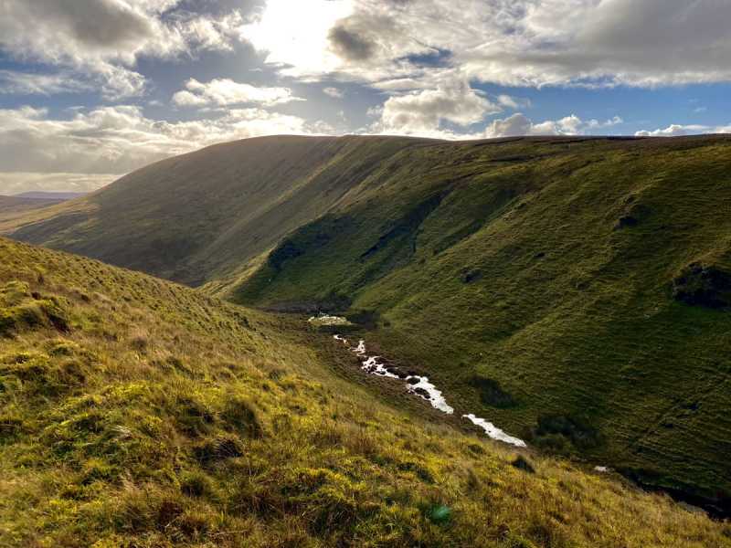
Picture: Craigagh seen from Spelhoag's northern end
Nothing to see here...
by Colin Murphy
26 Oct 2021
Like many of the Sperrins, Craigagh is an unremarkable hill with a flattish top. Topographically the only interesting part is the gully that separates it from the northern flank of Spelhoag (seen in photo). Luckily it is easily reached in about 20 minutes along a track that stretches from the road to the very top. A bagging exercise mostly. Linkback: mountainviews.ie/summit/586/comment/23315/
Use of MountainViews is governed by conditions and a privacy policy.
Read general information about the site. Opinions in material here are not necessarily endorsed by MountainViews.
Hillwalking is a risk sport. Information in comments, walks, shared GPS tracks or about starting places may
not be accurate for example as regards safety or access permission. You are responsible for your safety and your permission to walk.
See the credits and list definitions.


 Our Facebook page.