Members and Supporters, the MountainViews Committee requests your help to meet the costs of the website and of other activities such as insured events or publications.
Feature count in area: 64, by county: Derry: 34, Tyrone: 39, of which 9 are in both Derry and Tyrone,
OSI/LPS Maps: 12, 13, 6, 7, 8
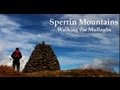
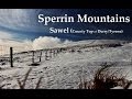
Highest Place: Sawel 678m
Starting Places (21) in area Sperrin Mountains: Altinure Road, Banagher Glen Nature Reserve, Barnes Gap Car Park, Crocknakin, Drumnaspar Picnic CP, Glenchiel Road, Glenedra Bridge, Glenelly Road, Parkreagh, Goles Road, Lough Ouske, Moneyneany Village, Moydamlaght Forest, Moydamlaght Road, Mullaghmore, Mullaghbane, Spaltindoagh, Sperrin Hamlet, Sperrin Heritage Centre, Sperrin Heritage Centre W, Sperrin Road, Barnes Top, Sperrin Road, Glashagh Bridge, Sperrin Road, Sperrin
Summits & other features in area Sperrin Mountains: E: Magherafelt Hills: Slieve Gallion NE Top 493.6m E: Magherafelt Hills: Slieve Gallion 526.6m N: Claudy Hills: Crockdooish 321m, Curradrolan Hill 270m, Eglish 277m, Letterlogher 249m, Mullaghmeash Hill 244m, Slieveboy 259m, Straid Hill 303m NE Cen: Glenelly North East: Barnes Top 456m, Craigagh Hill 460m, Crockbrack 526.1m, Knockanbane Mountain 441m, Meenard Mountain 620m, Meenard Mtn W Top 480m, Mullaghaneany 627m, Mullaghash 480m, Mullaghsallagh 485m, Oughtmore 569m, Spelhoagh 568m NE: Glenshane North: Benbradagh 465m, Boviel Top 454m, Carn Hill 448m, Carntogher 464m, Moneyoran Hill 414m NE: Glenshane South: Bohilbreaga 478m, Coolnasillagh Mountain 423m, Corick Mountain 430m, Crockalougha 407m, Mullaghmore 550m, White Mountain 537m NW Cen: Glenelly North West: Dart Mountain 619m, Dart Mountain North-West Top 525m, Learmount Mountain 489m, Learmount Mountain South Top 492m, Mullaghasturrakeen 581m, Mullaghcarbatagh 517m, Mullaghclogha 635m, Mullaghclogher 572m, Mullaghdoo 568m, Sawel 678m NW: Maheramason Hills: Clondermot Hill 220m, Gortmonly Hill 218m, Slievekirk 370m SE Cen: Glenelly South East: Carnanelly 562m, Carnanelly West Top 503.4m, Mullaghbane 467m, Mullaghturk 416m SE: Cookstown Hills: Cregganconroe 300m, Fir Mountain 362m, Oughtmore 382m SW Cen: Glenelly South West: Clogherny Top 408m, Craignamaddy 385m, Crocknamoghil 335m, Mullaghbolig 442m, Spaltindoagh 420m SW: Mullaghcarn: Curraghchosaly Mountain 416m, Mullaghcarn 542m, Mullaghcarn South Top 525m SW: Newtownstewart Hills: Bessy Bell 420m, Mullaghcroy 242m W: Strabane: Balix Hill 403m, Knockavoe 296m, Owenreagh Hill 400m
Note: this list of places may include island features such as summits, but not
islands as such.
Eglish, 277mHill
Place Rating ..
, Tyrone County in Ulster province, in Binnion Lists, Eglish is the 1215th highest place in Ireland.
Grid Reference C50494 04310,
OS 1:50k mapsheet 7 Place visited by: 14members, recently by: trostanite, dregish, LorraineG60, MichaelG55, eamonoc, Fergalh, NICKY, Aidy, sandman, Harry Goodman, AntrimRambler, chalky, Garmin, Peter Walker
I visited this place: NO (You need to be a logged-in member for this.)
Short or GPS IDs, 6 char: Eglish, 10 char: Eglish Linkback: https://mountainviews.ie/summit/1177/
Gallery for Eglish and surrounds
Summary
for Eglish :
Short easy walk.
Summary created by Harry Goodman
2015-03-23 16:50:49
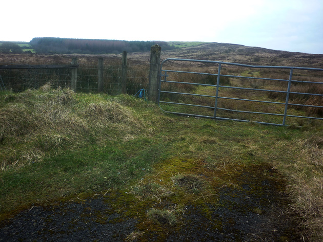
Picture: A view of Eglish from the start of the walk.
On the East flank of the hill park on the roadside grass verge near a gated entrance to a rough track into the field. Once over the gate do not take the track but go left and follow the fence line around and the up past a small plantation. Beyond the trees cross over the fence and keeping it on the right go up the grassy slope to gain the broad grassy top of the hill. Return by way of ascent. There are views of the surrounding small hills in the area and S to the main Sperrins ridge. Easily climbed up and back in about 40 minutes and covering some 2.2km in distance.
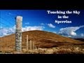
Unfortunately impossible to get to the summit of this hill at the time of writing. I intended to access on the wind farm road, from sandman's point D, but construction is well advanced now, with a gate and security hut at the bottom of the road. The security man was polite and friendly, but was definite on there being no chance of walking up the road as all visitors had to be authorised, signed in, and wearing safety hats etc. He wasn't sure, but was also doubtful that I could access from other directions, and said he thought the whole summit was cordoned off. I drove the short distance to the approximate start of Peter Walker's Track 2417 and managed to get a fair way up the hill, but the whole top seemed like a construction site, and was indeed cordoned off with ropes a bit further back from the works. It was a short distance anyway from the road to the summit, and I was most of the way there, with most of the height done also, so I didn't feel that I was missing out on much. The summit may be accessible again when all the windmills have been actually erected, but it looked like that could be quite a while away. Linkback: mountainviews.ie/summit/1177/comment/18507/
Read Less
Read More
Picture: A walker on the high point of the hill.
A worthy little Binnion.
by Harry Goodman
23 Mar 2015
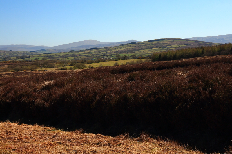
I parked on the E flank of the hill at the place suggested by Peter Walker and followed his route to the top. Conditions in March 2015 had not changed from those experienced by Peter twelve months earlier. Once off the rough muddy track the moorland consisted of rough patches of grass and heather and a series of peat embankments interspersed with marshy ground all of which made for heavy going uphill. On the wide grassy flat top my reading for the unmarked high point was A (C50497 04312). While there are expansive views across to the main Sperrins ridge and surrounding lower hills these are not unique and are views replicated from the tops of many of these lower hills. Perhaps the best comment I can make from my experience of climbing this hill is to recommend a route up and back which I followed on my descent and which eliminates the need to trudge over the rough ground highlighted by Peter walker and experienced first hand by me on my way up. On starting out , once across the gate, do not follow the rough track straight ahead but rather go left and follow the fence line around and then up past a small tree plantation. The going is much easier and less boggy that my ascent route. Once past the plantation cross over the fence and then follow it up over a mainly grassy slope to gain the summit . Return by way of ascent. Some 2.2km up and back. Linkback: mountainviews.ie/summit/1177/comment/17889/
Read Less
Read More
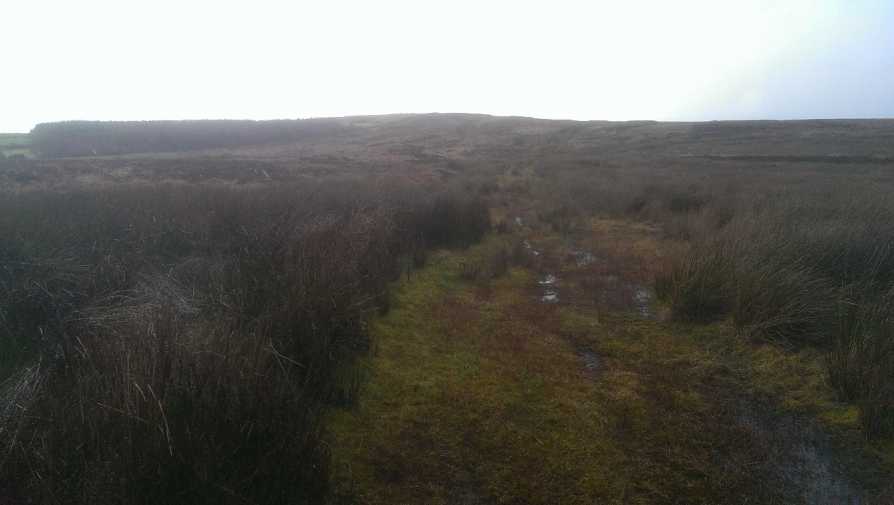
Picture: The route to Eglish..more suited to bog snorkeling than hillwalking
Swamp Thing
by Peter Walker
7 Mar 2014
Eglish is a newly appointed Binnion, and it gloriously conforms to many of the more pessimistic stereotypes associated with the Sperrins. Especially given the recent weather it's distinctly reminiscent of a disastrous entry on The Great Irish Bake Off; hugely shapeless and way too moist.
I started at (B (C512 048)) on the minor road contouring the hill's eastern flank; it's easy enough to squeeze a car off the road. The skies were somewhat grief-stricken, and my usually enthusiastic partner-in-crime Mr Neelix T. Dog seemed much more interested in having a snooze in the back of the BMW. Undaunted, I hopped over the gate and sallied forth along the track marked on the map. This was certainly less vegetated than the surroundings, but it didn't seem noticeably less wet (i.e. it was saturated). I persisted with it for a few hundred metres before just gritting my teeth and heading straight for the highest point on the skyline. About ten minutes of squelching and swearing led to a fence junction (easily climbed over) beyond which lay the summit area. The map suggests the views to be reasonably open to west and east...someone blessed with better weather may be able to verify that on the ground.
I attempted to return much the same way, but the track I've uploaded suggests I didn't. Just over half an hour after leaving it I was back at the car, a bit cross and deeply wet following involuntary immersion in a bog hole. Evidently the dog knows more about making hillwalking pleasurable than I do. Linkback: mountainviews.ie/summit/1177/comment/15905/
Read Less
Read More
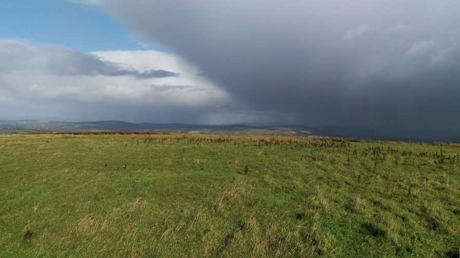
Picture: Summit Area.
Options.
by sandman
26 Apr 2016
Option 1 you can access the summit via the gate entrance described in the previous comments but you should keep to the track which although becomes faint as you keep left at C (C51011 04838) this will bring you to within a short distance of the summit just hop fence into next field but this route can be slightly water logged or you can opt for Option 2 park at the entrance to the proposed wind farm road D (C51063 03984) and walk on a nice gravel road which will take you basically to the same spot as Option 1. It looks as if the wind farm may be extended in the future. Linkback: mountainviews.ie/summit/1177/comment/18373/
Use of MountainViews is governed by conditions and a privacy policy.
Read general information about the site. Opinions in material here are not necessarily endorsed by MountainViews.
Hillwalking is a risk sport. Information in comments, walks, shared GPS tracks or about starting places may
not be accurate for example as regards safety or access permission. You are responsible for your safety and your permission to walk.
See the credits and list definitions.


 Our Facebook page.