Donation Request 2024

DONATE
Members and Supporters, the MountainViews Committee requests your help to meet the costs of the website and of other activities such as insured events or publications.
You do not have to be logged in to donate.
Features
Nearby features appear when you click the map.
Declutter tracks on map.
Place Search
Video
X
Pub: by
Sperrin Mountains Area , SW: Newtownstewart Hills Subarea
Feature count in area: 64, by county: Derry: 34, Tyrone: 39, of which 9 are in both Derry and Tyrone, OSI/LPS Maps: 12, 13, 6, 7, 8
Highest Place: Sawel 678m

Starting Places (21) in area Sperrin Mountains:
Altinure Road, Banagher Glen Nature Reserve, Barnes Gap Car Park, Crocknakin, Drumnaspar Picnic CP, Glenchiel Road, Glenedra Bridge, Glenelly Road, Parkreagh, Goles Road, Lough Ouske, Moneyneany Village, Moydamlaght Forest, Moydamlaght Road, Mullaghmore, Mullaghbane, Spaltindoagh, Sperrin Hamlet, Sperrin Heritage Centre, Sperrin Heritage Centre W, Sperrin Road, Barnes Top, Sperrin Road, Glashagh Bridge, Sperrin Road, Sperrin

Summits & other features in area Sperrin Mountains:
E: Magherafelt Hills: Slieve Gallion NE Top 493.6m
E: Magherafelt Hills: Slieve Gallion 526.6m
N: Claudy Hills: Crockdooish 321m, Curradrolan Hill 270m, Eglish 277m, Letterlogher 249m, Mullaghmeash Hill 244m, Slieveboy 259m, Straid Hill 303m
NE Cen: Glenelly North East: Barnes Top 456m, Craigagh Hill 460m, Crockbrack 526.1m, Knockanbane Mountain 441m, Meenard Mountain 620m, Meenard Mtn W Top 480m, Mullaghaneany 627m, Mullaghash 480m, Mullaghsallagh 485m, Oughtmore 569m, Spelhoagh 568m
NE: Glenshane North: Benbradagh 465m, Boviel Top 454m, Carn Hill 448m, Carntogher 464m, Moneyoran Hill 414m
NE: Glenshane South: Bohilbreaga 478m, Coolnasillagh Mountain 423m, Corick Mountain 430m, Crockalougha 407m, Mullaghmore 550m, White Mountain 537m
NW Cen: Glenelly North West: Dart Mountain 619m, Dart Mountain North-West Top 525m, Learmount Mountain 489m, Learmount Mountain South Top 492m, Mullaghasturrakeen 581m, Mullaghcarbatagh 517m, Mullaghclogha 635m, Mullaghclogher 572m, Mullaghdoo 568m, Sawel 678m
NW: Maheramason Hills: Clondermot Hill 220m, Gortmonly Hill 218m, Slievekirk 370m
SE Cen: Glenelly South East: Carnanelly 562m, Carnanelly West Top 503.4m, Mullaghbane 467m, Mullaghturk 416m
SE: Cookstown Hills: Cregganconroe 300m, Fir Mountain 362m, Oughtmore 382m
SW Cen: Glenelly South West: Clogherny Top 408m, Craignamaddy 385m, Crocknamoghil 335m, Mullaghbolig 442m, Spaltindoagh 420m
SW: Mullaghcarn: Curraghchosaly Mountain 416m, Mullaghcarn 542m, Mullaghcarn South Top 525m
SW: Newtownstewart Hills: Bessy Bell 420m, Mullaghcroy 242m
W: Strabane: Balix Hill 403m, Knockavoe 296m, Owenreagh Hill 400m

Note: this list of places may include island features such as summits, but not islands as such.
Rating graphic.
Bessy Bell, 420m Hill Sliabh Troim A name in Irish,
Place Rating ..
(Ir. Sliabh Troim [DUPN], 'mountain of elder'), Tyrone County in Ulster province, in Carn Lists, Bessy Bell is the 848th highest place in Ireland.
Grid Reference H39100 82100, OS 1:50k mapsheet 12
Place visited by: 74 members, recently by: ronanmckee, Tricia-Mulligan, Claybird007, Oscar-mckinney, Jai-mckinney, Carolyn105, Kirsty, Leonas_Escapades, Colin Murphy, eflanaga, Seamy13, wintersmick, pdtempan, TommyMc, Hoverla
I visited this place: NO (You need to be a logged-in member for this.)
Longitude: -7.394544, Latitude: 54.685449, Easting: 239100, Northing: 382100, Prominence: 355m,  Isolation: 6.1km, Has trig pillar
ITM: 639040 882093
Bedrock type: Psammite, (Newtownstewart Formation)
Notes on name: Bessy Bell and its lower neighbour, Mary Gray, are named after the heroines of a Scottish ballad. This begins Bessie Bell and Mary Gray, they were twa bonny lasses. The obvious Scots origin of the name did not deter Samuel Lewis from making an extravagant connection between Bessy Bell and the pagan deity Baal in his Topographical Dicitionary of Ireland (1843): “On the summit of Bessy Bell, or ‘Boase-Baal’, on which in pagan times sacrifice is supposed to have been offered to Baal or Bel, is a large and curious cairn.” Sliabh Troim is the original Irish name. Also recorded as Sliab Toad [LGÉ].
  Short or GPS IDs, 6 char: BsyBl, 10 char: Bessy Bell

Linkback: https://mountainviews.ie/summit/738/
Gallery for Bessy Bell (Sliabh Troim) and surrounds
Summary for Bessy Bell (Sliabh Troim): Easy but rewarding
Summary created by pdtempan 2021-12-03 11:22:25
A wedge of high ground between the valley of the Strule River on the east side and the Baronscourt estate on the north-west side. Bessy Bell/Sliabh Troim is traversed by a number of forest roads and access-roads for the two wind-farms on its upper slopes and the mobile phone mast at the summit. This means that the top can be attained without crossing any rough ground, making it one of the easier peaks to bag in this area. The most popular approaches are along the waymarked Ulster Way, either from the SW, starting at Cashty Wood (park at A (H378 804)) or from the E, starting at Beltany (B (H407 819)). A longer route starting at Newtownstewart is also feasible. In clear weather, fine views can be had towards the Dartry Mountains, the Donegal Highlands (Errigal being particularly prominent), the main ridge of the Sperrins and Mullaghcarn close at hand. Points of interest include a megalithic cairn at the summit (Donald Gorm's Carn), Toberneill holy well and a chambered grave and stone circles on the southern slopes. As of 2021 there is a new information board on the approach from Cashty Wood about the hill itself and the International Appalachian Trail.
Linkback: mountainviews.ie/summit/738/comment/5497/
Member Comments for Bessy Bell (Sliabh Troim)
Comment create / edit display placeholder

            MountainViews.ie picture about Bessy Bell (<em>Sliabh Troim</em>)
Picture: Bessy Bell Wind Farm
mcna on Bessy Bell
by mcna 24 Jun 2008
This is a fantastic hill with very rewarding views on a good day. I am so glad to see it has been added to Mountain views. I walk this about once a week and the scenery never fails to entertain me! I use this as training as it has a nice, sustained slope the entire way. There is wind farm near the top and a telecommunications mast on the summit hence there is a rough road all the way. This hill forms part of every day for me, I can see it from my house and from my classroom window so I now just the weather depending on how much of Bessy I can see and how clear she appears! It can be tricky enough to get to the start of the road if you don’t know the area. From Omagh head out the Derry road and just past the Sperrin Restaurant and service station there is road to the left. Now, I mean right after it - you could miss it very easily. If you are coming from Strabane direction drive on past the folk park and it’s just before the Sperrin Restaurant. At the cross roads beside the church take a left and continue along this road until the first right turn. This road will take you to the foot of the track which is roughly GR C (H374 809). This road is also used by the forestry service so there are lots of junctions along the way – just follow the road up hill. The wind farm is an excellent place to stop. There are information boards giving you details about the amount of electricity generated. The last section is up quite a steep hill to the telecommunications mast. The trig point is located about 20 m to the right but it is visible from the end of the track. It takes about 35 minutes to walk from the car to the top and about 25 back again. From here you can see Mullaghcarn and the high Sperrins, the pigeon top and on a really good day you can see Errigal and Muckish. You also look down over the Baronscourt estate and the Derg Valley. The walk can be extended by going over the summit and down the bog to the main Omagh to Derry road and over to the Mellon Country Hotel – all of which can be seen from the summit. You would need another car at “The Mellon” unless you planned to come back the same way. All in all, a very rewarding short walk that is used to introduce children to hill walking in this area but one that can be just as reward from adults! Linkback: mountainviews.ie/summit/738/comment/2694/
Read Less
Read More

            MountainViews.ie picture about Bessy Bell (<em>Sliabh Troim</em>)
Picture: An earlier shot of Bessy from Pollnalaght (Pigeon Top) to the S
Approach from east following Ulster Way
by dr_banuska 30 Sep 2010
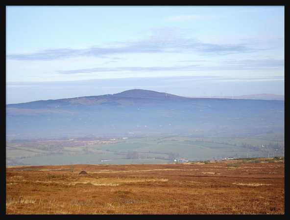
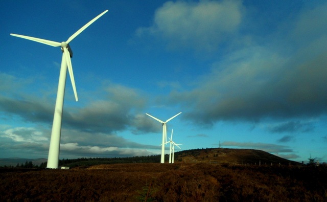
This is a hill I'd been wanting to climb for a while, for despite its relatively low height, it and the wind farm on its lower slopes are very prominent from nearby summits owing to its relatively detached position at the western end of the Sperrins. The Ulster Way conveniently passes over the summit (not sure it always did though - the route was altered and relaunched about a year ago).

I climbed Bessy earlier this week when driving between Omagh and Strabane. About 5 miles past Omagh I took the turn-off for Mountjoy on the left, just after a garage. A couple of miles past the village you'll see an Ulster Way sign, joining from a minor road on the right. The UW then takes the next left turn at D (H411 821) and I followed this uphill. This is a very steep, narrow road and luckily I didn't meet anyone else on the way up or down. The road soon levels out with an abandoned, two storey farmhouse on the left. I parked next to this and made the rest of the journey on foot. While OSNI map 12 suggests the road continues on from here it really becomes a grassy, hedged-in track.

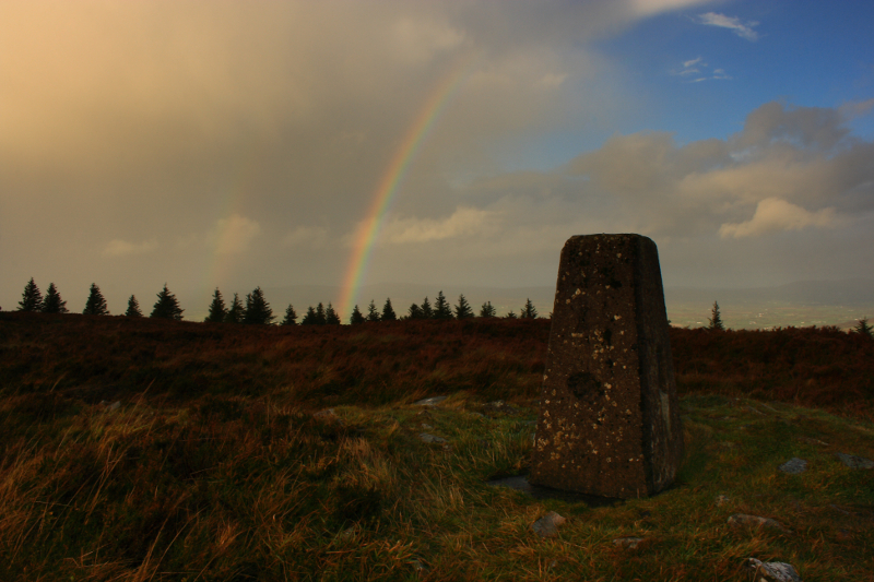
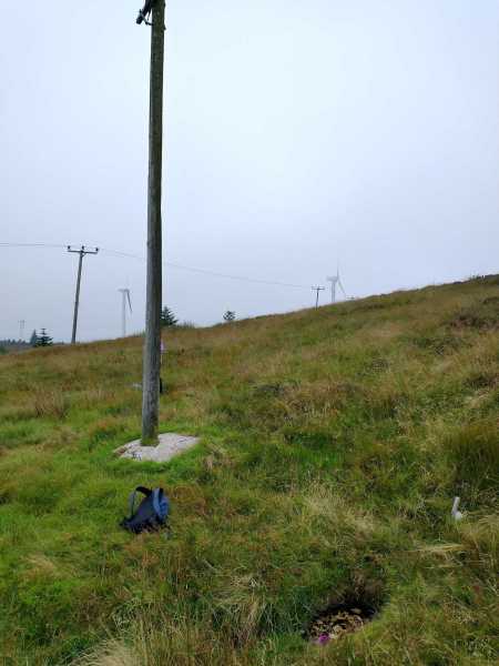
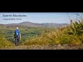
I followed the UW uphill and in a zigzag, over several stiles (some weren't necessary as the gates were open - one I was able to lift off the ground!), passing close to another seemingly abandoned farmhouse to the right. At times you'd be on a track and others passing through fields with grazing sheep and cows, with the turbines close by overhead. Sometimes the signage wasn't obvious which caused a bit of head scratching and a couple of wrong turns. Eventually a sign points off the track onto the open hillside and I began my ascent. Frustratingly I didn't see another sign on the ascent but luckily ended up right at a stile crossing a fence near the summit. The terrain was typical Sperrins: grassy, heathery, reedy in parts and luckily not too wet at the time. The trig is just a short distance from the fence with some masts beyond. I could see the wind farm access track that mcna and pquinn572 must've taken coming up the other side of the hill.

The view of the rolling Tyrone countryside N and E was impressive. I could see Mullaghcarn, the higher Sperrins beyond and Owenreagh E of Strabane with its own wind farm. I could also make out Omagh and Strabane. The Bluestacks were visible but NW was hazy so I couldn't make out Muckish, Errigal etc. Return was by the same way, though this time I noticed an UW sign pointing downhill along the fence and I followed this until a sign pointed right again.

Ascent took about an hour (including head scratching and wrong turns) and descent a lot less. When I rejoined the road coming from Mountjoy, this time I took left and after a couple of miles came into Newtownstewart, with easy access back onto the A5 to Strabane. From N'stewart I took a brief detour to see the ruins of Harry Avery O'Neill's Castle (signposted) - definitely worth a look if you're in the area. Linkback: mountainviews.ie/summit/738/comment/6120/
Read Less
Read More

            MountainViews.ie picture about Bessy Bell (<em>Sliabh Troim</em>)
Picture: Ever changing weather on the summit
Four Seasons In A Day
by Aidy 27 Oct 2013
There were dire predictions of hurricane force winds on the forecasts, but it looked like we would miss the worst of it, so I decided to walk the nearby Bessy Bell. Besides, I had a new pair of cheap, waterproof over-trousers, and thought today would be a good test. I parked at Point C on the Cashty Road and set off up the gravel track to the summit in bright, warm sunshine.

On the way up I experienced all four seasons, By the time I reached the top, heavy rain was driving sideways in extremely strong winds. Using the tripod was impossible, and it was nearly impossible to even stand still for hand held photos. Views were obscured by low cloud and heavy rain, but it was easy to see they would be worth the climb on a good day. I'll just have to return for better shots.

Nice walk, and the trousers were great - reached home dry as a bone despite the stormy weather. Linkback: mountainviews.ie/summit/738/comment/15239/
Read Less
Read More

            MountainViews.ie picture about Bessy Bell (<em>Sliabh Troim</em>)
Picture: Toberneill holy well, indicated by a marker pole
Sliabh Troim / Bessy Bell revisited and Toberneill located
by pdtempan 8 Sep 2021
Returned to Sliabh Troim / Bessy Bell 8 months after our last visit. Having already visited the summit the previous time, we knocked off the summit again fairly promptly from Cashty Road. We had lunch near the summit cairn which was marked as Donald Gorm's Carn on the 1st edition 6" OS map. We then devoted the rest of the day to exploring other features on the hill. We went in search of the holy well called Toberneill, which is not marked on the latest edition of the 1:50,000 Discoverer Series map. We searched in vain near the cluster of wind turbines SW of the summit, but the search wasn't completely fruitless, as I found a good patch of bilberries, which got made into a delicious bilberry fool the following evening. We then hunted more to the S of the summit, taking a new road going towards another cluster of turbines. We noticed a green strip rising back towards the summit, didn't think much of it, passed on and still couldn't spot the well. We then decided to walk back towards the summit and left the road to follow the said green strip. We passed underneath a line of telephone wires and reached another telegraph pole not supporting any cables. Francis looked down and spotted the well, and we realised that the pole had been re-purposed to mark the position of the well. We then spent half an hour at this spot. The exact position of this holy well is 54°40'53.3"N, -7°23'49.9"W, grid ref. E (H389 817). On the way down we aimed towards the chambered cairns and stone circles S of the summit (which ARE marked), but when the wind farm road veered away we could see the approximate location, but after testing the terrain, decided that the going was too arduous across trackless bog with long grass and heather, given that it was late in the day. These sites are probably easier to visit travelling uphill across grassy fields from Cashty Road, rather than downhill from the top of Bessy Bell. We left them for another day. We returned to the wind farm road heading WNW, and when it looped back NE, we continued W across the bog to reach the path we'd started on. This was a bit rough but manageable. The only serious barrier was a strip (perhaps regular enough to call a hedge) of rhododendron. We found the narrowest spot, crawled through on all fours, and on emerging we startled a female red deer. And so back to our starting point on Cashty Road.
If you are interested in the hill's history, traditions and monuments, see Kay Muhr's articles "The Mountain of Slewtrim or Bessy Bell" published in the Journal of the West Tyrone Historical Society, vol. i; and "Bealtaine in Scottish and Irish Place-Names" published in the Journal of Scottish Name Studies vol. 10 (available online). There is also a summary of interesting information gathered on a Facebook page named "Bessy Bell Mountain Co Tyrone". Linkback: mountainviews.ie/summit/738/comment/23264/
Read Less
Read More

            MountainViews.ie picture about Bessy Bell (<em>Sliabh Troim</em>)
Picture: Bessie`s Jewels
The Lure of Bessy
by eamonoc 21 Dec 2013
On Monday 16/12/2013, as I headed to Donegal about three hrs behind schedule and with no intention of climbing anything. I was on the Omagh Derry road and couldn`t help but notice Bessy Bell in the distance, racking my brain I remembered mcna`s directions to a well maintained forestry path at GR C (H374 809) and eventually arrived at same. The lure of Bessy Bell had proved too much so it was on with the boots and upward I went. About 2mins up the path I noticed a muddy track on the right so I followed it uphill to the edge of the forest and at an area of rhodedendron bushes I turned left and followed a faint path and an old fence uphill after approx half a km I arrived at the first of the huge wind turbines that adorn Bessy. The Summit was easily visible from here so I made my way across some heathery boggy ground to a well maintained track and followed it more easily to the summit . Time taken from car to summit was 25 mins. Fantastic views to be had in all directions. Headed quickly back to car a total round trip of 4.39km and 47mins walking time ie according to my garmin 410 Ken! Linkback: mountainviews.ie/summit/738/comment/15284/
Read Less
Read More
EDIT Point of Interest
text
Videos

Recent Contributions
x
Conditions and Info
Use of MountainViews is governed by conditions and a privacy policy.
Read general information about the site.
Opinions in material here are not necessarily endorsed by MountainViews.
Hillwalking is a risk sport. Information in comments, walks, shared GPS tracks or about starting places may not be accurate for example as regards safety or access permission. You are responsible for your safety and your permission to walk.
See the credits and list definitions.

OSi logo
OSNI/LPS logo
Open Street Map
(Various variations used.)
British summit data courtesy:
Database of British & Irish Hills