Welcome to MountainViews
If you want to use the website often please enrol (quick and free) at top right.
If you want to use the website often please enrol (quick and free) at top right.
Overview

For more map options click on any overview map area or any detail map feature.
Detail Map Features
Showing 18 of a total of 21 items:
Garraun 598m, Benchoona East Top 585m, Benchoona 581m, Garraun South Top 556m, Altnagaighera 549m, Doughruagh 526m, Doughruagh South Top 525m, Foher 223m,
3074, 15km
2728, 13km
3984, 10km
3733, 10km
5003, 10km
2726, 9km
3915, 9km
4399, 7km
4016, 7km
2940, 7km
Garraun 598m, Benchoona East Top 585m, Benchoona 581m, Garraun South Top 556m, Altnagaighera 549m, Doughruagh 526m, Doughruagh South Top 525m, Foher 223m,
Tracks:
Find Suggested Walks
Find hill, mountain, island, coastal feature.
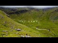
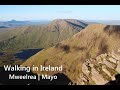
Videos

Recent Contributions
 Get Notifications
Get Notifications
Carricktriss Gorse: Safe access to this hill no longer seems possible
 TommyMc
Binnion: Tullagh Bay and Rockstown Harbour
 Jim_Brady
Donations Drive, now finished.
Good, relatively easy double bag
 Colin Murphy
Crocknapeast: Long walk up windfarm roads.
 Collaborative entry
Mulnanaff: Longish walk up windfarm road.
 Collaborative entry
Lake District: Dale Head Horseshoe
Double bag mostly on windfarm tracks.
 Colin Murphy
Binbane NE Top: Simple bag from its neighbouring top.
 Collaborative entry
Lake District: Coledale Horseshoe
Binbane: Steepish approach to relatively easy Carn.
 Collaborative entry
Crucknaree: Magnificent views!
 paddyhillsbagger
Conditions and Info
Use of MountainViews is governed by conditions and a privacy policy.
Read general information about the site.
Opinions in material here are not necessarily endorsed by MountainViews.
Hillwalking is a risk sport. Information in comments, walks, shared GPS tracks or about starting places may not be accurate for example as regards safety or access permission. You are responsible for your safety and your permission to walk.
See the credits and list definitions.
 Visit our Facebook page.
Video display
Twelve Bens
Area N: Doughruagh Subarea
Place count in area: 34,
OSI/LPS Maps: 37, 44, EW-CON, MSW
Highest place: Benbaun, 729m
Maximum height for area: 729 metres,
Maximum prominence for area: 684 metres,
Places in area Twelve Bens:
Cen: Lough Auna Hills:Cregg 297mTownaloughra East Top 216m
Cen: Polladirk:Bencullagh 632mMaumonght SW Top 454mDiamond Hill 442mKnockbrack 442mMaumonght 602m
E: Glencorbet:Benbaun 729mBenbrack 582mBenbaun 477mKnockpasheemore 412mBenfree 638mMuckanaght 654m
N: Doughruagh:Altnagaighera 549mBenchoona 581mBenchoona East Top 585mCurrywongaun 273mDoughruagh 526mDoughruagh South Top 525mGarraun 598mGarraun South Top 556mLetterettrin 333m
SE: Glencoaghan Loop:Bencollaghduff 696mBenglenisky 516mBenlettery 577mBencorr 711mBencorr North Top 690mBencorrbeg 577mBinn an tSaighdiúra 653mBenbreen 691mBenbreen Central Top 680mBenbreen North Top 674mDerryclare 677mBengower 664m
Note: this list of places includes island features such as summits, but not islands as such.
Highest place:
Benbaun, 729mPlaces in area Twelve Bens:
Cen: Lough Auna Hills:
Cregg 297mTownaloughra East Top 216mCen: Polladirk:
Bencullagh 632mMaumonght SW Top 454mDiamond Hill 442mKnockbrack 442mMaumonght 602mE: Glencorbet:
Benbaun 729mBenbrack 582mBenbaun 477mKnockpasheemore 412mBenfree 638mMuckanaght 654mN: Doughruagh:
Altnagaighera 549mBenchoona 581mBenchoona East Top 585mCurrywongaun 273mDoughruagh 526mDoughruagh South Top 525mGarraun 598mGarraun South Top 556mLetterettrin 333mSE: Glencoaghan Loop:
Bencollaghduff 696mBenglenisky 516mBenlettery 577mBencorr 711mBencorr North Top 690mBencorrbeg 577mBinn an tSaighdiúra 653mBenbreen 691mBenbreen Central Top 680mBenbreen North Top 674mDerryclare 677mBengower 664mNote: this list of places includes island features such as summits, but not islands as such.

Bedrock type: Schists, grits, metavolcanics, mylonitic, (Ben Levy Grit Formation)
The townland south of this top, running down to Kylemore Lough, is Lemnaheltia (Ir. Léim na hEilte, 'the doe's leap'). It appears on Mercator's map of Ireland (1595) as Dosleape. This must originally have been the name of a mountain or cliff. According to legend Fionn Mac Cumhail's dog Bran pursued a doe here. When the doe leapt from the summit, Bran fell from the cliff into the lake. Most likely it refers to the steep south face of Doughruagh overlooking Kylemore Lough and Pollacappul Lough, though Doughruagh is not in Lemnaheltia but the neighbouring townland of Pollacappul. Variations of this story can be found throughout Ireland. In Kerry, for instance, there is a lake named Lough Brin (Ir. Loch Broin, 'Bran's lake') south of the Reeks. Previously Lemnaheltia in MV. Altnagaighera is the name of a spur to the W which is lower than Garraun South top but more sharply defined. Garraun South Top is the 402nd highest place in Ireland.
Linkback: https://mountainviews.ie/summit/347/
COMMENTS for Garraun South Top (Maolchnoc (mullach theas)) 1 2 Next page >>  Follow this place's comments

|
|
|
|
||
| MountainViews.ie, a Hill-walking Website for the island of Ireland. 2400 Summiteers, 1480 Contributors, maintainer of lists: Arderins, Vandeleur-Lynams, Highest Hundred, County Highpoints etc | |||