Guestuser: Login or enrol?
- Home
- Main Display
- Main Display (Old)
- Find a Walk
- Display INTRODUCTION
- DONATE
- Click below for your
profile & contributions
guestuser- New
- Tracks, Walks
- Challenge
- Community
- Lists & Logs
- Popular Lists:
- County Highpoints
- Range & Area Highpoints
- Local 100
- Highest Hundred
- Vandeleur-Lynams
- Arderins
- Carns
- Best rated
- Irish 900 up
- Irish Island
- Munros
- All Lists
- Shorter Irish
- County Highpoints
- Range & Area Highpoints
- Highest Hundred
- Local 100
- Local 100 (pre2014)
- Local Historical Cultural
- Best rated
- Irish 900 up
- Larger Irish
- Arderins
- Arderin Begs
- Arderins + Arderin Begs
- Vandeleur-Lynams
- Vandeleur-Lynams + Arderins
- Carns
- Binnions
- Highest 50 per Province
- Island Features
- Irish Island
- Coastal Hills
- Irish 600 up
- Irish 500 up
- British
- Munros
- British 600 up
- British 500-600
- British Marilyns
- Comprehensive
- All Irish summits
- All Irish features
- All British summits
- All Britain+ Ireland
- Special
- Analysis List
- Simple Irish Listings
- Simple Irish & British Listings
-
- More
- Motley Views
Welcome to MountainViews
If you want to use the website often please enrol (quick and free) at top right.OverviewFor more map options click on any overview map area or any detail map feature.Detail Map FeaturesFind Suggested Walks
Find hill, mountain, island, coastal feature.Videos
Recent Contributions
 Get Notifications
Knocknaskea: Truly idyllic
Meall Cheo: Flat top, steep side.
Long trail to rewarding tops.
Búcán: As good as it gets
Very fine Carn with stunning views.
Foher: Although small, Foher dominates the beaches to the west.
Steep ascent, stunning views
Milane Hill: Not inviting but OK
GR 92: Estartit to l'Escala
Slievemore: Less prickly from North
GR 92: Roses to Cadaques
Silvermines Hydro Project
Conditions and Info
Use of MountainViews is governed by conditions and a privacy policy.
Read general information about the site.
Opinions in material here are not necessarily endorsed by MountainViews.
Hillwalking is a risk sport. Information in comments, walks, shared GPS tracks or about starting places may not be accurate for example as regards safety or access permission. You are responsible for your safety and your permission to walk.
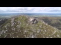
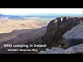
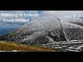
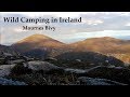
See the credits and list definitions.Video displayMourne Mountains Area N: Castlewellan SubareaPlace count in area: 59, OSI/LPS Maps: 20, 29, EW-CLY
Highest place: Slieve Donard, 849m
Maximum height for area: 849 metres, Maximum prominence for area: 821 metres,
Places in area Mourne Mountains:
Cen: Loughshannagh:Ben Crom 526mCarn Mountain 585.2mCarn Mountain North Top 553.7mDoan 592.6mOtt Mountain 526.8mSlieve Loughshannagh 617mSlieve Muck 670.4mSlievenaglogh 445m
E: Binnian:Slieve Binnian 745.9mSlieve Binnian East Top 639mSlieve Binnian North Top 678mSlieve Binnian North Tor 682.5mWee Binnian 460m
E: Donard:Chimney Rock Mountain 656mCrossone 540mMillstone Mountain 460mRocky Mountain 524mSlieve Donard 849m
E: Lamagan:Cove Mountain 654.8mSlieve Beg 595.9mSlievelamagan 702.2m
N: Bearnagh:Slieve Bearnagh 739mSlieve Bearnagh North Tor 680mSlieve Meelbeg 701.9mSlieve Meelmore 687m
N: Castlewellan:Slievenaboley 324mSlievenalargy 280mSlievenaslat 272m
N: Commedagh:Slieve Commedagh 767mSlieve Corragh 641.9mSlievenaglogh 584.4mSlievenaglogh East Top 571m
N: Croob:Cratlieve 429mSlieve Croob 534mSlievegarran 391mSlievenisky 446m
N: Rathfriland:Knockiveagh 235m
S: Kilkeel:Knockchree 306m
S: Rostrevor:Crenville 460mFinlieve 578mSlievemartin 485mSlievemeel 420mSlievemeen 472m
W: Hilltown:Gruggandoo 382mSlieveacarnane 296m
W: Slievemoughanmore:Crotlieve Mountain 347mEagle Mountain 638mRocky Mountain 404mShanlieve 626mSlievemoughanmore 560mTievedockaragh 473mWee Slievemoughan 428m
W: Spelga:Butter Mountain 503.8mCock Mountain 504mCock Mountain South-West Top 505mHen Mountain 354mPigeon Rock Mountain 534mPigeon Rock Mountain South Top 530mSlievenamiskan 444m
Note: this list of places includes island features such as summits, but not islands as such.
Down County in NI and in Ulster Province, in Binnion List, Sandstone Bedrock
Height: 272m OS 1:50k Mapsheet: 29 Grid Reference: J33065 37610
Place visited by 57 members. Recently by: patrickcampbel76, amcneill, mountainmike, Oscar-mckinney, garybuz, Paddym99, DeirdreM, chelman7, Wes, Florence, marcellawalking, jlk, newpark-cc, Matrim, cmcv10I have visited this place: NO (You need to be a logged-in member to change this.)Longitude: -5.958306, Latitude: 54.270013 , Easting: 333065, Northing: 337610 Prominence: 109m, Isolation: 3.9km
ITM: 732984 837612 , GPS IDs, 6 char: Slvnsl, 10 char: Slvnslt
Bedrock type: Sandstone, (Gala Group)
Slievenaslat is the 1234th highest place in Ireland.
Linkback: https://mountainviews.ie/summit/1185/COMMENTS for Slievenaslat 1 of 1  Follow this place's comments
 Height layer: © MapTiler

MountainViews.ie, a Hill-walking Website for the island of Ireland. 2500 Summiteers, 1480 Contributors, maintainer of lists such as: Arderins, Vandeleur-Lynams, Highest Hundred, County Highpoints etc

 Damian120
 simon3
 Colin Murphy
 Collaborative entry
 Colin Murphy
 simon3
 Colin Murphy
 Visit our Facebook page.