Overview

For more map options click on any overview map area or any detail map feature.
Detail Map Features
Find Suggested Walks
Find hill, mountain, island, coastal feature.
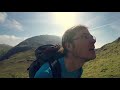
Videos


Recent Contributions
 Get Notifications
Get Notifications
Binbane: Steepish approach to relatively easy Carn.
 Collaborative entry
Walk on tracks above Glendalough
 ceadeile
Crucknaree: Magnificent views!
 paddyhillsbagger
Dunranhill: Sika deer and sitka spruce
 hibby
hibby
Circumnavigation of Tawny Rower
 glencree
Crocknasharragh: Impressive views on initial ascent.
 Colin Murphy
Near Church Mountain, Wicklow (Ireland)
Cunnigar: Short trek to summit
 Fergalh
Westtown Hill: Tramore's Highest Point
 DeirdreM
Keeloges-Aganny loop
 Colin Murphy
Knockbrinnea West Top: Eflanagan on the Knockbrinneas
 eflanaga
Great option for a day hike over Slieve Carr (inspired by Irish Peaks)
Conditions and Info
Use of MountainViews is governed by conditions and a privacy policy.
Read general information about the site.
Opinions in material here are not necessarily endorsed by MountainViews.
Hillwalking is a risk sport. Information in comments, walks, shared GPS tracks or about starting places may not be accurate for example as regards safety or access permission. You are responsible for your safety and your permission to walk.
See the credits and list definitions.
 Visit our Facebook page.
Video display
Partry & Joyce
Area Cen: Knocknafaughy Subarea
Place count in area: 27,
OSI/LPS Maps: 37, 38, CBE, EW-CON, MSW
Highest place: Maumtrasna, 682m
Maximum height for area: 682 metres,
Maximum prominence for area: 607 metres,
Places in area Partry & Joyce:
Cen: Finny:Glenbeg East 372m
Cen: Knocknafaughy:Knocknafaughy 254mRinavore 426m
Cen: Maumtrasna:Barnahowna 516mBuckaun East 495mGlennagleragh Mtn 617mKnocklaur 518mMaumtrasna 682mMaumtrasna North-East Top 572mTullymorehill 279m
N: Ballintober Hills:Bohaun 393mCorveagh 233mCroaghrimkarra 271mKeelkil 239m
SE: Cornamona:Mount Gable 417.8mBohaun 424mKnocknagussy 456m
SW: Bunnacunneen:Ben Beg 560mBunnacunneen 575mBunnacunneen South Top 539mBunnacunneen SE Top 479mLugnabrick SW Top 494mLugnabrick NE Top 494m
W: Devilsmother:Devilsmother 645mDevilsmother South Top 509mDevilsmother North Top 595mDevilsmother Far North Top 601m
Note: this list of places includes island features such as summits, but not islands as such.
Highest place:
Maumtrasna, 682mPlaces in area Partry & Joyce:
Cen: Finny:
Glenbeg East 372mCen: Knocknafaughy:
Knocknafaughy 254mRinavore 426mCen: Maumtrasna:
Barnahowna 516mBuckaun East 495mGlennagleragh Mtn 617mKnocklaur 518mMaumtrasna 682mMaumtrasna North-East Top 572mTullymorehill 279mN: Ballintober Hills:
Bohaun 393mCorveagh 233mCroaghrimkarra 271mKeelkil 239mSE: Cornamona:
Mount Gable 417.8mBohaun 424mKnocknagussy 456mSW: Bunnacunneen:
Ben Beg 560mBunnacunneen 575mBunnacunneen South Top 539mBunnacunneen SE Top 479mLugnabrick SW Top 494mLugnabrick NE Top 494mW: Devilsmother:
Devilsmother 645mDevilsmother South Top 509mDevilsmother North Top 595mDevilsmother Far North Top 601mNote: this list of places includes island features such as summits, but not islands as such.

Bedrock type: Conglomerate, sandstone, mudrock, tuff, (Rosroe Formation)
Tim Robinson suggests roighne is righin, 'tough or stubborn', (TR, 103) but it seems more likely that it is simply roighne, 'the best part', perhaps a praise-name for an old land division rather than the hill itself. Roighne Mhór is the 825th highest place in Ireland.
Linkback: https://mountainviews.ie/summit/711/
COMMENTS for Rinavore (Roighne Mhór) 1 of 1  Follow this place's comments

|
|
|
|
||
| MountainViews.ie, a Hill-walking Website for the island of Ireland. 2400 Summiteers, 1480 Contributors, maintainer of lists: Arderins, Vandeleur-Lynams, Highest Hundred, County Highpoints etc | |||