This website uses cookies, which are small text files that the website puts on your device to facilitate operation. Cookies help us provide a better service to you. They are used to track general user traffic information and to help the website function properly.
Feature count in area: 27, by county: Mayo: 15, Galway: 15, of which 3 are in both Galway and Mayo,
OSI/LPS Maps: 37, 38, CBE, EW-CON, MSW
Highest Place: Maumtrasna 682m
Starting Places (54) in area Partry & Joyce: Aasleagh Waterfall CP, An Móinín Mór, Ballydoo Lough, Barrevagh Bridge, Bealanabrack River Tributary, Black Rock, Bohaun, Bracklagh, Buckaun, Bunduvowen, Cammanagh, Carraig Bar, Carrowrevagh Lough, Clonbur, Cummer, Derrassa, Derrinkee Wood, Doon Rock, Failmore River, Finny Church, Fooey River Road, Glendavock, Glenmask, Glennacally Bridge, Glensaulmore Trailhead, Glentraigue, Gowlaunlee Lake, Keelkill North, Killeennimat Burial Ground, Knockaunnabausty (Cnocán na bPáistí), Knocknafaughy SW, L Mamwee, Lecarrow, Leenane, Leenane Hotel, unuseableLeenane R336, Lough Nambrackkeagh, Maum Bridge Road Lower, Maum Bridge Road Mid, Maum Bridge Road Upper, Mount Gable CP, Otter Pool, Owenbrin Bridge, Owenbrin Tributary, Owenduff River, Red Island, RIC Barracks Ruin, Rinavore East, Rinavore SW, Shanafaraghhaun Cross, Sheeffry Pass, Tawnyard Lough, Teevinish West, The Larches Pub
Summits & other features in area Partry & Joyce: Cen: Finny: Glenbeg East 372m Cen: Knocknafaughy: Knocknafaughy 254m, Rinavore 426m Cen: Maumtrasna: Barnahowna 516m, Buckaun East 495m, Glennagleragh Mtn 617m, Knocklaur 518m, Maumtrasna 682m, Maumtrasna North-East Top 572m, Tullymorehill 279m N: Ballintober Hills: Bohaun 393m, Corveagh 233m, Croaghrimkarra 271m, Keelkil 239m SE: Cornamona: Mount Gable 417.8m, Bohaun 424m, Knocknagussy 456m SW: Bunnacunneen: Ben Beg 560m, Bunnacunneen 575m, Bunnacunneen South Top 539m, Bunnacunneen SE Top 479m, Lugnabrick SW Top 494m, Lugnabrick NE Top 494m W: Devilsmother: Devilsmother 645m, Devilsmother South Top 509m, Devilsmother North Top 595m, Devilsmother Far North Top 601m
Note: this list of places may include island features such as summits, but not
islands as such.
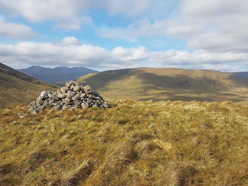
Knocknafaughy, 254mHill
Place Rating ..
, Galway County in Connacht province, in no lists, Knocknafaughy is the 1275th highest place in Ireland.
Grid Reference L93815 59658,
OS 1:50k mapsheet 38 Place visited by: 9members, recently by: paulbrown, markmjcampion, Cobhclimber, Fergalh, eamonoc, sandman, juliewoods, markwallace, Jamessheerin
I visited this place: NO (You need to be a logged-in member for this.)
Watching over Lough Nafooey from its western side this hill when viewed from the Lough is of an impressive nature but not so from way of ascent, well my way of ascent. By parking in a small lay-by located at K'fooy SW (L93286 59124) and walking directly across to the hill will allow you to ford the stream easily. A short and easy walk up to the summit . You can continue the walk from here and visit the near by Rinavore which can be seen in the background of the summit photo. Linkback: mountainviews.ie/summit/1210/comment/18912/
Read Less
Read More
Picture: Knocknafaughy from the south west
Part of a low level circuit
by markmjcampion
12 Nov 2020
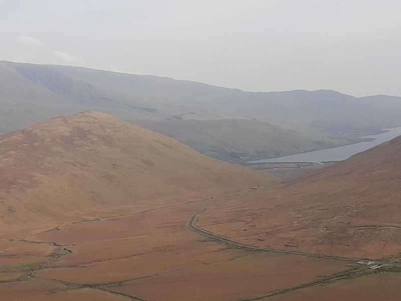
I came at this hill from the west as part of a near 4 hour circuit along with Rinavore and Rinabeg. See my comment on Rinavore for details. Great vantage point over Lough Nafooey and there's a mighty waterfall on its east side at approx. Black Rk (L93910 59252). Linkback: mountainviews.ie/summit/1210/comment/21322/
Use of MountainViews is governed by conditions and a privacy policy.
Read general information about the site. Opinions in material here are not necessarily endorsed by MountainViews.
Hillwalking is a risk sport. Information in comments, walks, shared GPS tracks or about starting places may
not be accurate for example as regards safety or access permission. You are responsible for your safety and your permission to walk.
See the credits and list definitions.


 Our Facebook page.