This website uses cookies, which are small text files that the website puts on your device to facilitate operation. Cookies help us provide a better service to you. They are used to track general user traffic information and to help the website function properly.
Feature count in area: 27, by county: Mayo: 15, Galway: 15, of which 3 are in both Galway and Mayo,
OSI/LPS Maps: 37, 38, CBE, EW-CON, MSW
Highest Place: Maumtrasna 682m
Starting Places (53) in area Partry & Joyce: Aasleagh Waterfall CP, An Móinín Mór, Ballydoo Lough, Barrevagh Bridge, Bealanabrack River Tributary, Black Rock, Bohaun, Bracklagh, Buckaun, Bunduvowen, Cammanagh, Carraig Bar, Carrowrevagh Lough, Clonbur, Cummer, Derrassa, Derrinkee Wood, Doon Rock, Failmore River, Finny Church, Fooey River Road, Glendavock, Glenmask, Glennacally Bridge, Glensaulmore Trailhead, Glentraigue, Gowlaunlee Lake, Keelkill North, Killeennimat Burial Ground, Knockaunnabausty (Cnocán na bPáistí), Knocknafaughy SW, Lecarrow, Leenane, Leenane Hotel, unuseableLeenane R336, Lough Nambrackkeagh, Maum Bridge Road Lower, Maum Bridge Road Mid, Maum Bridge Road Upper, Mount Gable CP, Otter Pool, Owenbrin Bridge, Owenbrin Tributary, Owenduff River, Red Island, RIC Barracks Ruin, Rinavore East, Rinavore SW, Shanafaraghhaun Cross, Sheeffry Pass, Tawnyard Lough, Teevinish West, The Larches Pub
Summits & other features in area Partry & Joyce: Cen: Finny: Glenbeg East 372m Cen: Knocknafaughy: Knocknafaughy 254m, Rinavore 426m Cen: Maumtrasna: Barnahowna 516m, Buckaun East 495m, Glennagleragh Mtn 617m, Knocklaur 518m, Maumtrasna 682m, Maumtrasna North-East Top 572m, Tullymorehill 279m N: Ballintober Hills: Bohaun 393m, Corveagh 233m, Croaghrimkarra 271m, Keelkil 239m SE: Cornamona: Mount Gable 417.8m, Bohaun 424m, Knocknagussy 456m SW: Bunnacunneen: Ben Beg 560m, Bunnacunneen 575m, Bunnacunneen South Top 539m, Bunnacunneen SE Top 479m, Lugnabrick SW Top 494m, Lugnabrick NE Top 494m W: Devilsmother: Devilsmother 645m, Devilsmother South Top 509m, Devilsmother North Top 595m, Devilsmother Far North Top 601m
Note: this list of places may include island features such as summits, but not
islands as such.
Bohaun, 424mHill Bothán A name in Irish,
Place Rating ..
(Ir. Bothán [OSI], 'little hut'), Galway County in Connacht province, in Carn Lists, Bothán is the 834th highest place in Ireland.
Grid Reference M00669 55955,
OS 1:50k mapsheet 38 Place visited by: 21members, recently by: ColinCallanan, Fergalh, GSheehy, tphase, markmjcampion, bryanmccabe, Garmin, Wilderness, eamonoc, simoburn, chalky, juliewoods, paddyhillsbagger, taobear, FilHil
I visited this place: NO (You need to be a logged-in member for this.)
From Cornamona on the R345 take a local road north west and after about 1km park in a lay by at a single track road (B'Doo L (M031 536)).
I enquired about access and a local farmer suggested that I go through the gate lower down the road (near a modern house) and follow the stony/grassy track till reaching a gate and stream (A (M018 544)), a 1 hour walk with a full rucksack.
The track was used in times gone by to cart turf down the hill, donkeys providing the pulling power. The old turf cutting fields are in evidence further up the hill, they are a challenge to cross, the cut-away areas having flooded and walls eroded.
At the old gate you have a choice of taking the boggy path ahead and ‘navigate’ through the old turf fields (have been there - I would not recommend it) or push up north alongside the stream over an old earthen wall. Both routes lead to a nearby hill called Teeranea (339m). At its top you can use a fence as guide, first W to an adjacent hill at 406m then NW all the way to the top at 424m.
The boggy terrain will slow you down somewhat but you will be rewarded with beautiful views over Lough Corrib to E and Lough Mask to NE. On the way up approaching Teeranea, look E to enjoy neighbouring Benlevy in full splendor. Linkback: mountainviews.ie/summit/722/comment/6751/
Read Less
Read More
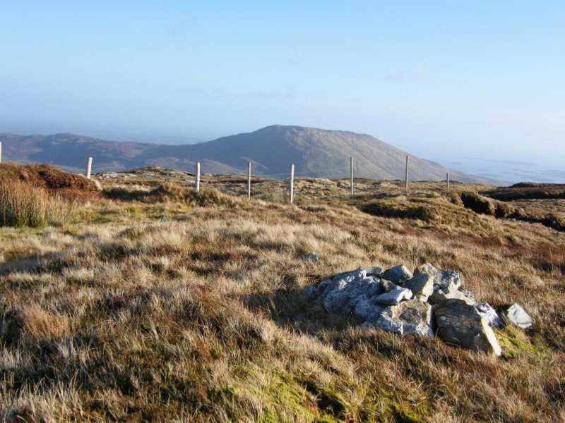
Picture: Bohaun summit with Glenbeg E in background.
A shorter steeper approach!
by paddyhillsbagger
8 Jan 2013
Rather than follow Filhill's route (which would involve a long trek) I chose a more direct, if steeper route from the North. Finding a spot to park near B'haun (M009 570), I enquired locally about access and got a friendly response from a cheery sheep farmer with whom I chatted for a while whilst enjoying the January sunshine!
The walk itself followed the line of a stone wall accessed via a farm gate and later when above the fields along the line of a stream. The top was gained in about an hour and although steep in places, a route can be chosen to avoid the more vertical parts.
The fence Filhill mentioned soon appeared and a small collection of stones sufficed as a summit cairn. Marvelous views all around. Linkback: mountainviews.ie/summit/722/comment/14899/
Read Less
Read More
Above the Valley
by Geansai
6 Apr 2012
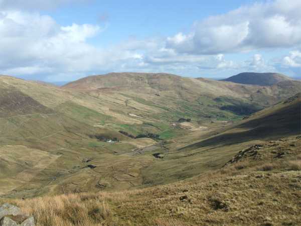
Here's a shot of Bothan from north of Knockagussy to the southwest with Binn Shleibhe to the right of the picture in the background. Linkback: mountainviews.ie/summit/722/comment/6758/
Use of MountainViews is governed by conditions and a privacy policy.
Read general information about the site. Opinions in material here are not necessarily endorsed by MountainViews.
Hillwalking is a risk sport. Information in comments, walks, shared GPS tracks or about starting places may
not be accurate for example as regards safety or access permission. You are responsible for your safety and your permission to walk.
See the credits and list definitions.


 Our Facebook page.