Members and Supporters, the MountainViews Committee requests your help to meet the costs of the website and of other activities such as insured events or publications.
Feature count in area: 27, by county: Mayo: 15, Galway: 15, of which 3 are in both Galway and Mayo,
OSI/LPS Maps: 37, 38, CBE, EW-CON, MSW
Highest Place: Maumtrasna 682m
Starting Places (53) in area Partry & Joyce: Aasleagh Waterfall CP, An Móinín Mór, Ballydoo Lough, Barrevagh Bridge, Bealanabrack River Tributary, Black Rock, Bohaun, Bracklagh, Buckaun, Bunduvowen, Cammanagh, Carraig Bar, Carrowrevagh Lough, Clonbur, Cummer, Derrassa, Derrinkee Wood, Doon Rock, Failmore River, Finny Church, Fooey River Road, Glendavock, Glenmask, Glennacally Bridge, Glensaulmore Trailhead, Glentraigue, Gowlaunlee Lake, Keelkill North, Killeennimat Burial Ground, Knockaunnabausty (Cnocán na bPáistí), Knocknafaughy SW, Lecarrow, Leenane, Leenane Hotel, unuseableLeenane R336, Lough Nambrackkeagh, Maum Bridge Road Lower, Maum Bridge Road Mid, Maum Bridge Road Upper, Mount Gable CP, Otter Pool, Owenbrin Bridge, Owenbrin Tributary, Owenduff River, Red Island, RIC Barracks Ruin, Rinavore East, Rinavore SW, Shanafaraghhaun Cross, Sheeffry Pass, Tawnyard Lough, Teevinish West, The Larches Pub
Summits & other features in area Partry & Joyce: Cen: Finny: Glenbeg East 372m Cen: Knocknafaughy: Knocknafaughy 254m, Rinavore 426m Cen: Maumtrasna: Barnahowna 516m, Buckaun East 495m, Glennagleragh Mtn 617m, Knocklaur 518m, Maumtrasna 682m, Maumtrasna North-East Top 572m, Tullymorehill 279m N: Ballintober Hills: Bohaun 393m, Corveagh 233m, Croaghrimkarra 271m, Keelkil 239m SE: Cornamona: Mount Gable 417.8m, Bohaun 424m, Knocknagussy 456m SW: Bunnacunneen: Ben Beg 560m, Bunnacunneen 575m, Bunnacunneen South Top 539m, Bunnacunneen SE Top 479m, Lugnabrick SW Top 494m, Lugnabrick NE Top 494m W: Devilsmother: Devilsmother 645m, Devilsmother South Top 509m, Devilsmother North Top 595m, Devilsmother Far North Top 601m
Note: this list of places may include island features such as summits, but not
islands as such.
Knocknagussy, 456mHill Cnoc an Mháma A name in Irish,
Place Rating ..
(Ir. Cnoc an Mháma [logainm.ie], 'hill of the pass')An Bhinn Dubh an extra name in Irish, Binn Dhubh, Galway County in Connacht province, in Carn Lists, Cnoc an Mháma is the 715th highest place in Ireland. Cnoc an Mháma is the most southerly summit in the Partry & Joyce area.
Grid Reference L97903 53450,
OS 1:50k mapsheet 38 Place visited by: 38members, recently by: Jai-mckinney, Oscar-mckinney, Carolyn105, elizauna, Haulie, markwallace, eflanaga, padstowe, obrien116, Oileanach, Rossie73, Fergalh, GSheehy, Cobhclimber, markmjcampion
I visited this place: NO (You need to be a logged-in member for this.)
Longitude: -9.540072, Latitude: 53.521281, Easting: 97903, Northing: 253450,
Prominence: 101m, Isolation: 2.4km ITM: 497875 753471 Bedrock type: Schists, grits, metavolcanics, mylonitic, (Ben Levy Grit Formation) Notes on name: The English name, Knocknagussy, appears to be an anglicisation of a different Irish name from that recorded by Tim Robinson on his map of Connemara: Binn Dhubh, 'black peak'; and also from that recorded at logainm.ie: Cnoc an Mháma. Knocknagussy suggests Cnoc na Giúise, 'hill of the pine tree', or Cnoc na Giúsaí, giúsach being a collective noun. In Connemara it can refer to pine found in the bog or bog-deal (giús portaigh) [Dinneen].
Short or GPS IDs, 6 char: Knc457, 10 char: Knckngsy Linkback: https://mountainviews.ie/summit/600/
Gallery for Knocknagussy (Cnoc an Mháma) and surrounds
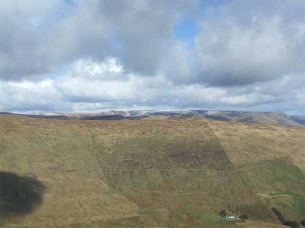
There's a great view of Maumeen Pass and Lough Corrib looking southwest and southeast but move away from the cairn a few yards down to the north and there's a great view into this valley. Thats snowy Maumtrasna peeking over the far ridge. Linkback: mountainviews.ie/summit/600/comment/6729/
Read Less
Read More
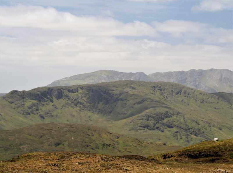
Picture: View of the hill from the East.
A view of the hill.
by simon3
28 May 2022
This is a view of Knocknagussy from Mount Gable to the east. Behind the summit in this view is the Maamturks ridge, with Binn Mhairg just to the right of the top of the highest point of Knocknagussy. Linkback: mountainviews.ie/summit/600/comment/23522/
Read Less
Read More
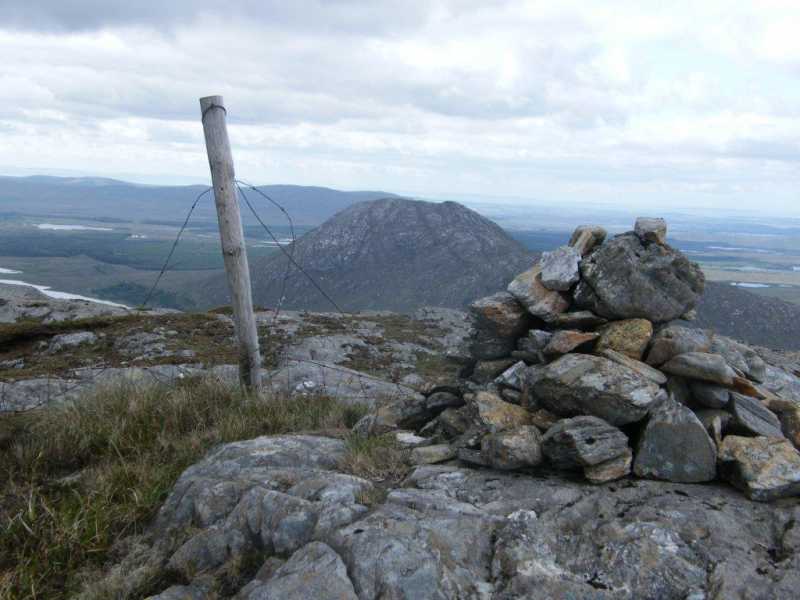
Picture: Knocknagussy cairn with Lackavrea behind.
Steep slog!
by paddyhillsbagger
26 Sep 2022
Found a small lay-by on the R345 at Móinín (L97931 52207). Crossed some boggy ground and headed roughly North up a very steep slope to the top. There was a small cairn next to a fence which straddled the summit. Lovely views. Linkback: mountainviews.ie/summit/600/comment/18120/
Use of MountainViews is governed by conditions and a privacy policy.
Read general information about the site. Opinions in material here are not necessarily endorsed by MountainViews.
Hillwalking is a risk sport. Information in comments, walks, shared GPS tracks or about starting places may
not be accurate for example as regards safety or access permission. You are responsible for your safety and your permission to walk.
See the credits and list definitions.


 Our Facebook page.