Guestuser: Login or enrol?
- Home
- Main Display
- Main Display (Old)
- Find a Walk
- Display INTRODUCTION
- DONATE
- Click below for your
profile & contributions
guestuserOverviewFor more map options click on any overview map area or any detail map feature.Detail Map FeaturesShowing 20 of a total of 26 items:
Croaghnageer 569.1m, Croaghanirwore 546.1m, Croaghnageer East Top 543.5m, Croaghconnellagh 523m, Croaghnageer North-East Top 521m, Croaghbarnes 498.8m, Brown's Hill 496.4m, Croaghagranagh 440m, Meenanea 435m, Cloghervaddy 402m,Tracks:2751, 42km 2238, 31km 4543, 15km 3164, 15km 4456, 15km 3637, 10km 2907, 10km 4662, 10km 5126, 10km 5134, 10km Find Suggested Walks
Find hill, mountain, island, coastal feature.Videos


Users Online:
abeach, Padraigin, des carroll
Guests online: 621Recent Contributions
 Get Notifications
Carrauntoohil: Above the Clouds: 360 Degree Cloud Inversion
Mangerton & Stoompa
Carrauntoohil: Above the Clouds: 360 Degree Cloud Inversion
Seefin Mountain West Top: Great paths, closed boardwalk
Broaghnabinnia West Ridge and Stumpa Duloigh Traverse
Proctor High Mark: A rocking stone not a rolling one
A tough but rewarding day
Proctor High Mark: Find the gaps in the walls to find the highpoint
Clapham High Mark: Find the gaps in the walls to find the highpoint
Interesting route around Trooperstown, Wicklow.
Parson's Pulpit: Short trek to summit through Burren type landscape
Cahas Surveying: Changes to Arderins etc
Conditions and Info
Use of MountainViews is governed by conditions and a privacy policy.
Read general information about the site.
Opinions in material here are not necessarily endorsed by MountainViews.
Hillwalking is a risk sport. Information in comments, walks, shared GPS tracks or about starting places may not be accurate for example as regards safety or access permission. You are responsible for your safety and your permission to walk.
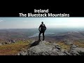
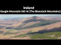
See the credits and list definitions.Video displayBluestack Mountains Area SE: Barnesmore SubareaPlace count in area: 45, OSI/LPS Maps: 11, 6
Highest place: Croaghgorm, 674m
Maximum height for area: 674 metres, Maximum prominence for area: 541 metres,
Places in area Bluestack Mountains:
Cen: Reelan Hills:Altnapaste 364mGaugin Mountain 565mLacroagh 403mBoultypatrick 429mCroveenananta 476mCroaghubbrid 416mCroaghugagh 410m
N: Fintown Hills:Aghla Mountain South Top 589mAghla Mountain 593mScraigs 426mCroaghleheen 385m
NW: Glenties:Cloghercor South 301mDerkbeg Hill 332mDrumnalough Hill 282m
S: Belshade:Croaghgorm 674mCroaghgorm South-West Top 597mCroaghgorm East Top 594mArdnageer 642mArdnageer SW Top 626mBanagher Hill 392mCroaghbane 641mCroaghgorm Far South-West Top 561mCronamuck 444mCroaghbarnes 498.8mGlascarns Hill 578.3mMeenanea 435m
SE: Barnesmore:Brown's Hill 496.4mCloghervaddy 402mCroaghagranagh 440mCroaghanirwore 546.1mCroaghbrack 401mCroaghconnellagh 523mCroaghnageer 569.1mCroaghnageer East Top 543.5mCroaghnageer North-East Top 521mCroaghonagh 451m
SW: Eany Beg Hills:Binbane 453mBinbane NE Top 439mLavagh Beg 650mLavagh More 671mBinnasruell 505mCarnaween 521mCloghmeen Hill 429mSilver Hill 600mCullaghacro 476m
Note: this list of places includes island features such as summits, but not islands as such.
Donegal County in Ulster Province, in Arderin Beg List, Leucogranite and porphyritic aplogranite Bedrock
Height: 543.5m OS 1:50k Mapsheet: 11 Grid Reference: H01819 88576
Place visited by 48 members. Recently by: bowler, mountainmike, Ulsterpooka, gdg, kernowclimber, mcrtchly, abeach, gerrym, trostanite, Grumbler, dino, AlanReid, annem, osullivanm, simon3I have visited this place: NO (You need to be a logged-in member to change this.)Longitude: -7.972533, Latitude: 54.745132 , Easting: 201819, Northing: 388576 Prominence: 28m, Isolation: 0.6km
ITM: 601768 888567 , GPS IDs, 6 char: Crg544, 10 char: CrghngEstT
Bedrock type: Leucogranite and porphyritic aplogranite, (Barnesmore Granite, G3 varieties of sheet complex)
Croaghnageer East Top is the 437th highest place in Ireland.
Linkback: https://mountainviews.ie/summit/1446/COMMENTS for Croaghnageer East Top (Cruach na gCaor soir barr) 1 of 1  Follow this place's comments


MountainViews.ie, a Hill-walking Website for the island of Ireland. 2400 Summiteers, 1480 Contributors, maintainer of lists: Arderins, Vandeleur-Lynams, Highest Hundred, County Highpoints etc

 Lauranna
 Lauranna
 Leatra
 Fergalh
 billbaggins
 Fergalh
 Fergalh
 Fergalh
 simon3
 Visit our Facebook page.