Guestuser: Login or enrol?
- Home
- Main Display
- Main Display (Old)
- Find a Walk
- Display INTRODUCTION
- DONATE
- Click below for your
profile & contributions
guestuser- New
- Tracks, Walks
- Challenge
- Community
- Lists & Logs
- Popular Lists:
- County Highpoints
- Range & Area Highpoints
- Local 100
- Highest Hundred
- Vandeleur-Lynams
- Arderins
- Carns
- Best rated
- Irish 900 up
- Irish Island
- Munros
- All Lists
- Shorter Irish
- County Highpoints
- Range & Area Highpoints
- Highest Hundred
- Local 100
- Local 100 (pre2014)
- Local Historical Cultural
- Best rated
- Irish 900 up
- Larger Irish
- Arderins
- Arderin Begs
- Arderins + Arderin Begs
- Vandeleur-Lynams
- Vandeleur-Lynams + Arderins
- Carns
- Binnions
- Highest 50 per Province
- Island Features
- Irish Island
- Coastal Hills
- Irish 600 up
- Irish 500 up
- British
- Munros
- British 600 up
- British 500-600
- British Marilyns
- Comprehensive
- All Irish summits
- All Irish features
- All British summits
- All Britain+ Ireland
- Special
- Analysis List
- Simple Irish Listings
- Simple Irish & British Listings
-
- More
- Motley Views
Welcome to MountainViews
If you want to use the website often please enrol (quick and free) at top right.OverviewFor more map options click on any overview map area or any detail map feature.Detail Map FeaturesShowing 18 of a total of 25 items:
Croaghnageer 569.1m, Croaghanirwore 546.1m, Croaghnageer East Top 543.5m, Croaghconnellagh 523m, Croaghnageer North-East Top 521m, Brown's Hill 496.4m, Croaghonagh 451m, Croaghagranagh 440m,Tracks:2751, 42km 2238, 31km 4543, 15km 3164, 15km 4456, 15km 5283, 13km 4554, 12km 3637, 10km 2907, 10km 4662, 10km Find Suggested Walks
Find hill, mountain, island, coastal feature.Videos


Recent Contributions
 Get Notifications
Carrigroe: Twin tops
Knocknakilton & Cummeen, Dingle Penninsula
Kilbrony Park Ramble
Grieve Hill: Summit position recently revised.
Leean Mountain: Ireland's Best Small Hill?
Croaghnageer and Croghanirwore
Scarr North-West Top: Popular spot in the heart of the mountains
Blackstairs Mountain: Good access and a great viewpoint above a patchwork quilt
9 km walk around Mullaghmeen Woods April 2025
Silvermines Hydro Project
Brown Mountain: Granite - mica schist boundary
Callahaniska: Simple but very rewarding
Conditions and Info
Use of MountainViews is governed by conditions and a privacy policy.
Read general information about the site.
Opinions in material here are not necessarily endorsed by MountainViews.
Hillwalking is a risk sport. Information in comments, walks, shared GPS tracks or about starting places may not be accurate for example as regards safety or access permission. You are responsible for your safety and your permission to walk.
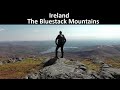
See the credits and list definitions.Video displayBluestack Mountains Area SE: Barnesmore SubareaPlace count in area: 45, OSI/LPS Maps: 11, 6
Highest place: Croaghgorm, 674m
Maximum height for area: 674 metres, Maximum prominence for area: 541 metres,
Places in area Bluestack Mountains:
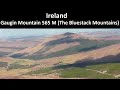
Cen: Reelan Hills:Altnapaste 364mGaugin Mountain 565mLacroagh 403mBoultypatrick 429mCroveenananta 476mCroaghubbrid 416mCroaghugagh 410m
N: Fintown Hills:Aghla Mountain South Top 589mAghla Mountain 593mScraigs 426mCroaghleheen 385m
NW: Glenties:Cloghercor South 301mDerkbeg Hill 332mDrumnalough Hill 282m
S: Belshade:Croaghgorm 674mCroaghgorm South-West Top 597mCroaghgorm East Top 594mArdnageer 642mArdnageer SW Top 626mBanagher Hill 392mCroaghbane 640.9mCroaghgorm Far South-West Top 561mCronamuck 444mCroaghbarnes 498.8mGlascarns Hill 578.3mMeenanea 435m
SE: Barnesmore:Brown's Hill 496.4mCloghervaddy 402mCroaghagranagh 440mCroaghanirwore 546.1mCroaghbrack 401mCroaghconnellagh 523mCroaghnageer 569.1mCroaghnageer East Top 543.5mCroaghnageer North-East Top 521mCroaghonagh 451m
SW: Eany Beg Hills:Binbane 453mBinbane NE Top 439mLavagh Beg 650mLavagh More 671mBinnasruell 505mCarnaween 521mCloghmeen Hill 429mSilver Hill 600mCullaghacro 476m
Note: this list of places includes island features such as summits, but not islands as such.
(Ir. Cruach Chonallach [SOD#], 'stack of the Cenél Conaill') Donegal County in Ulster Province, in Arderin List, Leucogranite and porphyritic aplogranite Bedrock
Height: 523m OS 1:50k Mapsheet: 11 Grid Reference: H02296 86371
Place visited by 68 members. Recently by: bowler, mountainmike, abeach, gdg, ptully362, trostanite, srr45, annem, AlanReid, wintersmick, ilenia, BogRunner1, eoghancarton, Grumbler, pmeldrumI have visited this place: NO (You need to be a logged-in member to change this.)Longitude: -7.965148, Latitude: 54.725323 , Easting: 202296, Northing: 386371 Prominence: 268m, Isolation: 1.8km, Has trig pillar
ITM: 602245 886363 , GPS IDs, 6 char: Crghcn, 10 char: Crghcnlgh
Bedrock type: Leucogranite and porphyritic aplogranite, (Barnesmore Granite, G3 varieties of sheet complex)
The prominent hill to the east of the Gap, near Lough Mourne, is Croaghonagh, or Cruach Eoghanach, signifying the western boundary of Cenel or Tír Eoghain, while the hill facing it on the western side is Croaghconnelagh or Cruach Conallach, the frontier of Tír Chonaill (www.donegallibrary.ie). Croaghconnellagh is the 501st highest place in Ireland.
Linkback: https://mountainviews.ie/summit/408/COMMENTS for Croaghconnellagh (Cruach Chonallach) 1 of 1  Follow this place's comments
 Height layer: © MapTiler

MountainViews.ie, a Hill-walking Website for the island of Ireland. 2500 Summiteers, 1480 Contributors, maintainer of lists such as: Arderins, Vandeleur-Lynams, Highest Hundred, County Highpoints etc

 Colin Murphy
 Collaborative entry
 Geo
Geo
 Peter Walker
 hibby
hibby
 Collaborative entry
 ceadeile
 hibby
hibby
 Collaborative entry
 Visit our Facebook page.