Welcome to MountainViews
If you want to use the website often please enrol (quick and free) at top right.
If you want to use the website often please enrol (quick and free) at top right.
Overview

For more map options click on any overview map area or any detail map feature.
Detail Map Features
Find Suggested Walks
Find hill, mountain, island, coastal feature.
Videos
Recent Contributions
 Get Notifications
Get Notifications
Donations Drive, now finished.
Binnion: Tullagh Bay and Rockstown Harbour
 Jim_Brady
Crocknapeast: Long walk up windfarm roads.
 Collaborative entry
Good, relatively easy double bag
 Colin Murphy
Mulnanaff: Longish walk up windfarm road.
 Collaborative entry
Double bag mostly on windfarm tracks.
 Colin Murphy
Binbane NE Top: Simple bag from its neighbouring top.
 Collaborative entry
Lake District: Dale Head Horseshoe
Binbane: Steepish approach to relatively easy Carn.
 Collaborative entry
Lake District: Coledale Horseshoe
Crucknaree: Magnificent views!
 paddyhillsbagger
Dunranhill: Sika deer and sitka spruce
 hibby
hibby
Conditions and Info
Use of MountainViews is governed by conditions and a privacy policy.
Read general information about the site.
Opinions in material here are not necessarily endorsed by MountainViews.
Hillwalking is a risk sport. Information in comments, walks, shared GPS tracks or about starting places may not be accurate for example as regards safety or access permission. You are responsible for your safety and your permission to walk.
See the credits and list definitions.
 Visit our Facebook page.
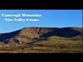
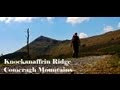
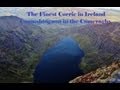
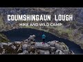
Video display
Knockmealdown Mountains
Area E: East Knockmealdowns Subarea
Place count in area: 17,
OSI/LPS Maps: 74, 82, EW-K
Highest place: Knockmealdown, 792.4m
Maximum height for area: 792.4 metres,
Maximum prominence for area: 682.7 metres,
Places in area Knockmealdown Mountains:
Cen: Central Knockmealdowns:Crohan West 521mKnockmeal 559.5mKnockmealdown 792.4mKnockmoylan 767.1mKnocknafallia 666.5mKnocknagnauv 655.1mSugarloaf Hill 662.7m
E: East Knockmealdowns:Broemountain 430.4mKnocknanask 486mKnocknasheega 430.4mKnocksculloge 432.6m
S: Araglin:Knockadullaun 352.2m
W: West Knockmealdowns:Crow Hill 516.8mFarbreaga 518mKnocknalougha 629mKnocknalougha South Top 518.6mKnockshanahullion 653.3m
Note: this list of places includes island features such as summits, but not islands as such.
Highest place:
Knockmealdown, 792.4mPlaces in area Knockmealdown Mountains:
Cen: Central Knockmealdowns:
Crohan West 521mKnockmeal 559.5mKnockmealdown 792.4mKnockmoylan 767.1mKnocknafallia 666.5mKnocknagnauv 655.1mSugarloaf Hill 662.7mE: East Knockmealdowns:
Broemountain 430.4mKnocknanask 486mKnocknasheega 430.4mKnocksculloge 432.6mS: Araglin:
Knockadullaun 352.2mW: West Knockmealdowns:
Crow Hill 516.8mFarbreaga 518mKnocknalougha 629mKnocknalougha South Top 518.6mKnockshanahullion 653.3mNote: this list of places includes island features such as summits, but not islands as such.

Bedrock type: Medium grained pink-purple sandstone, (Knockmealdown Sandstone Formation)
Knocknasheega is the 800th highest place in Ireland. Knocknasheega is the second most southerly summit and also the second most easterly in the Knockmealdown Mountains area.
Linkback: https://mountainviews.ie/summit/700/
COMMENTS for Knocknasheega (Cnoc na Síge) 1 of 1  Follow this place's comments

|
|
|
|
||
| MountainViews.ie, a Hill-walking Website for the island of Ireland. 2400 Summiteers, 1480 Contributors, maintainer of lists: Arderins, Vandeleur-Lynams, Highest Hundred, County Highpoints etc | |||