This website uses cookies, which are small text files that the website puts on your device to facilitate operation. Cookies help us provide a better service to you. They are used to track general user traffic information and to help the website function properly.
mcrtchly: Track/2206 in area near Crohan West, Knockmealdown Mountains (Ireland)
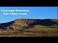
A circuit of the eastern Knockmeal hills
Ascent: 620m,
Length: 11.7km,
Creator time taken: 3h53m
Descent: 631m,
Time predicted from Naismith's rule: 3h 23m + breaks
Click here to rate track
PlacesStart at Knockmeal Mountain Road (Knockmeal) S11260 08164, Crohan West, Knockmeal, Knocknagnauv, Knocknafallia, end at Start
Track Rating ..
[RWD version 1 ]
Park at S112081 and walk north along the road for about 170m. Take a track on the left and pass through a gate, after which take the track on the left (ignore the track straight on which goes towards forestry). Follow this tarck along the north-east flank of Knockmeal as heads NW to the col between Knockmeal and Cohan West. At the col the track truns right but cross the new fence on your left and walk about 300m to the col and pick up a track following a drainage ditch northwards to the summit of Crohan West. From the summit retrace your steps to the col and contine from the col following the ditch to the summit of Knockmeal. From Knockmeal walk SW to the col between Knockmeal and Knocknafallia then follow a drainage ditch west towards Knocknagnauv. From the summit of Knocknagnauv walk SE to Knocknafallia and then continue eastwards to the obvious burial cairn where it is necessary to descend steeply NE back to the col between Knocknafallia and Knockmeal. From the col take the middle track back to the car.
Editing Details for track/2206
NOTE: ALL information such as Ascent, Length and Creator time taken etc should be regarded as approximate. The creator's comments are opinions and may not be accurate or still correct.
Your time to complete will depend on the speed of the slowest plus break time and your mode of transport.
NOTE: It is up to you to ensure that your route is appropriate for you and your party to follow bearing in mind all factors such as safety, weather conditions, experience and access permission.
Uploaded on: Sun, 19 May 2013 (19:14:14), Linkback: https://mountainviews.ie/track/2206/
* Note: A GPS Height in the elevation profile is sourced from the device that recorded the track. An "SRTM" height is derived from a model of elevations for parts of the earth. More detail
Use of MountainViews is governed by conditions and a privacy policy.
Read general information about the site. Opinions in material here are not necessarily endorsed by MountainViews.
Hillwalking is a risk sport. Information in comments, walks, shared GPS tracks or about starting places may
not be accurate for example as regards safety or access permission. You are responsible for your safety and your permission to walk.
See the credits and list definitions.


 Our Facebook page.