Welcome to MountainViews
If you want to use the website often please enrol (quick and free) at top right.
If you want to use the website often please enrol (quick and free) at top right.
Overview

For more map options click on any overview map area or any detail map feature.
Detail Map Features
Find Suggested Walks
Find hill, mountain, island, coastal feature.
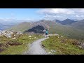
Videos
Recent Contributions
 Get Notifications
Get Notifications
Carricktriss Gorse: Safe access to this hill no longer seems possible
 TommyMc
Donations Drive, now finished.
Binnion: Tullagh Bay and Rockstown Harbour
 Jim_Brady
Crocknapeast: Long walk up windfarm roads.
 Collaborative entry
Good, relatively easy double bag
 Colin Murphy
Mulnanaff: Longish walk up windfarm road.
 Collaborative entry
Double bag mostly on windfarm tracks.
 Colin Murphy
Binbane NE Top: Simple bag from its neighbouring top.
 Collaborative entry
Lake District: Dale Head Horseshoe
Binbane: Steepish approach to relatively easy Carn.
 Collaborative entry
Lake District: Coledale Horseshoe
Crucknaree: Magnificent views!
 paddyhillsbagger
Conditions and Info
Use of MountainViews is governed by conditions and a privacy policy.
Read general information about the site.
Opinions in material here are not necessarily endorsed by MountainViews.
Hillwalking is a risk sport. Information in comments, walks, shared GPS tracks or about starting places may not be accurate for example as regards safety or access permission. You are responsible for your safety and your permission to walk.
See the credits and list definitions.
 Visit our Facebook page.
Video display
Galway Coastal Hill
Area
Place count in area: 30,
OSI/LPS Maps: 37, 38, 44, 45, EW-CON, MSW
Highest place: Tully Mountain West, 306m
Maximum height for area: 306 metres,
Maximum prominence for area: 87 metres,
Places in area Galway Coastal Hill:
Ardagh 49mArdbear N 64mBallynew 84mBarraderry 68mCamus Eighter 72mCamus Hill 96mCleggan Beacon 61mCuilleen 97mDawros More North 41mDerryadd West 127mDerrygimlagh West 41mDerrylahan 49mDoon Hill 67mFaul 50mFoher 223mGortmore 122mKilkieran 165mKinvarra 67mKnockfin 49mLehid 53mLettercallow 109mMannin Beg 41mMaum 62mMurneen 73mMurvey 81mRossaveel 48mShanboolard 85mStreamstown East 79mStreamstown West 103mTully Mountain West 306m
Note: this list of places includes island features such as summits, but not islands as such.
Highest place:
Tully Mountain West, 306mPlaces in area Galway Coastal Hill:
Ardagh 49mArdbear N 64mBallynew 84mBarraderry 68mCamus Eighter 72mCamus Hill 96mCleggan Beacon 61mCuilleen 97mDawros More North 41mDerryadd West 127mDerrygimlagh West 41mDerrylahan 49mDoon Hill 67mFaul 50mFoher 223mGortmore 122mKilkieran 165mKinvarra 67mKnockfin 49mLehid 53mLettercallow 109mMannin Beg 41mMaum 62mMurneen 73mMurvey 81mRossaveel 48mShanboolard 85mStreamstown East 79mStreamstown West 103mTully Mountain West 306mNote: this list of places includes island features such as summits, but not islands as such.

Linkback: https://mountainviews.ie/summit/5032/
COMMENTS for Lettercallow (Leitir Calaidh) 1 of 1  Follow this place's comments

|
|
|
|
||
| MountainViews.ie, a Hill-walking Website for the island of Ireland. 2400 Summiteers, 1480 Contributors, maintainer of lists: Arderins, Vandeleur-Lynams, Highest Hundred, County Highpoints etc | |||