Guestuser: Login or enrol?
- Home
- Main Display
- Main Display (Old)
- Find a Walk
- Display INTRODUCTION
- DONATE
- Click below for your
profile & contributions
guestuserOverviewFor more map options click on any overview map area or any detail map feature.Detail Map FeaturesFind Suggested Walks
Find hill, mountain, island, coastal feature.Videos
 Users Online:
Ulsterpooka
Guests online: 653Recent Contributions
 Get Notifications
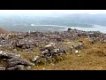
Carrauntoohil: Above the Clouds: 360 Degree Cloud Inversion
Mangerton & Stoompa
Seefin Mountain West Top: Great paths, closed boardwalk
Carrauntoohil: Above the Clouds: 360 Degree Cloud Inversion
Proctor High Mark: A rocking stone not a rolling one
A tough but rewarding day
Broaghnabinnia West Ridge and Stumpa Duloigh Traverse
Proctor High Mark: Find the gaps in the walls to find the highpoint
Interesting route around Trooperstown, Wicklow.
Clapham High Mark: Find the gaps in the walls to find the highpoint
Parson's Pulpit: Short trek to summit through Burren type landscape
Cahas Surveying: Changes to Arderins etc
Conditions and Info
Use of MountainViews is governed by conditions and a privacy policy.
Read general information about the site.
Opinions in material here are not necessarily endorsed by MountainViews.
Hillwalking is a risk sport. Information in comments, walks, shared GPS tracks or about starting places may not be accurate for example as regards safety or access permission. You are responsible for your safety and your permission to walk.
See the credits and list definitions.Video displaySlieve Mish Area E: Barnanageehy SubareaPlace count in area: 16, OSI/LPS Maps: 71, EW-DC, EW-DE
Highest place: Baurtregaum, 849.7m
Maximum height for area: 849.7 metres, Maximum prominence for area: 643 metres,
Places in area Slieve Mish:
Cen: Baurtregaum:Baurtregaum 849.7mBaurtregaum Far NE Top 601.2mBaurtregaum NE Top 818.5mBaurtregaum NW Top 723mCaherconree 835mCastle Hill 600mGearhane 792m
E: Barnanageehy:Barnanageehy 561m
W: Aughils:Beenduff 515mCaherbla 585.2mEmlagh 483mKnockbrack 459mKnockmore 565mLack Mountain 465mMoanlaur 566m
W: Camp:Corrin 332m
Note: this list of places includes island features such as summits, but not islands as such.
(prob. Ir. Bearna na Gaoithe [PDT], 'gap of the wind') Kerry County in Munster Province, in Arderin List, Purple cross-bedded sandstone Bedrock
Height: 561m OS 1:50k Mapsheet: 71 Grid Reference: Q80052 08239
Place visited by 81 members. Recently by: RonanS, Limerick5inarow, Tuigamala, Krzysztof_K, JohnAshton, farmerjoe1, maoris, CusackMargaret, johncusack, a3642278, peter1, Taisce, chelman7, Moses, eiremoss34I have visited this place: NO (You need to be a logged-in member to change this.)Longitude: -9.75541, Latitude: 52.21308 , Easting: 80052, Northing: 108239 Prominence: 56m, Isolation: 3.3km
ITM: 480041 608265 , GPS IDs, 6 char: Brnngh, 10 char: Brnnghy
Bedrock type: Purple cross-bedded sandstone, (Cappagh Sandstone Formation)
This is one of the most common names for a pass in Ireland. The name is actually marked on lower peaks to the E, and it seems likely that the gap in question is even further to the E. Barnanageehy is the 392nd highest place in Ireland. Barnanageehy is the most easterly summit and also the second most northerly in the Slieve Mish area.
Linkback: https://mountainviews.ie/summit/339/COMMENTS for Barnanageehy (Bearna na Gaoithe) 1 of 1  Follow this place's comments


MountainViews.ie, a Hill-walking Website for the island of Ireland. 2400 Summiteers, 1480 Contributors, maintainer of lists: Arderins, Vandeleur-Lynams, Highest Hundred, County Highpoints etc

 Lauranna
 Leatra
 Lauranna
 Fergalh
 billbaggins
 Fergalh
 Fergalh
 Fergalh
 simon3
 Visit our Facebook page.