Donation Request 2024
You do not have to be logged in to donate.
DONATE
Members and Supporters, the MountainViews Committee requests your help to meet the costs of the website and of other activities such as insured events or publications.You do not have to be logged in to donate.
Welcome to MountainViews
If you want to use the website often please enrol (quick and free) at top right.
If you want to use the website often please enrol (quick and free) at top right.
Overview

For more map options click on any overview map area or any detail map feature.
Detail Map Features
Showing 7 items:
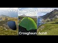
Croaghaun 688m, Croaghaun SW Top 664m, Benmore 332m,
1774, 15km
2748, 9km
3820, 8km
3334, 6km
Croaghaun 688m, Croaghaun SW Top 664m, Benmore 332m,
Tracks:
Find Suggested Walks
Find hill, mountain, island, coastal feature.
Videos
Recent Contributions
 Get Notifications
Get Notifications
Crocknapeast: Long walk up windfarm roads.
 Collaborative entry
Double bag mostly on windfarm tracks.
 Colin Murphy
Mulnanaff: Longish walk up windfarm road.
 Collaborative entry
Good, relatively easy double bag
 Colin Murphy
Binbane NE Top: Simple bag from its neighbouring top.
 Collaborative entry
Binbane: Steepish approach to relatively easy Carn.
 Collaborative entry
Lake District: Dale Head Horseshoe
Crucknaree: Magnificent views!
 paddyhillsbagger
Lake District: Coledale Horseshoe
Dunranhill: Sika deer and sitka spruce
 hibby
hibby
Crocknasharragh: Impressive views on initial ascent.
 Colin Murphy
Longish walk to isolated top
 Colin Murphy
Conditions and Info
Use of MountainViews is governed by conditions and a privacy policy.
Read general information about the site.
Opinions in material here are not necessarily endorsed by MountainViews.
Hillwalking is a risk sport. Information in comments, walks, shared GPS tracks or about starting places may not be accurate for example as regards safety or access permission. You are responsible for your safety and your permission to walk.
See the credits and list definitions.
 Visit our Facebook page.
Video display
Achill & Corraun
Area NW: Croaghaun Subarea
Place count in area: 16,
OSI/LPS Maps: 22, 30, CBW, EW-ACC, EW-ACC
Highest place: Croaghaun, 688m
Maximum height for area: 688 metres,
Maximum prominence for area: 688 metres,
Places in area Achill & Corraun:
Cen: Minaun:Minaun (Achill Island) 466m
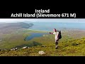
N: Slievemore:Krinnuck (Achill Island) 214mSlievemore (Achill Island) 671m
NW: Croaghaun:Benmore (Achill Island) 332mCornaclea Hill (Achill Island) 269mCroaghaun (Achill Island) 688mCroaghaun SW Top (Achill Island) 664m
S: Knockmore Achill:Achillbeg Island N Top (Achillbeg Island) 109.7mAchillbeg Island S Top (Achillbeg Island) 108.5mKnockmore (Achill Island) 337mTievereivagh (Achill Island) 286m
SE: Corraun:Knocklettragh 452mCorraun Hill 524mCorraun Hill Highpoint 541m
SW: Clare Island:Knockmore (Clare Island) 462mKnocknaveen (Clare Island) 223m
Note: this list of places includes island features such as summits, but not islands as such.
Highest place:
Croaghaun, 688mPlaces in area Achill & Corraun:
Cen: Minaun:
Minaun (Achill Island) 466mN: Slievemore:
Krinnuck (Achill Island) 214mSlievemore (Achill Island) 671mNW: Croaghaun:
Benmore (Achill Island) 332mCornaclea Hill (Achill Island) 269mCroaghaun (Achill Island) 688mCroaghaun SW Top (Achill Island) 664mS: Knockmore Achill:
Achillbeg Island N Top (Achillbeg Island) 109.7mAchillbeg Island S Top (Achillbeg Island) 108.5mKnockmore (Achill Island) 337mTievereivagh (Achill Island) 286mSE: Corraun:
Knocklettragh 452mCorraun Hill 524mCorraun Hill Highpoint 541mSW: Clare Island:
Knockmore (Clare Island) 462mKnocknaveen (Clare Island) 223mNote: this list of places includes island features such as summits, but not islands as such.

Reachable "On Foot " Y
Bedrock type: Quartz pebble conglomerate and schists, (Keem Conglomerate Formation)
This is a lower top just 600m W of Croaghaun itself. A little caution is required on the summit in poor visibility due to the precipice to the N. Offshore winds, which can blow walkers towards or even over the cliffs, are not unknown here. Croaghaun SW Top is the third highest mountain in the Achill & Corraun area and the 172nd highest in Ireland. Croaghaun SW Top is the second most westerly summit in the Achill & Corraun area.
Linkback: https://mountainviews.ie/summit/166/
COMMENTS for Croaghaun SW Top (Cruachán (mullach thiar theas)) 1 2 3 Next page >>  Follow this place's comments

|
|
|
|
||
| MountainViews.ie, a Hill-walking Website for the island of Ireland. 2400 Summiteers, 1480 Contributors, maintainer of lists: Arderins, Vandeleur-Lynams, Highest Hundred, County Highpoints etc | |||