Donation Request 2024
You do not have to be logged in to donate.
DONATE
Members and Supporters, the MountainViews Committee requests your help to meet the costs of the website and of other activities such as insured events or publications.You do not have to be logged in to donate.
Welcome to MountainViews
If you want to use the website often please enrol (quick and free) at top right.
If you want to use the website often please enrol (quick and free) at top right.
Overview

For more map options click on any overview map area or any detail map feature.
Detail Map Features
Find Suggested Walks
Find hill, mountain, island, coastal feature.
Videos
Recent Contributions
 Get Notifications
Get Notifications
Crocknapeast: Long walk up windfarm roads.
 Collaborative entry
Double bag mostly on windfarm tracks.
 Colin Murphy
Mulnanaff: Longish walk up windfarm road.
 Collaborative entry
Good, relatively easy double bag
 Colin Murphy
Binbane NE Top: Simple bag from its neighbouring top.
 Collaborative entry
Binbane: Steepish approach to relatively easy Carn.
 Collaborative entry
Lake District: Dale Head Horseshoe
Crucknaree: Magnificent views!
 paddyhillsbagger
Lake District: Coledale Horseshoe
Dunranhill: Sika deer and sitka spruce
 hibby
hibby
Crocknasharragh: Impressive views on initial ascent.
 Colin Murphy
Longish walk to isolated top
 Colin Murphy
Conditions and Info
Use of MountainViews is governed by conditions and a privacy policy.
Read general information about the site.
Opinions in material here are not necessarily endorsed by MountainViews.
Hillwalking is a risk sport. Information in comments, walks, shared GPS tracks or about starting places may not be accurate for example as regards safety or access permission. You are responsible for your safety and your permission to walk.
See the credits and list definitions.
 Visit our Facebook page.
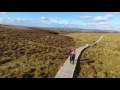
Video display
Breifne
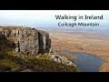
Area N: Cuilcagh Mountains Subarea
Place count in area: 14,
OSI/LPS Maps: 26, 27, 27A
Highest place: Cuilcagh, 666m
Maximum height for area: 666 metres,
Maximum prominence for area: 570 metres,
Places in area Breifne:
N: Cuilcagh Mountains:Benaughlin 370mBenbeg 539mCuilcagh 666mMullaleam 424m
NE: Derrylin:Knockninny Hill 191mSlieve Rushen 404m
SW: Iron Mountains:Bencroy 518mKnockacullion 562mSlieve Anierin 585m
W: Benbrack:Bartonny Top 411mBenbrack 502mBenbrack NE Top 496mBenbrack West Top 463mThe Playbank 542m
Note: this list of places includes island features such as summits, but not islands as such.
Highest place:
Cuilcagh, 666mPlaces in area Breifne:
N: Cuilcagh Mountains:
Benaughlin 370mBenbeg 539mCuilcagh 666mMullaleam 424mNE: Derrylin:
Knockninny Hill 191mSlieve Rushen 404mSW: Iron Mountains:
Bencroy 518mKnockacullion 562mSlieve Anierin 585mW: Benbrack:
Bartonny Top 411mBenbrack 502mBenbrack NE Top 496mBenbrack West Top 463mThe Playbank 542mNote: this list of places includes island features such as summits, but not islands as such.

Bedrock type: Cyclothemic sandstone, siltstone, coal, (Lackagh Sandstone Formation)
Cuilcagh lies on the Shannon-Erne watershed. The Shannon rises on the north-western slopes of Cuilcagh at Shannon Pot, a steep-sided pool where the underground river emerges. Strictly speaking, there are streams a mile or two further uphill. Originating in Ulster, the Shannon’s journey through this province lasts less than ten miles, before it enters Connacht. It forms the boundary between Connacht and Leinster for much of its length, and ultimately meets the sea in the province of Munster. Thus it is both a boundary and a link between all four provinces of Ireland. In fact, it even formed the western boundary of the ancient fifth province of Meath. Around Cuilcagh there is a belief concerning the ‘Northern Shannon’, an underground river that supposedly connects the waters at Shannon Pot to the River Claddagh, which emerges at Marble Arch Caves and then flows into the Erne. If Cuilceach genuinely is a variant of cailceach, 'chalky', the name is rather puzzling, as the mountain consists predominantly of sandstone and shale, covered with much bog and heather. Where the rock does outcrop, as at the summit cliffs, it is mainly grey. However, it is possible that the name refers to the limestone rock on the lower northern flanks. Here a number of streams disappear below ground at swallow holes named Cats Hole, Pollawaddy, Pollasumera and Polliniska, all forming part of the Marble Arch cave system. If so, the name would mean 'calcareous' rather than 'chalky'. Cuilcagh is the highest mountain in the Breifne area and the 168th highest in Ireland. Cuilcagh is the highest point in county Cavan and also the highest in Fermanagh.
Linkback: https://mountainviews.ie/summit/165/
COMMENTS for Cuilcagh (Binn Chuilceach) 1 2 3 4 5 .. 7 Next page >>  Follow this place's comments

|
|
|
|
||
| MountainViews.ie, a Hill-walking Website for the island of Ireland. 2400 Summiteers, 1480 Contributors, maintainer of lists: Arderins, Vandeleur-Lynams, Highest Hundred, County Highpoints etc | |||