Cookies. This website uses cookies, which are small text files that the website puts on your device to facilitate operation. Cookies help us provide a better service to you. They are used to track general user traffic information and to help the website function properly.

Click to hide this notice for 30 days.
Welcome to MountainViews
If you want to use the website often please enrol (quick and free) at top right.
Overview
Detail
Zoom: ??
For more map options click on any overview map area or any detail map feature.
Find Suggested Walks
Find hill, mountain, island, coastal feature.
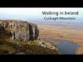
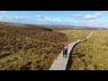
Videos

Recent Contributions
Get Notifications

Carricktriss Gorse: Safe access to this hill no longer seems possible

Binnion: Tullagh Bay and Rockstown Harbour

Donations Drive, now finished.

Good, relatively easy double bag

Crocknapeast: Long walk up windfarm roads.

Mulnanaff: Longish walk up windfarm road.

Lake District: Dale Head Horseshoe

Double bag mostly on windfarm tracks.

Binbane NE Top: Simple bag from its neighbouring top.

Lake District: Coledale Horseshoe

Binbane: Steepish approach to relatively easy Carn.

Crucknaree: Magnificent views!

Conditions and Info
Use of MountainViews is governed by conditions and a privacy policy.
Read general information about the site.
Opinions in material here are not necessarily endorsed by MountainViews.
Hillwalking is a risk sport. Information in comments, walks, shared GPS tracks or about starting places may not be accurate for example as regards safety or access permission. You are responsible for your safety and your permission to walk.
See the credits and list definitions.
Video display
Breifne Area   N: Cuilcagh Mountains Subarea
Place count in area: 14, OSI/LPS Maps: 26, 27, 27A 
Highest place:
Cuilcagh, 666m
Maximum height for area: 666 metres,     Maximum prominence for area: 570 metres,

Note: this list of places includes island features such as summits, but not islands as such.
Rating graphic.
Benbeg Mountain Binn Bheag A name in Irish (prob. Ir. Binn Bheag [PDT], 'little peak') Cavan County in Ulster Province, in Arderin List, Fine-grained sandstone, minor shale Bedrock

Height: 539m OS 1:50k Mapsheet: 26&27A Grid Reference: H12087 25426
Place visited by 158 members. Recently by: chelman7, Carolineswalsh, Lgr, eugeneryan959, Timmy.Mullen, conormcbandon, Krzysztof_K, John.geary, NualaB, Carolyn105, Jai-mckinney, Oscar-mckinney, Ansarlodge, leetelefson, Cecil1976
I have visited this place: NO (You need to be a logged-in member to change this.)

Longitude: -7.815669, Latitude: 54.177702 , Easting: 212087, Northing: 325426 Prominence: 34m,  Isolation: 2.1km
ITM: 612033 825431,   GPS IDs, 6 char: Benbeg, 10 char: Benbeg
Bedrock type: Fine-grained sandstone, minor shale, (Briscloonagh Sandstone Formation)

See Máire MacNeill, 'The Festival of Lughnasa' (p. 175) for details of the festive assembly held on Donagh Sunday, the last Sunday in July, at the Black Rocks near Bellavally Gap.   Benbeg is the 450th highest place in Ireland. Benbeg is the third highest point in county Cavan.

Linkback: https://mountainviews.ie/summit/378/
COMMENTS for Benbeg (Binn Bheag) 1 2 Next page >>  
Follow this place's comments
MountainViews.ie Picture about mountain Benbeg (<i>Binn Bheag</i>) in area Breifne, Ireland
Picture: Benbeg and Cuilcagh in the Background
 
Is it worth the risk?
by glenlecky  4 Sep 2010
Walked up Cuilcagh along the way marked route from the Cuilcagh Mountain Park car park on 31/08/2010. The day was good so I went on south to Benbeg where I found this new looking cairn, not mentioned previously. There were no other rocks around the summit.

I didn't examine it too closely in case I knocked it over and cursed my family or something. They have a hard enough time having a father who believes in fairies! I made a hasty retreat back to Cuilcagh and the carpark where I found my car had a puncture...
Is Benbeg now off limits because of mystical forces?

Suggestions please
(On the origins of the Cairn, not how to fix a puncture) Linkback: https://mountainviews.ie/summit/378/comment/6081/
Your Score: Very useful <<  >>Average
 
MountainViews.ie Picture about mountain Benbeg (<i>Binn Bheag</i>) in area Breifne, Ireland
Picture: Benbeg from the long sweeping ridge to Cuilcagh
gerrym on Benbeg, 2006
by gerrym  1 May 2006
Approach for the start of this one is through the Bellavally Gap to reach the carpark at the scenic viewpoint of Altachullion (137241 starA). Walk uphill and take the first turn R along a minor road and then through a gate onto a forest track. A matter then of heading for the open hill on pretty good ground, among the sheep and newly born lambs. There are good views SW to the Iron mtns, which makes up for the non descript top of Benbeg itself. The payoff is when come to the forest reaching up the hillside and set eyes on the long sweeping ridge to the summit of Cuilcagh. The top of Benbeg is reached in an easy 40 mins - it has been "eaten away" and drops down into an area of extensive forest.
Keep to the edge of the slope and follow it as drops down and then rises along a well worn track, with stunning views ahead to the steep E nose of Cuilcagh. Pass a little lough with deep green waters below, some rocky outcrops and a final steeper pull to the level summit area of Cuilcaigh (1.5 hrs). Cracking views back along the ridge as it curves towards Benbeg, and another lough i missed from the top. There is a short walk to the large summit cairn and trig point, with views across to the Sligo Hills and the sea of brown of a N approach.
I dropped down from the cairn nearly due S, dropping steeply beside an area of cliffs and scree. Traversed along the base of the cliffs for a while and then headed S for the area of forest around the base of Benbeg. This was over mature heather with hidden holes which wasn't too pleasant. Soon reach an area of clearfell and a 35 min walk along the forest track and road to the carpark. Fantastic walk which didn't take that long and met no one else - try it if have only climbed Cuilcagh from the N. Linkback: https://mountainviews.ie/summit/378/comment/2320/
Your Score: Very useful <<  >>Average
 
MountainViews.ie Picture about mountain Benbeg (<i>Binn Bheag</i>) in area Breifne, Ireland
Picture: Benbeg from Altachullion Viewpoint
 
eflanaga on Benbeg, 2006
by eflanaga  4 May 2006
(Climbed March 28th) Started walk from Altachullion Viewpoint H137 241 starA in extremely wet and miserable conditions. Benbeg appeared relatively clear of cloud but Cuilcagh to the right and the Northern end of Benbrack Ridge (to the left) were heavily covered. After securing the car I returned the short distance to the R200 turning right and taking next lane to right. My intention was to follow the lane around and up to Commas Forest taking tracks through forest so as to emerge about 200m north-west of Benbeg summit. However, since I was late starting the walk and he weather was deteriorating I decided to take a more direct route detouring at first derelict building on the lane and bearing straight for the summit. Ground was fairly marshy given the recent heavy rain and prevailing wet conditions. Once through the ‘farmyard’ I veered right to a fence and bank when they come into view. This will take you to another fence within 400 metres of eastern cliff H122 255 starB which itself is only a short distance from summit. Unfortunately, by the time I reached the summit the mist had descended leaving only a view of the forest and a disused quarry below the cliff. Since I wanted to take in Benbrack as well and there was precious little to be seen, I didn’t delay. Taking a bearing of 243 degrees SW I descended the 1.65K to the R200 at H106 246 starC. It was here I made a fundamental and cardinal mapping error which resulted in the loss of more than an hour on the Benbrack leg of the trek (See Benbrack for report). Pic taken at end of walk when weather had improved! Linkback: https://mountainviews.ie/summit/378/comment/2336/
Your Score: Very useful <<  >>Average
 
MountainViews.ie Picture about mountain Benbeg (<i>Binn Bheag</i>) in area Breifne, Ireland
Picture: Scree slope and fence that we followed to summit
mcna on Benbeg, 2007
by mcna  29 May 2007
Benbeg was our starting point for Cuilcagh and reached it through the village of Swanlinbar, taking the first right as you come into the village from Enniskillen direction. Drove past the view point fore mentioned and took the first minor road on the right (opposite a house) and parked up beside the derelict farm house down the road. Here we met the local farmer and had a great chat with him about routes, weather and the world in general – lovely man and very helpful! Walked on up the road and through the gate at the end – a few hundred metres up the road was another gate into the forest (well more like a tree graveyard as very few trees survived the clutches of the lumberjack!) We followed the track round and up hill to a stile that led up hill. This was difficult ground – steep, lots of small, deep streams and cut down trees and branches that had moss growing over them. This slowed us down but when we emerged from the trees we had a very short, steep walk to a flatter grass area. Beautiful views opened up and we were just beside the steep scree slope of Benbeg. From here on there is a light track. I would seriously recommend crossing the fence at this point as you would be teetering on the brink of the scree slope otherwise. Took us a few minutes to reach the summit which is undefined apart from a few stones (I counted 5) build up there - someone is trying to start a cairn I think! Sat down for a brew at this point and savoured the magnificent views to the south on a beautiful, clear afternoon – truly amazing scenery words can’t describe how fabulous it was to sit there in silence and see for 40 odd miles in front of you. If there was ever a reason to walk mountains this was it! And the best bit is it wasn’t even that difficult!! It took about an 1 hr 15 mins to this point. Again, as always I have difficulty picking just one picture – we continued on to Cuilcagh – see that report for the rest of the journey and the descent! Linkback: https://mountainviews.ie/summit/378/comment/2715/
Your Score: Very useful <<  >>Average
 
MountainViews.ie Picture about mountain Benbeg (<i>Binn Bheag</i>) in area Breifne, Ireland
Picture: On The Way Over From Cuilcagh
 
Avoid The Peat Hag Hell
by Aidy  22 Sep 2015
Approached from Cuilcagh (see comment for that mountain for first part of route), and the gloomy day meant I didn't see this area at its best. There was a wild feel to the place though, and on a good day, it looked like you could see for a huge distance down the midlands. The one thing I would recommend is, if coming from Cuilcagh, stay on the eastern side of the saddle, where although care is need in parts due to steep drops, you can avoid a hellishly torturous area of peat hags. Linkback: https://mountainviews.ie/summit/378/comment/18323/
Your Score: Very useful <<  >>Average
 
Absalon on Benbeg, 2002
by Absalon  22 Oct 2002
Fine views of west Cavan highlands and Cavan lakes to the east but Benbeg is mainly a stop on the way to or from Cuilcagh. Linkback: https://mountainviews.ie/summit/378/comment/173/
Your Score: Very useful <<  >>Average
 
COMMENTS for Benbeg (Binn Bheag) 1 2 Next page >>
(End of comment section for Benbeg (Binn Bheag).)

OSi logo OSNI/LPS logo
Some mapping:
Open Street Map
(Various variations used.)
British summit data courtesy:
Database of British & Irish Hills
(Creative Commons Licence)
MountainViews.ie, a Hill-walking Website for the island of Ireland. 2400 Summiteers, 1480 Contributors, maintainer of lists: Arderins, Vandeleur-Lynams, Highest Hundred, County Highpoints etc