If you want to use the website often please enrol (quick and free) at top right.

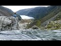
Mullaghcleevaun 846.7m, Tonelagee 815.8m, Mullaghcleevaun East Top 796m, Conavalla 734m, Duff Hill 720.8m, Gravale 719m, Stoney Top 713.7m, Camaderry Mountain 698.6m, Benleagh 689m, Tomaneena 682.4m,


 Get Notifications
Carricktriss Gorse: Safe access to this hill no longer seems possible
 TommyMc
Binnion: Tullagh Bay and Rockstown Harbour
 Jim_Brady
Donations Drive, now finished.
Good, relatively easy double bag
 Colin Murphy
Crocknapeast: Long walk up windfarm roads.
 Collaborative entry
Mulnanaff: Longish walk up windfarm road.
 Collaborative entry
Lake District: Dale Head Horseshoe
Double bag mostly on windfarm tracks.
 Colin Murphy
Binbane NE Top: Simple bag from its neighbouring top.
 Collaborative entry
Lake District: Coledale Horseshoe
Binbane: Steepish approach to relatively easy Carn.
 Collaborative entry
Crucknaree: Magnificent views!
 paddyhillsbagger
Use of MountainViews is governed by conditions and a privacy policy.
Read general information about the site.
Opinions in material here are not necessarily endorsed by MountainViews.
Hillwalking is a risk sport. Information in comments, walks, shared GPS tracks or about starting places may not be accurate for example as regards safety or access permission. You are responsible for your safety and your permission to walk.
See the credits and list definitions.
 Visit our Facebook page.
 Length: 33.9km, Creator time taken: 8h11m, Ascent: 1413m,
Descent: 1420m
Places: Start at T1403197504, Brockagh Mountain SE Top, Brockagh Mountain, Brockagh Mountain NW Top, Tonelagee South-East Top, Tonelagee E Top, Tonelagee, Stoney Top, Mullaghcleevaun, Mullaghcleevaun East Top, Carrigshouk, Kanturk, Scarr North-West Top, Scarr, end at Start
Logged as completed by 1

See blog post here: http://www.adventureburn.com/pmg-walk-10-wild-wild-wicklow/
NOTE: ALL information such as Ascent, Length and Creator time taken etc should be regarded as approximate. The creator's comments are opinions and may not be accurate or still correct.
Your time to complete will depend on your speed plus break time and your mode of transport. For walkers: Naismith's rule, an approximate though often inaccurate estimate, suggests a time of 9h 8m + time stopped for breaks
NOTE: It is up to you to ensure that your route is appropriate for you and your party to follow bearing in mind all factors such as safety, weather conditions, experience and access permission.
* Note: A GPS Height in the elevation profile is sourced from the device that recorded the track. An "SRTM" height is derived from a model of elevations for parts of the earth. More detail![]()
|
|
|
||
| MountainViews.ie, a Hill-walking Website for the island of Ireland. 2400 Summiteers, 1480 Contributors, maintainer of lists: Arderins, Vandeleur-Lynams, Highest Hundred, County Highpoints etc | |||