Welcome to MountainViews
If you want to use the website often please enrol (quick and free) at top right.
If you want to use the website often please enrol (quick and free) at top right.
Overview

For more map options click on any overview map area or any detail map feature.
Detail Map Features
Find Suggested Walks
Find hill, mountain, island, coastal feature.
Videos


Recent Contributions
 Get Notifications
Get Notifications
Knocknagullion: Relatively challenging climb with great views.
 Collaborative entry
Tough enough Carn with very fine views
 Colin Murphy
Nowen Hill Far West Top: Previous access issue to this simple stroll seems to ha
 Colin Murphy
Good tracks to two Carns.
 Colin Murphy
Minaun: Towards Keem
 magnumpig
Crott Mountain, near Croagh Patrick, now demo
 simon3
Saggart Hill: Masts and prehistoric tombs
 hibby
hibby
Cupidstown Hill: 5 minutes walk to the top of Kildare
 hibby
hibby
A visit to Tievummera via its South East spur.
 simon3
Tievummera Highpoint: Undistinguished highpoint of spectacular Sheefry scarp.
 Collaborative entry
Croagh Patrick's ridge to the east, visited from the south.
Tievummera Trig: Bump with trig pillar on long scarp with steep slope to the nor
 Collaborative entry
Conditions and Info
Use of MountainViews is governed by conditions and a privacy policy.
Read general information about the site.
Opinions in material here are not necessarily endorsed by MountainViews.
Hillwalking is a risk sport. Information in comments, walks, shared GPS tracks or about starting places may not be accurate for example as regards safety or access permission. You are responsible for your safety and your permission to walk.
See the credits and list definitions.
 Visit our Facebook page.
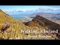
Video display
Central Dingle
Area N: Fermoyle Subarea
Place count in area: 25,
OSI/LPS Maps: 70, 71, 78, EW-DC, EW-DE, EW-DW
Highest place: Beenoskee, 826m
Maximum height for area: 826 metres,
Maximum prominence for area: 491 metres,
Places in area Central Dingle:
Cen: Annascaul Lake West:Cnoc na Bánóige 641.6mCnoc na Bánóige North Top 447.6mKnockmulanane 593.2mKnockmulanane West Top 563.5m
Cen: Dromavally:Cummeen 477mDromavally Mountain 552mKnocknakilton 423m
N: Annascaul Lake North:Coombane 610mBeenatoor 592mBeenoskee 826mStradbally Mountain 798m
N: Carrigdav:Carrigadav 240m
N: Fermoyle:Farrandalouge 144m
S: Annascaul:Beenmore 252mBrickany 374mKnockafeehane 301mKnocknanacree 286m
W: Ballyduff:Slievenalecka 458.4mBeenbo 476.7mSlievenagower 485.8m
W: Slieveanea:An Cnapán Mór 649mKnockmoylemore 493mCroaghskearda 608mSlievanea 628.7mSlievanea NE Top 670.7m
Note: this list of places includes island features such as summits, but not islands as such.
Highest place:
Beenoskee, 826mPlaces in area Central Dingle:
Cen: Annascaul Lake West:
Cnoc na Bánóige 641.6mCnoc na Bánóige North Top 447.6mKnockmulanane 593.2mKnockmulanane West Top 563.5mCen: Dromavally:
Cummeen 477mDromavally Mountain 552mKnocknakilton 423mN: Annascaul Lake North:
Coombane 610mBeenatoor 592mBeenoskee 826mStradbally Mountain 798mN: Carrigdav:
Carrigadav 240mN: Fermoyle:
Farrandalouge 144mS: Annascaul:
Beenmore 252mBrickany 374mKnockafeehane 301mKnocknanacree 286mW: Ballyduff:
Slievenalecka 458.4mBeenbo 476.7mSlievenagower 485.8mW: Slieveanea:
An Cnapán Mór 649mKnockmoylemore 493mCroaghskearda 608mSlievanea 628.7mSlievanea NE Top 670.7mNote: this list of places includes island features such as summits, but not islands as such.

Bedrock type: Purple cross-bedded sandstone, (Cappagh Sandstone Formation)
Fearann Dealúígh is the 1479th highest place in Ireland. Fearann Dealúígh is the most northerly summit in the Central Dingle area.
Linkback: https://mountainviews.ie/summit/1353/
COMMENTS for Farrandalouge (Fearann Dealúígh) 1 of 1  Follow this place's comments

|
|
|
|
||
| MountainViews.ie, a Hill-walking Website for the island of Ireland. 2400 Summiteers, 1480 Contributors, maintainer of lists: Arderins, Vandeleur-Lynams, Highest Hundred, County Highpoints etc | |||