This website uses cookies, which are small text files that the website puts on your device to facilitate operation. Cookies help us provide a better service to you. They are used to track general user traffic information and to help the website function properly.
Colin Murphy: Track/5048 in area near An StarraicĂn, Central Dingle (Ireland)
Tricky but spectacular route from the north.
Ascent: 398m,
Length: 6.2km,
Creator time taken: 2h46m
Descent: 398m,
Time predicted from Naismith's rule: 1h 54m + breaks
Click here to rate track
PlacesStart at Kilmore Lodge (KlMor Lg) Q52261 08920, Slievenalecka, end at Start
Track Rating ..
[RWD version 1 ]
When approached from the north, this is a challenging climb, which would not be recommended in poor conditions due to the steepness on all sides and the grassy, occasionally slippery terrain underfoot. Parking at the side of the road opposite a gate, where there is room for several cars. Go through gate onto a track, which was very muddy when I did it.
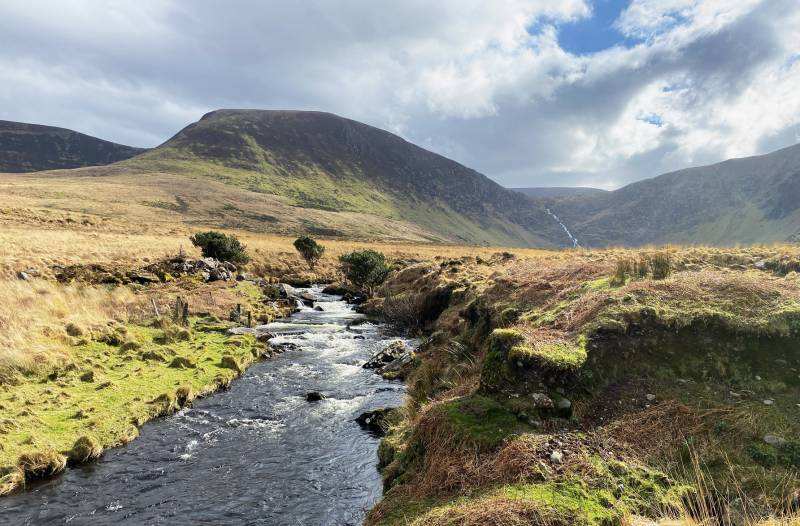
View from the north and An ScĂłraid River.
The gently rising track continues for about 1km, crossing several small footbridges and a stile. There are beautiful views all the way as you follow An Scoraid River. About 100m before you reach the north end of Lough Adoon, swing SW towards the ridge rising up to the summit. From here the northern end of the mountain seems razor-sharp, but is in fact about 10m wide.
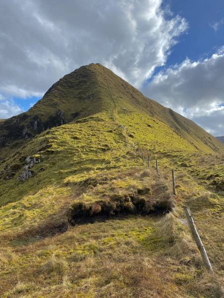
The steep northern slope.
Continue SSE up the steepening slope, the terrain being mostly grass with the occasional boulder. The views higher up the slope are spectacular with Lough Adoon to the east and Loch Chom Callain to the west at the foot of the towering Slievanea.
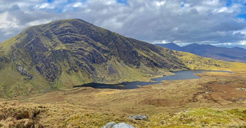
Slievanea NE seen from the ridge.
The final section of the climb is very steep and requires some scrambling up a grassy slope with steep inclines left and right and great care should be taken here. The mountain has a fine aspect, appearing as a perfect looming triangle, and the summit area is just a few metres wide and broad.
Slievenagower from the summit.
Returning the same way I recommend that you make the initial descent in a seated position as it is too steep to safely walk down. A great climb with wonderful views, and should be saved for a fine day with good conditions, if only for safety’s sake.
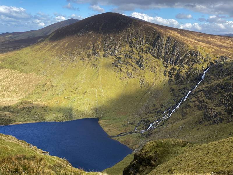
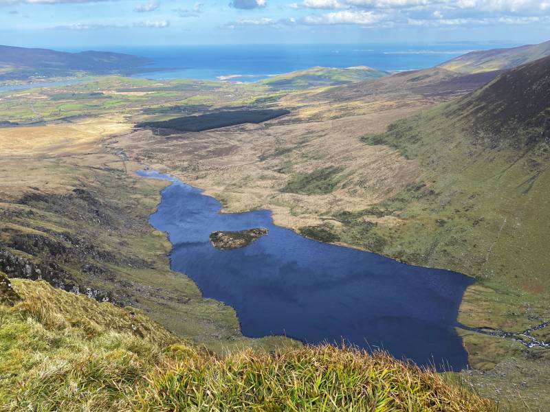
Lough Adoon with Brandon Bay in the distance.
Editing Details for track/5048
NOTE: ALL information such as Ascent, Length and Creator time taken etc should be regarded as approximate. The creator's comments are opinions and may not be accurate or still correct.
Your time to complete will depend on the speed of the slowest plus break time and your mode of transport.
NOTE: It is up to you to ensure that your route is appropriate for you and your party to follow bearing in mind all factors such as safety, weather conditions, experience and access permission.
Uploaded on: Tue, 12 Mar 2024 (12:18:39), Linkback: https://mountainviews.ie/track/5048/
* Note: A GPS Height in the elevation profile is sourced from the device that recorded the track. An "SRTM" height is derived from a model of elevations for parts of the earth. More detail
Use of MountainViews is governed by conditions and a privacy policy.
Read general information about the site. Opinions in material here are not necessarily endorsed by MountainViews.
Hillwalking is a risk sport. Information in comments, walks, shared GPS tracks or about starting places may
not be accurate for example as regards safety or access permission. You are responsible for your safety and your permission to walk.
See the credits and list definitions.


 Our Facebook page.