Members and Supporters, the MountainViews Committee requests your help to meet the costs of the website and of other activities such as insured events or publications.
Feature count in area: 15, all in Donegal,
OSI/LPS Maps: 1, 2, 6
Highest Place: Moylenanav 539m
Starting Places (28) in area Donegal Central: Astelleen Burn Waterfall, Ballyarr, Binnadoo, Braughan Road, Drumfin Bridge, Edenacarnan East, Edenacarnan North, Edenacarnan South, Garrangalta Rocks, Gartan Wood, Glenveagh Bridge, Glenveagh National Park SW, Glenveigh Castle, Losset North, Lough Acrobane Farmhouse, Lough Acrobane South, Lough Acrobane South West, Lough Barra Slipway CP, Lough Barra W, Lough Natooey West, Lough Salt North, Lough Salt West, Moyle Hill, Nabrackbaddy Lough, Parochial House, River Barra Bridge NE, River Barra Bridge SW, Sruhancrolee Bridge
Summits & other features in area Donegal Central: NE: Loughsalt Hills: Crockmore 349m, Croaghmore 278m, Edenacarnan 192m, Loughaskerry 252m, Loughsalt Mountain 469m, Moyle Hill 148m, Stragraddy Mountain 285m SW: Glendowan Mountains: Binswilly 337m, Brown Mountain 224m, Cionn Bheatha 384m, Crockastoller 418m, Farscallop 420.6m, Gartan Mountain 357m, Leahanmore 442m, Moylenanav 539m
Note: this list of places may include island features such as summits, but not
islands as such.
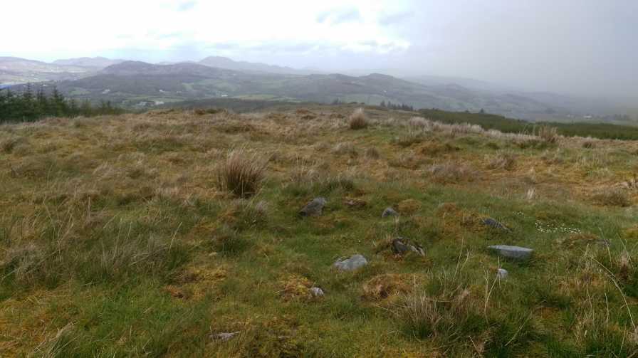
Brown Mountain, 224mHill
Place Rating ..
, Donegal County in Ulster province, in Binnion Lists, Brown Mountain is the 1348th highest place in Ireland.
Grid Reference C06156 15051,
OS 1:50k mapsheet 6 Place visited by: 10members, recently by: eamonoc, jackill, Fergalh, wicklore, Aidy, sandman, Lucky1, chalky, Harry Goodman, Garmin
I visited this place: NO (You need to be a logged-in member for this.)
Brown Mountain is situated close to the village of Church Hill and overlooks Lough Gartan but unfortunately due to the forest , views are restricted from the summit the best views are had from the summit of Crockraw. Access is via the forest entrance at GrtnWd (C06894 16239) following the trails as per the OS map or alternatively the shortest route is via the small road at Par Hs (C07006 15559) . If you intend to make a walk a trail to point A (C05433 14882) exists which connects the forest trails to open hillside, a kindly local has marked this route. Linkback: mountainviews.ie/summit/1256/comment/18010/
Use of MountainViews is governed by conditions and a privacy policy.
Read general information about the site. Opinions in material here are not necessarily endorsed by MountainViews.
Hillwalking is a risk sport. Information in comments, walks, shared GPS tracks or about starting places may
not be accurate for example as regards safety or access permission. You are responsible for your safety and your permission to walk.
See the credits and list definitions.


 Our Facebook page.